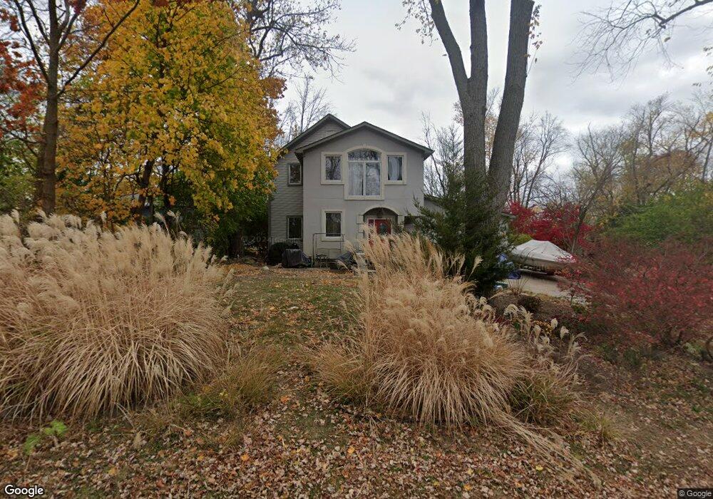
4035 Fieldview Ave West Bloomfield, MI 48324
Estimated Value: $462,000 - $564,000
3
Beds
3
Baths
2,941
Sq Ft
$172/Sq Ft
Est. Value
About This Home
This home is located at 4035 Fieldview Ave, West Bloomfield, MI 48324 and is currently estimated at $505,014, approximately $171 per square foot. 4035 Fieldview Ave is a home located in Oakland County with nearby schools including Our Lady Of Refuge School and St Mary's Preparatory School.
Ownership History
Date
Name
Owned For
Owner Type
Purchase Details
Closed on
Apr 5, 2021
Sold by
Rosenthal Nicholas and Rosenthal Cheryl
Bought by
Rosenthal Nicholas and Rosenthal Cheryl
Current Estimated Value
Purchase Details
Closed on
Aug 29, 1996
Sold by
Kleismit Trudy E
Bought by
Rosenthal Nicholas
Home Financials for this Owner
Home Financials are based on the most recent Mortgage that was taken out on this home.
Original Mortgage
$80,000
Outstanding Balance
$6,730
Interest Rate
7.97%
Estimated Equity
$498,284
Create a Home Valuation Report for This Property
The Home Valuation Report is an in-depth analysis detailing your home's value as well as a comparison with similar homes in the area
Home Values in the Area
Average Home Value in this Area
Purchase History
| Date | Buyer | Sale Price | Title Company |
|---|---|---|---|
| Rosenthal Nicholas | -- | None Available | |
| Rosenthal Nicholas | $103,000 | -- |
Source: Public Records
Mortgage History
| Date | Status | Borrower | Loan Amount |
|---|---|---|---|
| Open | Rosenthal Nicholas | $80,000 |
Source: Public Records
Tax History Compared to Growth
Tax History
| Year | Tax Paid | Tax Assessment Tax Assessment Total Assessment is a certain percentage of the fair market value that is determined by local assessors to be the total taxable value of land and additions on the property. | Land | Improvement |
|---|---|---|---|---|
| 2024 | $3,244 | $211,560 | $0 | $0 |
| 2022 | $3,102 | $194,930 | $26,830 | $168,100 |
| 2021 | $4,555 | $185,050 | $0 | $0 |
| 2020 | $2,766 | $175,300 | $26,830 | $148,470 |
| 2018 | $4,136 | $146,220 | $26,830 | $119,390 |
| 2015 | -- | $118,820 | $0 | $0 |
| 2014 | -- | $109,890 | $0 | $0 |
| 2011 | -- | $93,620 | $0 | $0 |
Source: Public Records
Map
Nearby Homes
- 3991 Fieldview Ave
- 3965 Carrick Ave
- 3950 Bradmore Ave
- 6903 Dandison Blvd
- 4066 Green Lake Rd
- 0000 Langtoft
- 6978 Colony Dr
- 6768 Buckland Ave
- 6675 Langtoft St
- 3632 Fieldview Ave
- 4245 Bunker Ave
- 4442 Borland St
- 4335 Crestdale Ave
- 3641 Green Lake Rd
- 4212 Greendale Ave
- 7337 Richardson Rd
- 4540 Rolling Pine Ct
- 7146 Arrowood Dr
- 6707 Heatherwood Dr
- 6980 Hambro St
- 4025 Fieldview Ave
- 4065 Fieldview Ave
- 6773 Edwood Ave
- 4040 Fieldview Ave
- 4026 Fieldview Ave
- 4048 Fieldview Ave
- 6790 Edwood Ave
- 6780 Edwood Ave
- 3955 Fieldview Ave
- 3985 Fieldview Ave
- 6757 Edwood Ave Unit Bldg-Unit
- 6757 Edwood Ave
- 1234 Fieldview
- 1234 Fieldveiw
- 4066 Fieldview Ave
- 6772 Edwood Ave
- 4010 Fieldview Ave
- 6764 Edwood Ave
- 3964 Carrick Ave
- 4072 Fieldview Ave