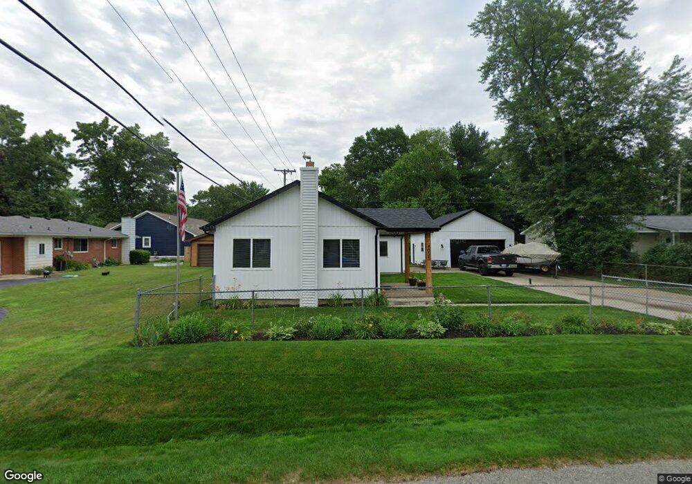
4035 Maple Blvd West Bloomfield, MI 48323
Estimated Value: $268,840 - $300,000
1
Bed
2
Baths
1,402
Sq Ft
$199/Sq Ft
Est. Value
About This Home
This home is located at 4035 Maple Blvd, West Bloomfield, MI 48323 and is currently estimated at $279,460, approximately $199 per square foot. 4035 Maple Blvd is a home located in Oakland County with nearby schools including Walled Lake Central High School, St. Matthew Lutheran School, and St. William School.
Ownership History
Date
Name
Owned For
Owner Type
Purchase Details
Closed on
Oct 30, 1998
Sold by
Josephson David Lee
Bought by
Josephson David Lee
Current Estimated Value
Home Financials for this Owner
Home Financials are based on the most recent Mortgage that was taken out on this home.
Original Mortgage
$78,750
Interest Rate
6.96%
Purchase Details
Closed on
Aug 29, 1997
Sold by
Rose Philip W
Bought by
Josephson David Lee
Create a Home Valuation Report for This Property
The Home Valuation Report is an in-depth analysis detailing your home's value as well as a comparison with similar homes in the area
Home Values in the Area
Average Home Value in this Area
Purchase History
| Date | Buyer | Sale Price | Title Company |
|---|---|---|---|
| Josephson David Lee | -- | -- | |
| Josephson David Lee | $85,000 | -- |
Source: Public Records
Mortgage History
| Date | Status | Borrower | Loan Amount |
|---|---|---|---|
| Previous Owner | Josephson David Lee | $78,750 |
Source: Public Records
Tax History
| Year | Tax Paid | Tax Assessment Tax Assessment Total Assessment is a certain percentage of the fair market value that is determined by local assessors to be the total taxable value of land and additions on the property. | Land | Improvement |
|---|---|---|---|---|
| 2025 | $2,162 | $117,100 | $38,560 | $78,540 |
| 2024 | $1,250 | $110,470 | $0 | $0 |
| 2022 | $1,179 | $101,290 | $28,560 | $72,730 |
| 2021 | $1,939 | $93,430 | $0 | $0 |
| 2020 | $1,165 | $92,430 | $28,560 | $63,870 |
| 2018 | $1,888 | $83,430 | $24,720 | $58,710 |
| 2015 | -- | $64,370 | $0 | $0 |
| 2014 | -- | $58,310 | $0 | $0 |
| 2011 | -- | $50,090 | $0 | $0 |
Source: Public Records
Map
Nearby Homes
- 4212 Greendale Ave
- 7369 Sweetbriar
- 3835 Ranya Dr
- 6978 Colony Dr
- 1047 Addison Cir
- 4383 Green Lake Rd
- 4405 Green Lake Rd
- 8226 Dickert St
- 3280 Chambourne St
- 8330 Dickert St
- 7555 Windgate Cir
- 8304 Arlis St
- 3991 Fieldview Ave
- 7567 Windgate Cir
- 6885 Aeroview St
- 8370 Arlis St
- 3965 Carrick Ave
- 6980 Hambro St
- 6790 Grassland Ave
- 2994 Lankford Ln
- 7815 Richardson Rd
- 4047 Maple Blvd
- 4036 Circle Blvd
- 7803 Richardson Rd
- 4036 Maple Blvd
- 4060 Circle Blvd
- 4024 Maple Blvd
- 4050 Maple Blvd
- 4075 Maple Blvd
- 4080 Maple Blvd
- 4076 Circle Blvd
- 4039 Circle Blvd
- 7816 Richardson Rd
- 4037 Highland Ct Unit Bldg-Unit
- 4037 Highland Ct
- 7777 Richardson Rd
- 4085 Highland Ct
- 7887 Richardson Rd
- 7806 Richardson Rd
- 4039 Circle Bvld
Your Personal Tour Guide
Ask me questions while you tour the home.