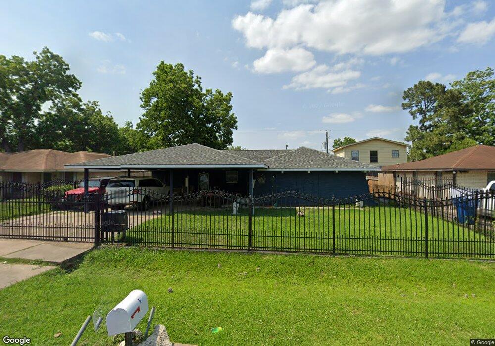
4035 Merrimac St Houston, TX 77093
East Aldine NeighborhoodEstimated Value: $210,000 - $276,000
4
Beds
3
Baths
1,828
Sq Ft
$133/Sq Ft
Est. Value
About This Home
This home is located at 4035 Merrimac St, Houston, TX 77093 and is currently estimated at $242,311, approximately $132 per square foot. 4035 Merrimac St is a home located in Harris County with nearby schools including Vardeman EC/PK/K, Orange Grove Elementary School, and Macarthur Ninth Grade School.
Ownership History
Date
Name
Owned For
Owner Type
Purchase Details
Closed on
Jul 22, 2018
Sold by
Botello Abel and Deanda Lisa De
Bought by
Valdivia Maria Guadalupe
Current Estimated Value
Purchase Details
Closed on
Oct 23, 2012
Sold by
Gonzalez Yesenia M and Gonzalez Zulma B
Bought by
Botello Blanca E
Purchase Details
Closed on
Apr 4, 2006
Sold by
Botello Blanca E
Bought by
Gonzales Yesenia M and Gonalez Zulma B
Purchase Details
Closed on
Aug 16, 1999
Sold by
Collins Stephen Keith
Bought by
Botello Blanca E
Create a Home Valuation Report for This Property
The Home Valuation Report is an in-depth analysis detailing your home's value as well as a comparison with similar homes in the area
Home Values in the Area
Average Home Value in this Area
Purchase History
| Date | Buyer | Sale Price | Title Company |
|---|---|---|---|
| Valdivia Maria Guadalupe | -- | None Available | |
| Botello Blanca E | -- | None Available | |
| Gonzales Yesenia M | -- | None Available | |
| Botello Blanca E | -- | -- |
Source: Public Records
Tax History Compared to Growth
Tax History
| Year | Tax Paid | Tax Assessment Tax Assessment Total Assessment is a certain percentage of the fair market value that is determined by local assessors to be the total taxable value of land and additions on the property. | Land | Improvement |
|---|---|---|---|---|
| 2025 | $6,011 | $316,884 | $35,425 | $281,459 |
| 2024 | $6,011 | $310,678 | $35,425 | $275,253 |
| 2023 | $5,224 | $280,569 | $35,425 | $245,144 |
| 2022 | $4,392 | $213,595 | $12,045 | $201,550 |
| 2021 | $4,234 | $196,421 | $12,045 | $184,376 |
| 2020 | $4,133 | $181,938 | $12,045 | $169,893 |
| 2019 | $4,006 | $168,415 | $12,045 | $156,370 |
| 2018 | $2,473 | $172,236 | $12,045 | $160,191 |
| 2017 | $3,904 | $172,236 | $12,045 | $160,191 |
| 2016 | $3,904 | $172,236 | $12,045 | $160,191 |
| 2015 | $1,831 | $165,990 | $12,045 | $153,945 |
| 2014 | $1,831 | $148,539 | $12,045 | $136,494 |
Source: Public Records
Map
Nearby Homes
- 4007 Wedgewood St
- 9213 Washington St
- 4415 Mooney Rd
- 4522 Collins Rd
- 11206 Eastex Fwy
- 3418 Hopper Rd
- 11769 Gloger St
- 3214 Brea Crest St
- 3111 Hartwick Rd
- 3804 Cedar Hill Ln
- 2930 Bertrand St
- 4410 Shelton Rd
- 2922 Bertrand St
- 11375 Allwood St
- 2915 Brea Crest St
- 11781 Eastex Fwy
- 11937 Connor St
- 2723 Castledale Dr
- 2817 Cromwell St
- 5404 Mount Houston Rd
- 4103 Merrimac St
- 4031 Merrimac St
- 4010 Monitor St
- 4107 Merrimac St
- 4102 Monitor St
- 4002 Monitor St
- 4106 Monitor St
- 4034 Merrimac St
- 4030 Merrimac St
- 4102 Merrimac St
- 4111 Merrimac St
- 4106 Merrimac St
- 4014 Merrimac St
- 4110 Monitor St
- 4026 Merrimac St
- 4018 Merrimac St
- 4010 Merrimac St
- 4110 Merrimac St
- 4115 Merrimac St
- 4022 Merrimac St