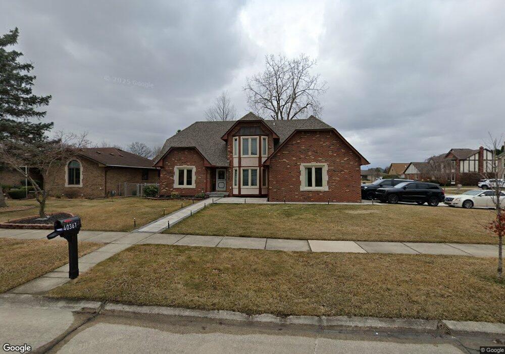
40361 Langton Dr Sterling Heights, MI 48310
Estimated Value: $432,658 - $483,000
4
Beds
3
Baths
2,271
Sq Ft
$203/Sq Ft
Est. Value
About This Home
This home is located at 40361 Langton Dr, Sterling Heights, MI 48310 and is currently estimated at $460,415, approximately $202 per square foot. 40361 Langton Dr is a home located in Macomb County with nearby schools including Schuchard Elementary School, Frank Jeannette Junior High School, and Adlai Stevenson High School.
Ownership History
Date
Name
Owned For
Owner Type
Purchase Details
Closed on
Sep 2, 2009
Sold by
Haio Rafida and Haio Ferial Youhannan
Bought by
Razzoki Azzam and Haio Jandar
Current Estimated Value
Purchase Details
Closed on
May 26, 2009
Sold by
Haio Rafida
Bought by
Haio Rafida and Haio Ferial
Purchase Details
Closed on
Mar 30, 2007
Sold by
Shaman Sanna and Shaman Adam S
Bought by
The Bank Of New York Trust Co Na and Jp Morgan Chase Bank Na
Create a Home Valuation Report for This Property
The Home Valuation Report is an in-depth analysis detailing your home's value as well as a comparison with similar homes in the area
Home Values in the Area
Average Home Value in this Area
Purchase History
| Date | Buyer | Sale Price | Title Company |
|---|---|---|---|
| Razzoki Azzam | $50,000 | Devon Title Agency | |
| Haio Rafida | -- | None Available | |
| The Bank Of New York Trust Co Na | $238,500 | None Available |
Source: Public Records
Tax History Compared to Growth
Tax History
| Year | Tax Paid | Tax Assessment Tax Assessment Total Assessment is a certain percentage of the fair market value that is determined by local assessors to be the total taxable value of land and additions on the property. | Land | Improvement |
|---|---|---|---|---|
| 2025 | $4,961 | $222,300 | $0 | $0 |
| 2024 | $4,537 | $209,500 | $0 | $0 |
| 2023 | $4,283 | $188,500 | $0 | $0 |
| 2022 | $4,465 | $172,500 | $0 | $0 |
| 2021 | $4,373 | $162,500 | $0 | $0 |
| 2020 | $3,900 | $157,600 | $0 | $0 |
| 2019 | $3,996 | $154,400 | $0 | $0 |
| 2018 | $4,044 | $143,400 | $0 | $0 |
| 2017 | $3,860 | $134,700 | $23,200 | $111,500 |
| 2016 | $3,729 | $134,700 | $0 | $0 |
| 2015 | -- | $123,700 | $0 | $0 |
| 2014 | -- | $75,000 | $0 | $0 |
Source: Public Records
Map
Nearby Homes
- 2503 Westmont Cir
- 41395 Ambercrest Dr
- 2336 Heritage Pointe Dr Unit 17
- 39588 Dequindre Rd
- 39560 Dequindre Rd
- 2700 Renshaw Dr
- 3550 Kirkton Dr
- 2233 Mellowood Dr
- 41466 Dequindre Rd
- 2833 Bywater Dr
- 3777 Hamlet Dr
- 5238 Windmill Dr
- 41599 Red Oak Dr
- 3514 Bates Dr
- 41659 Touchstone Dr
- 39198 Faith Dr
- 3715 Knightbridge Cir
- 3600 Brandi Dr
- 40444 Harmon Dr
- 5092 Julian Dr
- 40347 Langton Dr
- 40360 Denbigh Dr
- 40333 Langton Dr
- 2531 Cobden Dr
- 40346 Denbigh Dr
- 40362 Langton Dr
- 2545 Cobden Dr
- 40348 Langton Dr
- 2517 Cobden Dr
- 40376 Langton Dr
- 40319 Langton Dr
- 40332 Denbigh Dr
- 2559 Cobden Dr
- 40334 Langton Dr
- 40320 Langton Dr
- 40318 Denbigh Dr
- 2573 Cobden Dr
- 2528 Marlbank Dr
- 40305 Langton Dr
- 2514 Marlbank Dr