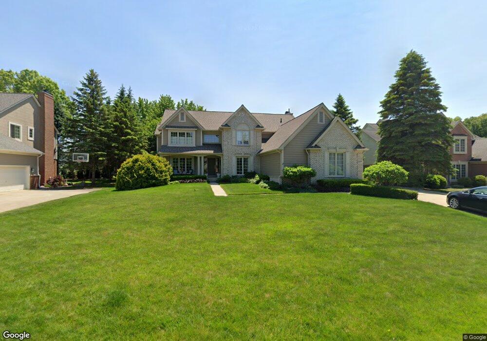
4038 Coventry Dr Auburn Hills, MI 48326
Estimated Value: $608,225 - $699,000
1
Bed
3
Baths
2,954
Sq Ft
$222/Sq Ft
Est. Value
About This Home
This home is located at 4038 Coventry Dr, Auburn Hills, MI 48326 and is currently estimated at $656,556, approximately $222 per square foot. 4038 Coventry Dr is a home located in Oakland County with nearby schools including Musson Elementary School, Van Hoosen Middle School, and Rochester Adams High School.
Ownership History
Date
Name
Owned For
Owner Type
Purchase Details
Closed on
Feb 12, 1999
Sold by
Green Leland D
Bought by
Morris Russell A
Current Estimated Value
Home Financials for this Owner
Home Financials are based on the most recent Mortgage that was taken out on this home.
Original Mortgage
$260,000
Outstanding Balance
$62,121
Interest Rate
6.85%
Estimated Equity
$594,435
Purchase Details
Closed on
Oct 4, 1996
Sold by
Hawthorn Homes Inc
Bought by
Hawthorn Homes Inc
Create a Home Valuation Report for This Property
The Home Valuation Report is an in-depth analysis detailing your home's value as well as a comparison with similar homes in the area
Home Values in the Area
Average Home Value in this Area
Purchase History
| Date | Buyer | Sale Price | Title Company |
|---|---|---|---|
| Morris Russell A | $325,000 | -- | |
| Hawthorn Homes Inc | $283,680 | -- |
Source: Public Records
Mortgage History
| Date | Status | Borrower | Loan Amount |
|---|---|---|---|
| Open | Morris Russell A | $260,000 |
Source: Public Records
Tax History Compared to Growth
Tax History
| Year | Tax Paid | Tax Assessment Tax Assessment Total Assessment is a certain percentage of the fair market value that is determined by local assessors to be the total taxable value of land and additions on the property. | Land | Improvement |
|---|---|---|---|---|
| 2024 | $3,068 | $249,150 | $0 | $0 |
| 2023 | $2,950 | $226,180 | $0 | $0 |
| 2022 | $5,664 | $197,250 | $0 | $0 |
| 2021 | $5,486 | $197,240 | $0 | $0 |
| 2020 | $2,850 | $200,640 | $0 | $0 |
| 2019 | $5,376 | $195,660 | $0 | $0 |
| 2018 | $5,370 | $186,700 | $0 | $0 |
| 2017 | $5,264 | $186,160 | $0 | $0 |
| 2016 | $5,211 | $183,830 | $0 | $0 |
| 2015 | -- | $193,950 | $0 | $0 |
| 2014 | -- | $165,980 | $0 | $0 |
| 2011 | -- | $143,940 | $0 | $0 |
Source: Public Records
Map
Nearby Homes
- 4035 Hillsdale Dr Unit 275
- 3640 Camden Ct
- 3634 Camden Ct
- 3633 Thornwood Dr
- 3674 Merriweather Ln
- 3534 Riverside Dr Unit 141
- 3780 Bald Mountain Rd
- 3879 Teakwood Ln
- 1906 Independence Ct
- 5700 Rolling Hills Dr
- 3273 Salem Dr
- 3095 Bridgewater Rd Unit 30
- 3057 Bridgewater Rd
- 423 Silvervale Dr
- 1609 Kilburn Rd N
- 2935 Woodford Cir
- 3111 Ramzi Ln
- 3639 Heatherwood Ct
- 5826 Murfield Dr
- 3185 Saint James Ct
- 4032 Coventry Dr
- 4046 Coventry Dr
- 3946 Hillsdale Dr Unit 195
- 3944 Hillsdale Dr Unit 194
- 3942 Hillsdale Dr Unit 193
- 4028 Arcadia Dr
- 3948 Hillsdale Dr Unit 196
- 4052 Coventry Dr
- 3940 Hillsdale Dr Unit 192
- 4039 Coventry Dr
- 4033 Coventry Dr
- 3938 Hillsdale Dr Unit 191
- 4073 Coventry Dr
- 3936 Hillsdale Dr Unit 190
- 3936 Hillsdale Dr Unit Bldg-Unit190
- 3936 Hillsdale Dr
- 4066 Coventry Dr
- 3950 Hillsdale Dr
- 3950 Hillsdale Dr Unit 197
- 4042 Arcadia Dr