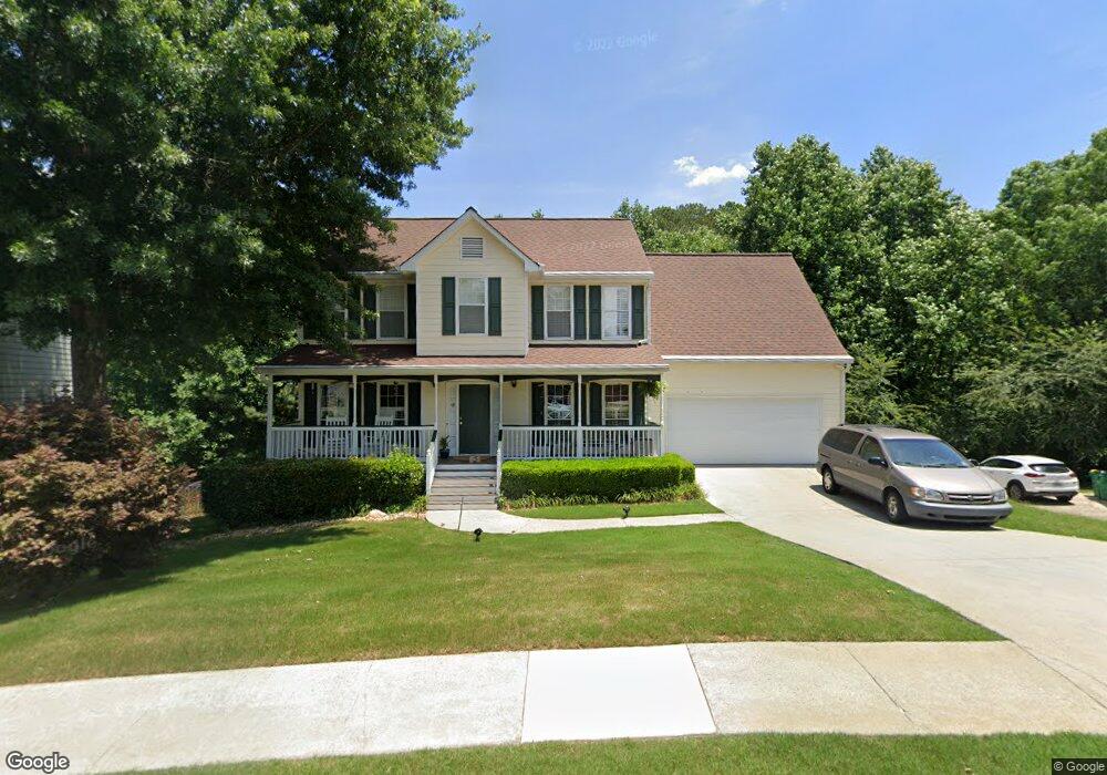
4039 Mount Vernon Dr Unit 2 Woodstock, GA 30189
Oak Grove NeighborhoodEstimated Value: $419,000 - $456,826
4
Beds
3
Baths
2,504
Sq Ft
$175/Sq Ft
Est. Value
About This Home
This home is located at 4039 Mount Vernon Dr Unit 2, Woodstock, GA 30189 and is currently estimated at $437,913, approximately $174 per square foot. 4039 Mount Vernon Dr Unit 2 is a home located in Cherokee County with nearby schools including Carmel Elementary School, Woodstock Middle School, and Woodstock High School.
Ownership History
Date
Name
Owned For
Owner Type
Purchase Details
Closed on
Oct 17, 2007
Sold by
Anderson Neal C and Anderson Heather M
Bought by
Anderson Neal C and Anderson Heather M
Current Estimated Value
Home Financials for this Owner
Home Financials are based on the most recent Mortgage that was taken out on this home.
Original Mortgage
$117,000
Interest Rate
5.93%
Mortgage Type
New Conventional
Purchase Details
Closed on
Feb 27, 2001
Sold by
Arzenshek Greogry
Bought by
Brown Cyndy C
Home Financials for this Owner
Home Financials are based on the most recent Mortgage that was taken out on this home.
Original Mortgage
$170,900
Interest Rate
6.69%
Mortgage Type
New Conventional
Purchase Details
Closed on
May 8, 1995
Sold by
David Bock Homes
Bought by
Arzenshek Gregory
Create a Home Valuation Report for This Property
The Home Valuation Report is an in-depth analysis detailing your home's value as well as a comparison with similar homes in the area
Home Values in the Area
Average Home Value in this Area
Purchase History
| Date | Buyer | Sale Price | Title Company |
|---|---|---|---|
| Anderson Neal C | -- | -- | |
| Brown Cyndy C | $179,900 | -- | |
| Arzenshek Gregory | $138,000 | -- |
Source: Public Records
Mortgage History
| Date | Status | Borrower | Loan Amount |
|---|---|---|---|
| Closed | Anderson Neal C | $117,000 | |
| Previous Owner | Brown Cyndy C | $170,900 | |
| Closed | Arzenshek Gregory | $0 |
Source: Public Records
Tax History Compared to Growth
Tax History
| Year | Tax Paid | Tax Assessment Tax Assessment Total Assessment is a certain percentage of the fair market value that is determined by local assessors to be the total taxable value of land and additions on the property. | Land | Improvement |
|---|---|---|---|---|
| 2024 | $3,794 | $164,396 | $35,600 | $128,796 |
| 2023 | $3,664 | $156,180 | $32,000 | $124,180 |
| 2022 | $3,167 | $132,848 | $28,000 | $104,848 |
| 2021 | $2,852 | $107,876 | $22,880 | $84,996 |
| 2020 | $2,696 | $101,064 | $21,200 | $79,864 |
| 2019 | $2,491 | $92,240 | $19,200 | $73,040 |
| 2018 | $2,367 | $86,360 | $16,800 | $69,560 |
| 2017 | $2,345 | $211,600 | $16,800 | $67,840 |
| 2016 | $2,357 | $210,500 | $16,800 | $67,400 |
| 2015 | $2,183 | $191,400 | $14,400 | $62,160 |
| 2014 | $1,947 | $171,000 | $14,400 | $54,000 |
Source: Public Records
Map
Nearby Homes
- 4054 Mount Vernon Dr Unit 2
- 510 Scenic Pass
- 201 Vista Ln
- 615 Lexington Way Unit IV
- 2018 Township Dr Unit 1
- 353 Vista Ln
- 115 Township Ct
- 110 Hearthstone Dr Unit I
- 2004 Township Dr
- 1045 Legacy Walk
- 1015 Legacy Walk
- 410 Katherine Ln
- 525 Brooksdale Dr
- 705 Wind Song Trace
- 708 Wind Song Trace
- 333 Etowah Valley Trace
- 516 Philadelphia Ln
- 510 Terrace Way
- 4039 Mount Vernon Dr
- 4037 Mount Vernon Dr Unit 2
- 4041 Mount Vernon Dr
- 4035 Mount Vernon Dr
- 4043 Mount Vernon Dr
- 4036 Mount Vernon Dr
- 4038 Mount Vernon Dr Unit 2
- 4034 Mount Vernon Dr Unit 2
- 4033 Mount Vernon Dr Unit 2
- 4033 Mount Vernon Dr
- 4045 Mount Vernon Dr
- 4032 Mount Vernon Dr
- 302 Chesapeake Ridge
- 302 Chesapeake Ridge
- 300 Chesapeake Ridge Unit 2
- 4047 Mount Vernon Dr
- 304 Chesapeake Ridge Unit 2
- 4030 Mount Vernon Dr Unit 4030
- 4030 Mount Vernon Dr
- 306 Chesapeake Ridge