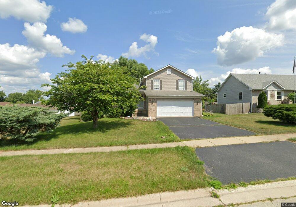
404 Brook Linsee Ln Poplar Grove, IL 61065
Estimated Value: $273,210 - $313,000
3
Beds
3
Baths
1,546
Sq Ft
$191/Sq Ft
Est. Value
About This Home
This home is located at 404 Brook Linsee Ln, Poplar Grove, IL 61065 and is currently estimated at $295,303, approximately $191 per square foot. 404 Brook Linsee Ln is a home located in Boone County with nearby schools including Poplar Grove Elementary School, North Boone Middle School, and North Boone Upper Elementary School.
Ownership History
Date
Name
Owned For
Owner Type
Purchase Details
Closed on
Mar 3, 2017
Sold by
Pablo Castaneda
Bought by
Carroll David A and Cunningham Kather
Current Estimated Value
Home Financials for this Owner
Home Financials are based on the most recent Mortgage that was taken out on this home.
Original Mortgage
$110,000
Interest Rate
4.21%
Mortgage Type
New Conventional
Purchase Details
Closed on
Oct 7, 2016
Bought by
Castaneda Pablo
Purchase Details
Closed on
Dec 7, 2015
Sold by
Rybaski Jeanine D
Bought by
Nationstar Mortgage Llc
Purchase Details
Closed on
Sep 22, 2009
Bought by
Rybaski Jeanine D
Create a Home Valuation Report for This Property
The Home Valuation Report is an in-depth analysis detailing your home's value as well as a comparison with similar homes in the area
Home Values in the Area
Average Home Value in this Area
Purchase History
| Date | Buyer | Sale Price | Title Company |
|---|---|---|---|
| Carroll David A | $137,500 | Heritage Title Co | |
| Castaneda Pablo | $83,800 | -- | |
| Nationstar Mortgage Llc | -- | -- | |
| Rybaski Jeanine D | $104,900 | -- |
Source: Public Records
Mortgage History
| Date | Status | Borrower | Loan Amount |
|---|---|---|---|
| Previous Owner | Carroll David A | $110,000 |
Source: Public Records
Tax History Compared to Growth
Tax History
| Year | Tax Paid | Tax Assessment Tax Assessment Total Assessment is a certain percentage of the fair market value that is determined by local assessors to be the total taxable value of land and additions on the property. | Land | Improvement |
|---|---|---|---|---|
| 2024 | $5,427 | $69,770 | $8,333 | $61,437 |
| 2023 | $5,427 | $63,458 | $8,333 | $55,125 |
| 2022 | $5,031 | $54,621 | $8,333 | $46,288 |
| 2021 | $4,547 | $49,571 | $8,333 | $41,238 |
| 2020 | $4,486 | $49,571 | $8,333 | $41,238 |
| 2019 | $4,624 | $46,205 | $8,333 | $37,872 |
| 2018 | $4,854 | $159,821 | $121,949 | $37,872 |
| 2017 | $4,971 | $46,013 | $8,375 | $37,638 |
| 2016 | $4,525 | $38,753 | $8,333 | $30,420 |
| 2015 | $3,786 | $38,753 | $8,333 | $30,420 |
| 2014 | $808 | $37,815 | $8,333 | $29,482 |
Source: Public Records
Map
Nearby Homes
- 109 W Edson St
- 109 W Edson St Unit 111 W Edson Street
- 402 Bree Dr
- 313 S State St
- 293 Oak St
- 100 N State St
- 110 N State St
- 473 Burled Wood Dr
- 479 Burled Wood Dr
- 140 Bullard St
- 539 Sycamore St
- 528 Oak Ln
- 522 Oak Ln
- xxxx Illinois 173
- 14086 Highway Route 76
- 14086 Il Route 76
- 13766 Il Route 76
- 111 Brandywine Dr SE
- 117 Brandywine Dr SE
- 134 Liverpool Dr SE
- 406 Brook Linsee Ln
- 203 Bree Dr
- 209 Bree Dr
- 408 Brook Linsee Ln
- 405 Brook Linsee Ln
- 403 Brook Linsee Ln
- 200 Britnie Dr
- 407 Brook Linsee Ln
- 401 Brook Linsee Ln
- 409 Brook Linsee Ln
- 208 Bree Dr
- 210 Bree Dr
- 404 Jayde Place
- 202 Bree Dr
- 402 Jayde Place
- 204 Bree Dr
- 203 Britnie Dr
- 206 Bree Dr
- 216 Bree Dr
- 205 Britnie Dr