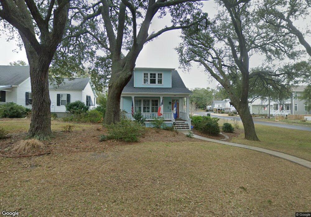
404 Clarendon Ave Southport, NC 28461
Estimated Value: $749,232 - $1,118,000
2
Beds
4
Baths
2,484
Sq Ft
$384/Sq Ft
Est. Value
About This Home
This home is located at 404 Clarendon Ave, Southport, NC 28461 and is currently estimated at $953,808, approximately $383 per square foot. 404 Clarendon Ave is a home located in Brunswick County with nearby schools including Southport Elementary School, South Brunswick Middle School, and South Brunswick High School.
Ownership History
Date
Name
Owned For
Owner Type
Purchase Details
Closed on
Apr 17, 2015
Sold by
Keiffer John S and Bray Bonita L
Bought by
Brock David Warren and Brock Sherry M
Current Estimated Value
Purchase Details
Closed on
Feb 25, 2010
Sold by
Tanner Ervin O
Bought by
Keiffer John S and Bray Bonita L
Home Financials for this Owner
Home Financials are based on the most recent Mortgage that was taken out on this home.
Original Mortgage
$85,000
Interest Rate
4.97%
Mortgage Type
Seller Take Back
Create a Home Valuation Report for This Property
The Home Valuation Report is an in-depth analysis detailing your home's value as well as a comparison with similar homes in the area
Home Values in the Area
Average Home Value in this Area
Purchase History
| Date | Buyer | Sale Price | Title Company |
|---|---|---|---|
| Brock David Warren | $560,000 | None Available | |
| Keiffer John S | $115,000 | None Available |
Source: Public Records
Mortgage History
| Date | Status | Borrower | Loan Amount |
|---|---|---|---|
| Previous Owner | Keiffer John S | $85,000 |
Source: Public Records
Tax History Compared to Growth
Tax History
| Year | Tax Paid | Tax Assessment Tax Assessment Total Assessment is a certain percentage of the fair market value that is determined by local assessors to be the total taxable value of land and additions on the property. | Land | Improvement |
|---|---|---|---|---|
| 2025 | -- | $539,710 | $108,900 | $430,810 |
| 2024 | $4,135 | $539,710 | $108,900 | $430,810 |
| 2023 | $3,928 | $539,710 | $108,900 | $430,810 |
| 2022 | $0 | $383,230 | $79,200 | $304,030 |
| 2021 | $0 | $383,230 | $79,200 | $304,030 |
| 2020 | $2,700 | $383,230 | $79,200 | $304,030 |
| 2019 | $3,420 | $88,760 | $79,200 | $9,560 |
| 2018 | $2,942 | $76,120 | $66,000 | $10,120 |
| 2017 | $2,912 | $76,120 | $66,000 | $10,120 |
| 2016 | $2,700 | $76,120 | $66,000 | $10,120 |
| 2015 | $2,700 | $324,430 | $66,000 | $258,430 |
| 2014 | -- | $334,306 | $110,880 | $223,426 |
Source: Public Records
Map
Nearby Homes
- 409 N Lord St
- 210 W West St
- 207 Clarendon Ave
- 229 N Caswell Ave
- 203 Clarendon Ave
- 424 West St
- 520 Clarendon Ave
- 606 W Brown St Unit K
- 606 W Brown St Unit D
- 220 N Caswell Ave
- 205 W Leonard St
- 209 N Lord St
- 608 W Brown St Unit C
- 608 W Brown St Unit F
- Lot 8 Clarendon Ave
- 403 N Howe St
- 2308 Crescent Bay Dr
- 2293 Crescent Bay Dr
- 411 Nicks Way Unit B
- 617 Port Haven Way
- 404 Clarendon Ave
- 406 Clarendon Ave
- 408 Clarendon Ave
- 302 W Brown St
- 405 Clarendon Ave
- 311 W Brown St
- 407 N Caswell Ave
- 418 Clarendon Ave
- 411 N Caswell Ave
- 309 W Brown St
- 303 W Brown St
- 411 N Caswell Ave
- 403 Clarendon Ave
- 401 Clarendon Ave
- 407 Clarendon Ave
- 312 Clarendon Ave
- 306 Hillcrest Dr
- 315 N Caswell Ave
- 309 W St George St
- 309 W Saint George St