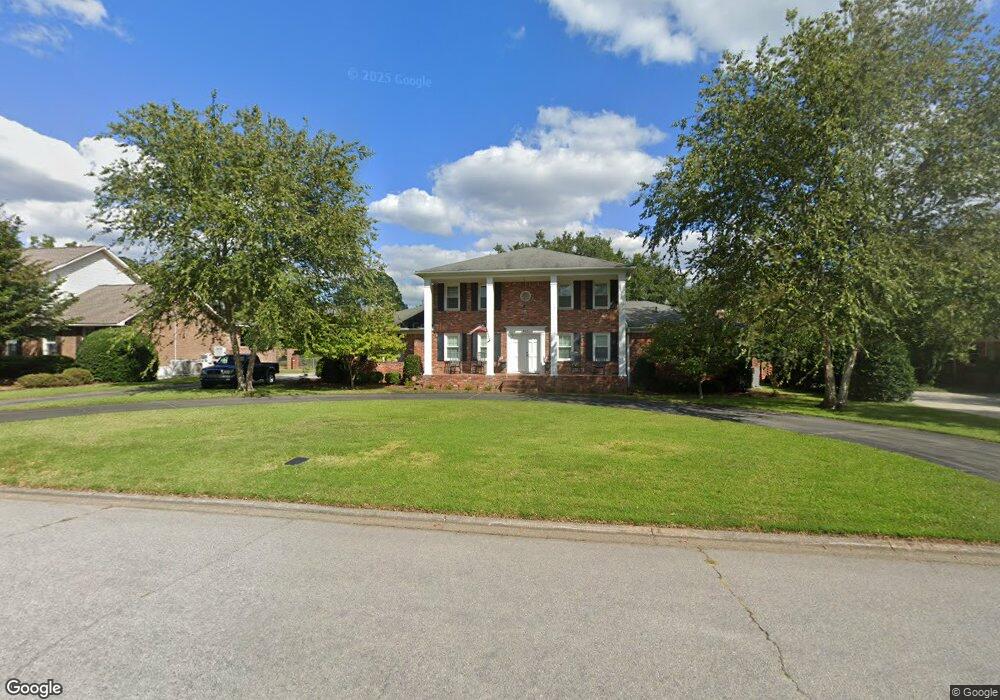
404 Crown Point Rd Columbia, SC 29209
The Hamptons NeighborhoodEstimated Value: $383,949 - $437,000
4
Beds
3
Baths
2,349
Sq Ft
$176/Sq Ft
Est. Value
About This Home
This home is located at 404 Crown Point Rd, Columbia, SC 29209 and is currently estimated at $413,987, approximately $176 per square foot. 404 Crown Point Rd is a home located in Richland County with nearby schools including Meadowfield Elementary School, Hand Middle School, and Dreher High School.
Ownership History
Date
Name
Owned For
Owner Type
Purchase Details
Closed on
Apr 28, 2006
Sold by
Childress Ronald M and Estate Of Peter Mills Childres
Bought by
Cagle Terry D and Cagle Julia Ann
Current Estimated Value
Home Financials for this Owner
Home Financials are based on the most recent Mortgage that was taken out on this home.
Original Mortgage
$80,000
Outstanding Balance
$46,094
Interest Rate
6.31%
Mortgage Type
Fannie Mae Freddie Mac
Estimated Equity
$367,893
Create a Home Valuation Report for This Property
The Home Valuation Report is an in-depth analysis detailing your home's value as well as a comparison with similar homes in the area
Home Values in the Area
Average Home Value in this Area
Purchase History
| Date | Buyer | Sale Price | Title Company |
|---|---|---|---|
| Cagle Terry D | $250,000 | None Available |
Source: Public Records
Mortgage History
| Date | Status | Borrower | Loan Amount |
|---|---|---|---|
| Open | Cagle Terry D | $80,000 |
Source: Public Records
Tax History Compared to Growth
Tax History
| Year | Tax Paid | Tax Assessment Tax Assessment Total Assessment is a certain percentage of the fair market value that is determined by local assessors to be the total taxable value of land and additions on the property. | Land | Improvement |
|---|---|---|---|---|
| 2024 | $1,697 | $296,000 | $0 | $0 |
| 2023 | $1,697 | $10,296 | $0 | $0 |
| 2022 | $1,505 | $257,400 | $57,800 | $199,600 |
| 2021 | $1,555 | $10,300 | $0 | $0 |
| 2020 | $2,035 | $10,300 | $0 | $0 |
| 2019 | $2,049 | $10,300 | $0 | $0 |
| 2018 | $1,884 | $9,260 | $0 | $0 |
| 2017 | $1,835 | $9,260 | $0 | $0 |
| 2016 | $1,769 | $9,260 | $0 | $0 |
| 2015 | $1,769 | $9,260 | $0 | $0 |
| 2014 | $1,767 | $231,600 | $0 | $0 |
| 2013 | -- | $9,260 | $0 | $0 |
Source: Public Records
Map
Nearby Homes
- 405 Black Friars Rd
- 497 Galway Ln
- 104 Preserve Ln
- 416 Tamarack Dr
- 6603 Christie Rd
- 6627 Christie Rd
- 6400 Saye Cut
- 9 Ansley Ct
- 604 Hampton Trace Ln
- 918 Cedar Terrace
- 513 Knollwood Dr
- 444 Cami Forest Ln
- 109 Rosebank Dr
- 1018 Brandon Ave
- 1017 Drake St
- 821 Walters Ln
- 23 Braiden Manor Rd
- 622 Chimney Hill Rd
- 1126 S Beltline Blvd
- 4125 Mikell Ln
- 400 Crown Point Rd
- 408 Crown Point Rd
- 405 Crown Point Rd
- 401 Black Friars Rd
- 409 Crown Point Rd
- 401 Crown Point Rd
- 412 Crown Point Rd
- 409 Black Friars Rd
- 413 Crown Point Rd
- 334 Crown Point Rd
- 404 Old Woodlands Rd
- 408 Old Woodlands Rd
- 412 Old Woodlands Rd
- 327 Black Friars Rd
- 333 Crown Point Rd
- 416 Crown Point Rd
- 6309 Olde Knight Pkwy
- 404 Black Friars Rd
- 330 Crown Point Rd
- 406 Black Friars Rd