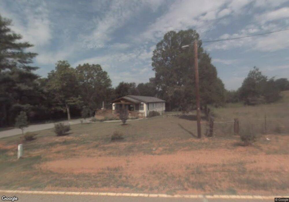
404 Davis Rd Liberty, SC 29657
Estimated Value: $176,000 - $278,000
2
Beds
2
Baths
1,283
Sq Ft
$178/Sq Ft
Est. Value
About This Home
This home is located at 404 Davis Rd, Liberty, SC 29657 and is currently estimated at $227,900, approximately $177 per square foot. 404 Davis Rd is a home located in Pickens County with nearby schools including Liberty Elementary School, Liberty Middle School, and Liberty High School.
Ownership History
Date
Name
Owned For
Owner Type
Purchase Details
Closed on
Apr 30, 2007
Sold by
Gaulden Charles H
Bought by
Edwards William T
Current Estimated Value
Home Financials for this Owner
Home Financials are based on the most recent Mortgage that was taken out on this home.
Original Mortgage
$62,000
Outstanding Balance
$37,589
Interest Rate
6.11%
Mortgage Type
VA
Estimated Equity
$190,311
Purchase Details
Closed on
Mar 22, 2007
Sold by
Regent Carolina Investments Llc
Bought by
Gaulden Charles H
Home Financials for this Owner
Home Financials are based on the most recent Mortgage that was taken out on this home.
Original Mortgage
$62,000
Outstanding Balance
$37,589
Interest Rate
6.11%
Mortgage Type
VA
Estimated Equity
$190,311
Purchase Details
Closed on
Nov 21, 2006
Sold by
Jones Christine Allison Zarczynski
Bought by
Regent Carolina Investments Llc
Create a Home Valuation Report for This Property
The Home Valuation Report is an in-depth analysis detailing your home's value as well as a comparison with similar homes in the area
Home Values in the Area
Average Home Value in this Area
Purchase History
| Date | Buyer | Sale Price | Title Company |
|---|---|---|---|
| Edwards William T | $62,000 | Attorney | |
| Gaulden Charles H | -- | Attorney | |
| Regent Carolina Investments Llc | $27,500 | None Available |
Source: Public Records
Mortgage History
| Date | Status | Borrower | Loan Amount |
|---|---|---|---|
| Open | Edwards William T | $62,000 | |
| Previous Owner | Gaulden Charles H | $55,000 |
Source: Public Records
Tax History Compared to Growth
Tax History
| Year | Tax Paid | Tax Assessment Tax Assessment Total Assessment is a certain percentage of the fair market value that is determined by local assessors to be the total taxable value of land and additions on the property. | Land | Improvement |
|---|---|---|---|---|
| 2024 | $754 | $4,720 | $640 | $4,080 |
| 2023 | $678 | $4,720 | $640 | $4,080 |
| 2022 | $652 | $4,720 | $640 | $4,080 |
| 2021 | $637 | $4,720 | $640 | $4,080 |
| 2020 | $680 | $4,724 | $640 | $4,084 |
| 2019 | $683 | $4,720 | $640 | $4,080 |
| 2018 | $724 | $4,720 | $640 | $4,080 |
| 2017 | $0 | $0 | $0 | $0 |
Source: Public Records
Map
Nearby Homes
- 311 Davis Rd
- 426 N Palmetto St
- 121 Forrester Dr
- 714 N Ashton Dr
- 108 Forrester Dr
- 100 Forrester Dr Unit 205 Ashton Drive
- 202 Ashton Dr
- 11 Moorefield Memorial Hwy
- 10 Moorefield Memorial Hwy
- 09 Moorefield Memorial Hwy
- 03 Moorefield Memorial Hwy
- 12 Moorefield Memorial Hwy
- 01 Moorefield Memorial Hwy
- 00 Moorefield Memorial Hwy
- 02 Moorefield Memorial Hwy
- 05 Moorefield Memorial Hwy
- 108 Meadow Ln
- 00 E Main St
- 409 W Main St
- 441 Hillandale Rd
- 406 Davis Rd
- 106 Gilstrap Dr
- 106 Gilstrap Dr Unit Liberty
- 00 Gilstrap
- 110 Gilstrap Dr
- 110 Gilstrap Dr Unit Lot 2
- 411 Davis Rd
- 105 Sunset Dr
- 414 Davis Rd
- 202 Gilstrap Dr
- 106 Belleview Dr
- 102 Belleview Dr
- 100 Sunset Dr
- 420 Davis Rd
- 412 Davis Rd
- 210 Gilstrap Dr
- 400 Davis Rd
- 103 Belleview Dr
- 110 Sunset Dr
- 107 Belleview Dr