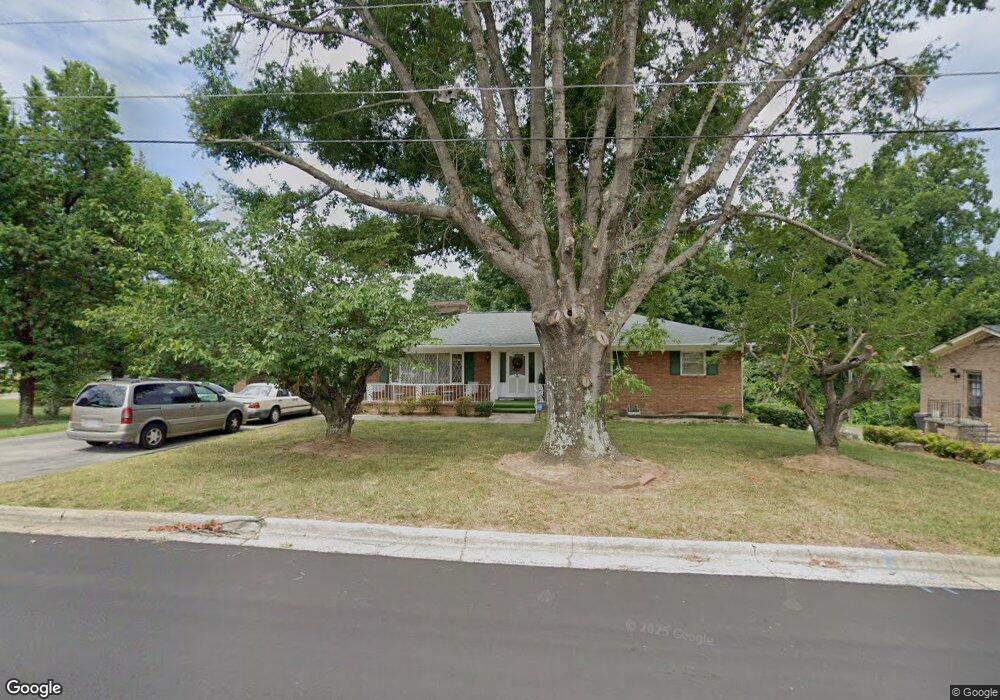
404 Hubbard St Reidsville, NC 27320
Estimated Value: $230,000 - $289,000
--
Bed
--
Bath
1,797
Sq Ft
$141/Sq Ft
Est. Value
About This Home
This home is located at 404 Hubbard St, Reidsville, NC 27320 and is currently estimated at $252,679, approximately $140 per square foot. 404 Hubbard St is a home located in Rockingham County with nearby schools including Reidsville High School, Moss Street Elementary, and Reidsville Middle School.
Ownership History
Date
Name
Owned For
Owner Type
Purchase Details
Closed on
Dec 21, 2021
Sold by
Bolden Thomas E and Bolden Lucy M
Bought by
Grill Steven and Grill Kendra
Current Estimated Value
Purchase Details
Closed on
Aug 31, 2006
Sold by
Johnson Barbara L
Bought by
Bolden Thomas E and Bolden Lucy M
Home Financials for this Owner
Home Financials are based on the most recent Mortgage that was taken out on this home.
Original Mortgage
$127,550
Interest Rate
6.58%
Mortgage Type
New Conventional
Create a Home Valuation Report for This Property
The Home Valuation Report is an in-depth analysis detailing your home's value as well as a comparison with similar homes in the area
Home Values in the Area
Average Home Value in this Area
Purchase History
| Date | Buyer | Sale Price | Title Company |
|---|---|---|---|
| Grill Steven | $25,000 | None Listed On Document | |
| Bolden Thomas E | $135,000 | None Available |
Source: Public Records
Mortgage History
| Date | Status | Borrower | Loan Amount |
|---|---|---|---|
| Previous Owner | Bolden Thomas E | $127,550 |
Source: Public Records
Tax History Compared to Growth
Tax History
| Year | Tax Paid | Tax Assessment Tax Assessment Total Assessment is a certain percentage of the fair market value that is determined by local assessors to be the total taxable value of land and additions on the property. | Land | Improvement |
|---|---|---|---|---|
| 2025 | $3,114 | $251,097 | $17,248 | $233,849 |
| 2024 | $3,114 | $251,097 | $17,248 | $233,849 |
| 2023 | $3,114 | $133,014 | $15,680 | $117,334 |
| 2022 | $1,907 | $133,014 | $15,680 | $117,334 |
| 2021 | $1,907 | $133,014 | $15,680 | $117,334 |
| 2020 | $1,907 | $133,014 | $15,680 | $117,334 |
| 2019 | $1,907 | $133,014 | $15,680 | $117,334 |
| 2018 | $1,990 | $138,555 | $21,620 | $116,935 |
| 2017 | $1,990 | $138,555 | $21,620 | $116,935 |
| 2015 | $2,010 | $138,555 | $21,620 | $116,935 |
| 2014 | $1,990 | $138,555 | $21,620 | $116,935 |
Source: Public Records
Map
Nearby Homes
- 00 Robinson Cir
- 315 Hubbard St
- 403 Pennsylvania Ave
- 101 S Branch St
- 802 Lawsonville Ave
- 312 Church St
- 335 S Branch St
- 511 Barnes St
- 515 Barnes St
- 115 N Harris St
- 137 Ridge St
- 612 Thomas St
- 502 Thomas St
- 607 Lancaster Dr
- 117 Ridge St
- 00 E Morehead St
- 304 Roanoke St
- 971 Willow St
- 105 Edna St
- 816 Barnes St
- 406 Hubbard St
- 332 Hubbard St
- 330 Hubbard St
- 608 E Morehead St
- 610 E Morehead St
- 606 E Morehead St
- 329 Hubbard St
- 854 Robinson Cir
- 612 E Morehead St
- 604 E Morehead St
- 328 Hubbard St
- 602 E Morehead St
- 327 Hubbard St
- 326 Hubbard St
- 325 Hubbard St
- 603 E Morehead St
- 605 E Morehead St
- 324 Hubbard St
- 607 E Morehead St
- 601 E Morehead St