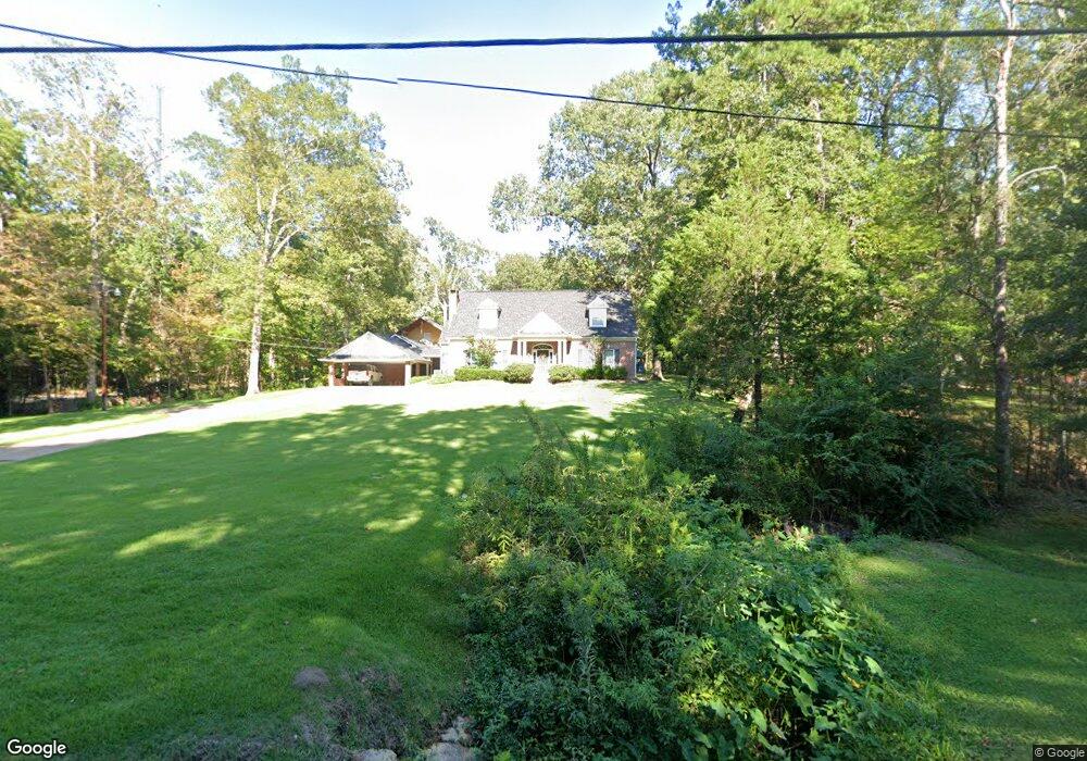
404 Karen Dr Lufkin, TX 75901
Estimated Value: $238,402 - $320,000
--
Bed
8
Baths
1,789
Sq Ft
$163/Sq Ft
Est. Value
About This Home
This home is located at 404 Karen Dr, Lufkin, TX 75901 and is currently estimated at $291,601, approximately $162 per square foot. 404 Karen Dr is a home located in Angelina County with nearby schools including Kurth Primary School, Anderson Elementary School, and Lufkin Middle School.
Ownership History
Date
Name
Owned For
Owner Type
Purchase Details
Closed on
Feb 24, 2022
Sold by
Ryan Thurman Kendall
Bought by
Bowling Kelsey
Current Estimated Value
Purchase Details
Closed on
Dec 17, 2019
Sold by
Thurman Kenny and Thurman Carol Sue
Bought by
Thurman Kendall Ryan and Thurman Lindsay
Purchase Details
Closed on
May 24, 2019
Sold by
Thurman Carol Sue
Bought by
Thurman Kendall Ryan and Thurman Lindsay
Purchase Details
Closed on
Aug 2, 2007
Sold by
Thurman Carol Sue
Bought by
Thurman Carol Sue
Purchase Details
Closed on
Nov 16, 2005
Sold by
Cook Brenda
Bought by
Foreman Joyce
Create a Home Valuation Report for This Property
The Home Valuation Report is an in-depth analysis detailing your home's value as well as a comparison with similar homes in the area
Home Values in the Area
Average Home Value in this Area
Purchase History
| Date | Buyer | Sale Price | Title Company |
|---|---|---|---|
| Bowling Kelsey | -- | None Listed On Document | |
| Thurman Kendall Ryan | -- | None Available | |
| Thurman Kendall Ryan | -- | None Available | |
| Thurman Carol Sue | -- | None Available | |
| Foreman Joyce | -- | None Available |
Source: Public Records
Tax History Compared to Growth
Tax History
| Year | Tax Paid | Tax Assessment Tax Assessment Total Assessment is a certain percentage of the fair market value that is determined by local assessors to be the total taxable value of land and additions on the property. | Land | Improvement |
|---|---|---|---|---|
| 2025 | $4,685 | $224,200 | $3,850 | $220,350 |
| 2024 | $4,573 | $218,840 | $3,850 | $214,990 |
| 2023 | $4,333 | $218,070 | $3,850 | $214,220 |
| 2022 | $4,178 | $197,240 | $2,790 | $194,450 |
| 2021 | $4,108 | $173,850 | $2,790 | $171,060 |
| 2020 | $3,726 | $151,600 | $3,230 | $148,370 |
| 2019 | $4,317 | $166,090 | $15,840 | $150,250 |
| 2018 | $3,723 | $163,080 | $15,840 | $147,240 |
| 2017 | $3,723 | $156,190 | $15,840 | $140,350 |
| 2016 | $3,628 | $152,190 | $15,840 | $136,350 |
| 2015 | $3,341 | $152,190 | $15,840 | $136,350 |
| 2014 | $3,341 | $151,070 | $15,840 | $135,230 |
Source: Public Records
Map
Nearby Homes
- R33234 Platt Rd
- 2608 Tulane Dr
- 2540 Brentwood Dr
- 508 Forest Creek Dr
- 406 Forest Creek Dr
- 1302 Parkman St
- 2102 Brentwood Dr
- 2104 Brentwood Dr
- 5100 Farm To Market 58
- 1502 Brentwood Dr
- 115 Willow Brook Dr
- 2302 Tulane Dr
- 110 Copperwood Loop
- 410 Brentwood Dr
- 2606 Brentwood Dr
- 510 Brentwood Dr
- R33219, R33220 Brentwood Dr
- 3306 S Chestnut St
- 502 Brentwood Dr