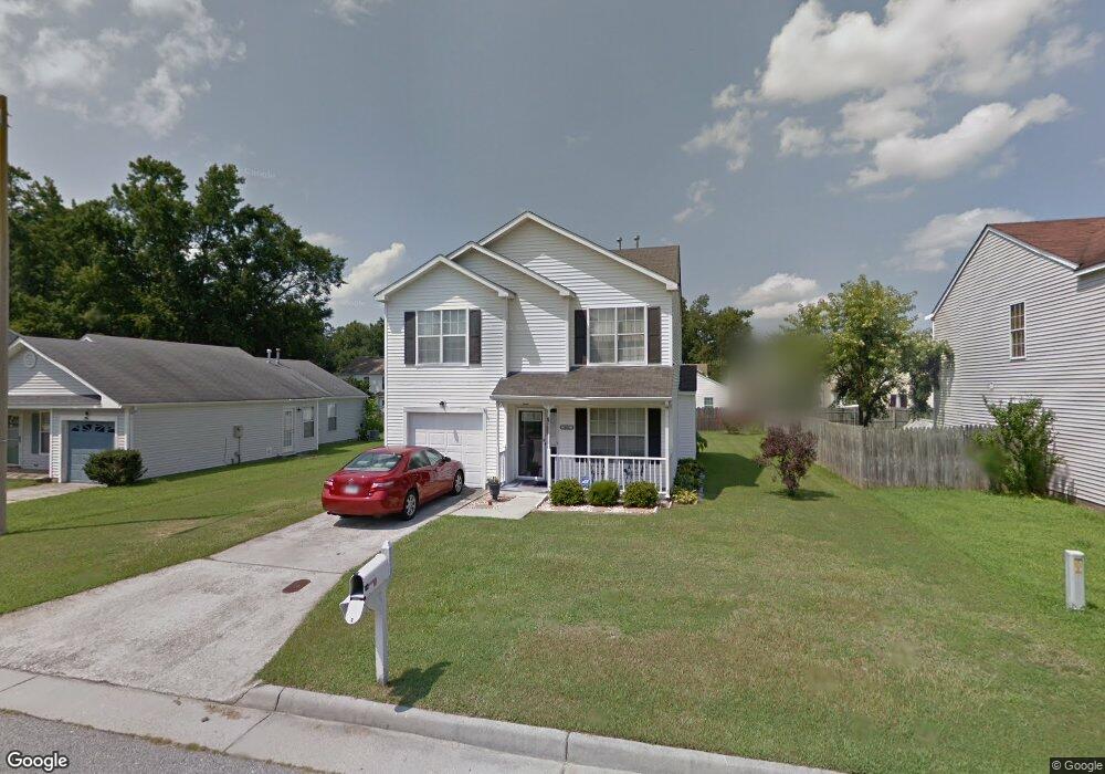
404 Keaton Way Suffolk, VA 23434
Chuckatuck NeighborhoodEstimated Value: $305,576 - $319,000
3
Beds
3
Baths
1,421
Sq Ft
$219/Sq Ft
Est. Value
About This Home
This home is located at 404 Keaton Way, Suffolk, VA 23434 and is currently estimated at $311,144, approximately $218 per square foot. 404 Keaton Way is a home located in Suffolk City with nearby schools including Oakland Elementary School, King's Fork Middle School, and King's Fork High School.
Ownership History
Date
Name
Owned For
Owner Type
Purchase Details
Closed on
Mar 14, 2013
Sold by
Cobb Valerie P
Bought by
Mcdonald Clarence
Current Estimated Value
Home Financials for this Owner
Home Financials are based on the most recent Mortgage that was taken out on this home.
Original Mortgage
$162,011
Outstanding Balance
$114,327
Interest Rate
3.54%
Mortgage Type
FHA
Estimated Equity
$196,817
Create a Home Valuation Report for This Property
The Home Valuation Report is an in-depth analysis detailing your home's value as well as a comparison with similar homes in the area
Home Values in the Area
Average Home Value in this Area
Purchase History
| Date | Buyer | Sale Price | Title Company |
|---|---|---|---|
| Mcdonald Clarence | $165,000 | -- |
Source: Public Records
Mortgage History
| Date | Status | Borrower | Loan Amount |
|---|---|---|---|
| Open | Mcdonald Clarence | $162,011 |
Source: Public Records
Tax History Compared to Growth
Tax History
| Year | Tax Paid | Tax Assessment Tax Assessment Total Assessment is a certain percentage of the fair market value that is determined by local assessors to be the total taxable value of land and additions on the property. | Land | Improvement |
|---|---|---|---|---|
| 2024 | $3,532 | $269,800 | $80,000 | $189,800 |
| 2023 | $3,280 | $256,300 | $80,000 | $176,300 |
| 2022 | $2,530 | $232,100 | $80,000 | $152,100 |
| 2021 | $2,198 | $198,000 | $52,800 | $145,200 |
| 2020 | $2,007 | $180,800 | $52,800 | $128,000 |
| 2019 | $1,913 | $172,300 | $52,800 | $119,500 |
| 2018 | $1,942 | $172,100 | $52,800 | $119,300 |
| 2017 | $1,841 | $172,100 | $52,800 | $119,300 |
| 2016 | $1,751 | $163,600 | $52,800 | $110,800 |
| 2015 | $1,036 | $159,300 | $52,800 | $106,500 |
| 2014 | $1,036 | $159,300 | $52,800 | $106,500 |
Source: Public Records
Map
Nearby Homes
- 520 Kemp Landing
- 5061 Kings Grant Cir
- 5080 Kings Grant Cir
- 115 Tournament Ct
- 132 Ashford Dr
- 312 Stonehenge Dr
- 307 Shore Dr
- 5014 Kings Grant Cir
- 245 Wexford Dr W
- 150 Wexford Dr E
- 285 Wexford Dr W
- 2060 Queens Point Dr
- 1200 Capella Ln Unit A
- 1301 Regal Rd Unit C
- 1301 Regal Rd Unit A
- 102 Chalmers Dr
- 1101 Capella Ln Unit C
- 1100 Capella Ln Unit A
- 1100 Regal Rd Unit B
- 1056 Boundary Dr