Estimated Value: $2,464,000 - $4,840,000
4
Beds
5
Baths
5,011
Sq Ft
$813/Sq Ft
Est. Value
About This Home
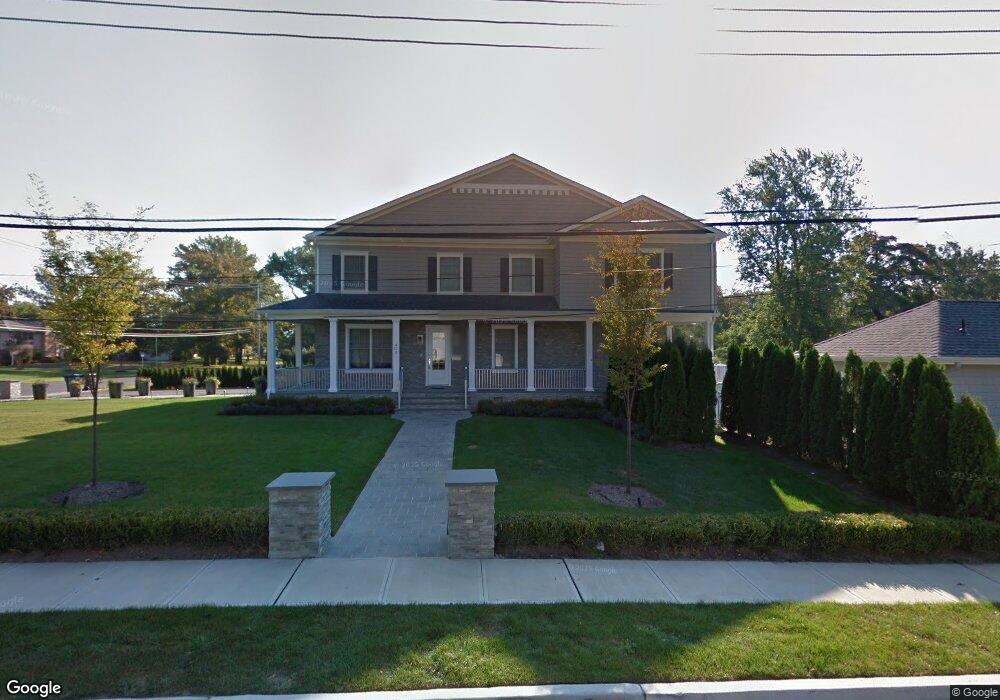
This home is located at 404 Maple St, Deal, NJ 07723 and is currently estimated at $4,072,328, approximately $812 per square foot. 404 Maple St is a home located in Monmouth County with nearby schools including Ocean Township High School, St. Mary of the Assumption School, and Bnot Shirah of Deal.
Ownership History
Date
Name
Owned For
Owner Type
Purchase Details
Closed on
Feb 16, 2006
Sold by
Morris Chehebar
Bought by
Jemal David and Jemal Wendy
Current Estimated Value
Home Financials for this Owner
Home Financials are based on the most recent Mortgage that was taken out on this home.
Original Mortgage
$160,000
Interest Rate
5.71%
Mortgage Type
Credit Line Revolving
Purchase Details
Closed on
Mar 9, 2000
Sold by
Greenspan Reba
Bought by
Mcm Realty Llc
Create a Home Valuation Report for This Property
The Home Valuation Report is an in-depth analysis detailing your home's value as well as a comparison with similar homes in the area
Home Values in the Area
Average Home Value in this Area
Purchase History
| Date | Buyer | Sale Price | Title Company |
|---|---|---|---|
| Jemal David | $1,200,000 | -- | |
| Morris Chehebar | -- | -- | |
| Mcm Realty Llc | $475,000 | -- |
Source: Public Records
Mortgage History
| Date | Status | Borrower | Loan Amount |
|---|---|---|---|
| Closed | Morris Chehebar | $160,000 | |
| Open | Morris Chehebar | $840,000 |
Source: Public Records
Tax History
| Year | Tax Paid | Tax Assessment Tax Assessment Total Assessment is a certain percentage of the fair market value that is determined by local assessors to be the total taxable value of land and additions on the property. | Land | Improvement |
|---|---|---|---|---|
| 2025 | $39,296 | $3,011,100 | $1,710,000 | $1,301,100 |
| 2024 | $33,675 | $2,755,700 | $1,520,000 | $1,235,700 |
Source: Public Records
Map
Nearby Homes
- 1 Country Club Dr
- 15 Joanna Ct
- 26 Wyckoff St
- 10 Campbell Ct
- 244 Overbrook Ave
- 404 Brookside Ave
- 504 Crosby Ave
- 0 Overbrook Ave
- 339 Elberon Blvd
- 328 Elberon Blvd
- 306 Roosevelt Ave
- 267 Roosevelt Ave
- 296 Garfield Ave
- 210 Larchwood Ave
- 274 Michael Ave
- 271 Jerome Ave
- 160 Ocean Ave
- 243 Woodcrest Rd
- 18 Lady Bess Dr
- 24 Berger Ave
- 201 Sherman Ave
- 405 Maple St
- 301 Sherman Ave
- 451 Holly Terrace
- 403 Maple St
- 250 Parker Ave
- 210 Parker Ave
- 202 Sherman Ave
- 312 Sherman Ave
- 300 Parker Ave
- 200 Sherman Ave
- 200 Parker Ave
- 415 Sherman Ave
- 419 Sherman Ave
- 401 Sherman Ave
- 314 Sherman Ave
- 440 Golf Rd
- 440 Golf Rd Unit [WINTER]
- 450 Holly Terrace
- 444 Golf Rd
Your Personal Tour Guide
Ask me questions while you tour the home.