404 Mount Lowe Dr Bakersfield, CA 93309
Stockdale Estates NeighborhoodEstimated Value: $1,045,000 - $2,074,000
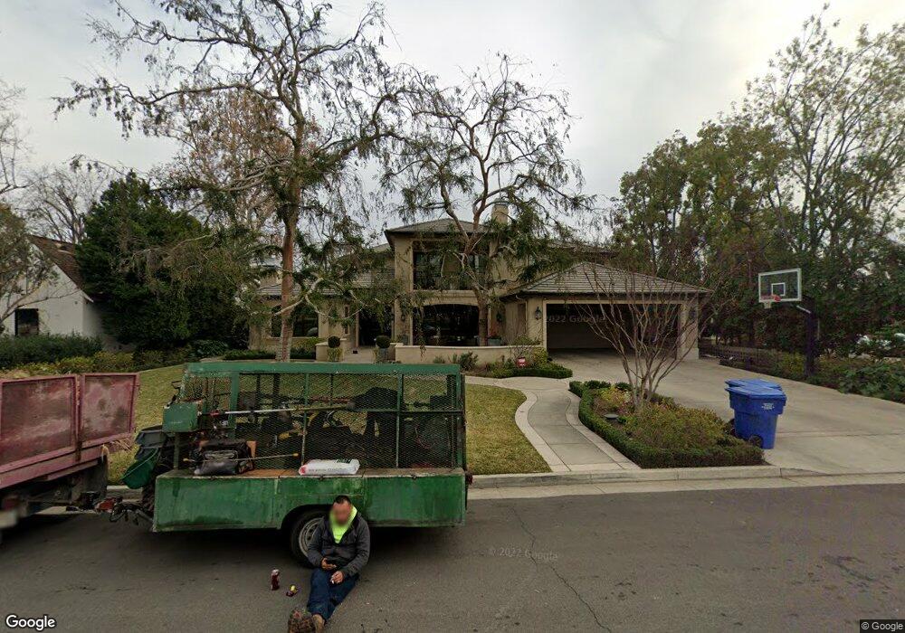
About This Home
This home is located at 404 Mount Lowe Dr, Bakersfield, CA 93309 and is currently estimated at $1,685,028, approximately $399 per square foot. 404 Mount Lowe Dr is a home located in Kern County with nearby schools including Stockdale Elementary School, O.J. Actis Junior High School, and Bakersfield High School.
Ownership History
We collect this data history from publicly available records. To have your information removed, we recommend requesting removal directly through your county’s website.
Purchase Details
Purchase Details
Purchase Details
Home Values in the Area
Average Home Value in this Area
Purchase History
We collect this data history from publicly available records. To have your information removed, we recommend requesting removal directly through your county’s website.
| Date | Buyer | Sale Price | Title Company |
|---|---|---|---|
| -- | -- | ||
| $360,000 | Commonwealth Land Title Ins | ||
| $160,000 | Stewart Title |
Mortgage History
We collect this data history from publicly available records. To have your information removed, we recommend requesting removal directly through your county’s website.
| Date | Status | Borrower | Loan Amount |
|---|---|---|---|
| Closed | $1,256,000 | ||
| Closed | $1,181,250 | ||
| Closed | $100,000 | ||
| Closed | $322,700 |
Tax History
We collect this data history from publicly available records. To have your information removed, we recommend requesting removal directly through your county’s website.
| Year | Tax Paid | Tax Assessment Tax Assessment Total Assessment is a certain percentage of the fair market value that is determined by local assessors to be the total taxable value of land and additions on the property. | Land | Improvement |
|---|---|---|---|---|
| 2025 | $20,736 | $1,677,515 | $384,235 | $1,293,280 |
| 2024 | $20,138 | $1,644,623 | $376,701 | $1,267,922 |
| 2023 | $20,138 | $1,612,376 | $369,315 | $1,243,061 |
| 2022 | $19,360 | $1,580,762 | $362,074 | $1,218,688 |
| 2021 | $19,086 | $1,549,768 | $354,975 | $1,194,793 |
| 2020 | $18,898 | $1,533,878 | $351,336 | $1,182,542 |
| 2019 | $18,670 | $1,533,878 | $351,336 | $1,182,542 |
| 2018 | $17,720 | $1,474,318 | $337,695 | $1,136,623 |
| 2017 | $17,458 | $1,445,411 | $331,074 | $1,114,337 |
| 2016 | $16,155 | $1,417,071 | $324,583 | $1,092,488 |
| 2015 | $16,066 | $1,395,786 | $319,708 | $1,076,078 |
| 2014 | $5,707 | $483,446 | $313,446 | $170,000 |
Map
- 6600 Kane Way
- 6702 Edmund Way
- 604 River Oaks Dr
- 6400 Sundale Ave
- 900 River Oaks Dr
- 7108 Saint Andrews Dr
- 6313 Sundale Ave
- 1033 Tam o Shanter Dr
- 1304 Manning St
- 7007 Mesa Verde Way
- 6405 Desert Hills Ave
- 100 Stockdale Cir
- 504 Pebble Beach Dr
- 1220 Club View Dr
- 325 Oak Fair Way
- 1217 Tam o Shanter Dr
- 6104 Bel Aire Way
- 6100 Bel Aire Way
- 6904 Ranch House Rd
- 501 Oak Fair Way
- 410 Mount Lowe Dr
- 414 Mount Lowe Dr
- 411 Fairway Dr
- 6609 Mount Shasta Dr
- 400 Mount Lowe Dr
- 715 Fairway Dr
- 407 Fairway Dr
- 405 Fairway Dr
- 401 Fairway Dr
- 314 Mount Lowe Dr
- 801 Fairway Dr
- 410 Fairway Dr
- 408 Fairway Dr
- 402 Fairway Dr
- 537 Fairway Dr
- 310 Mount Lowe Dr
- 800 Fairway Dr
- 2 Fairway Ct
- 6515 Mount Shasta Dr
- 6508 Tevis Dr
Ask me questions while you tour the home.