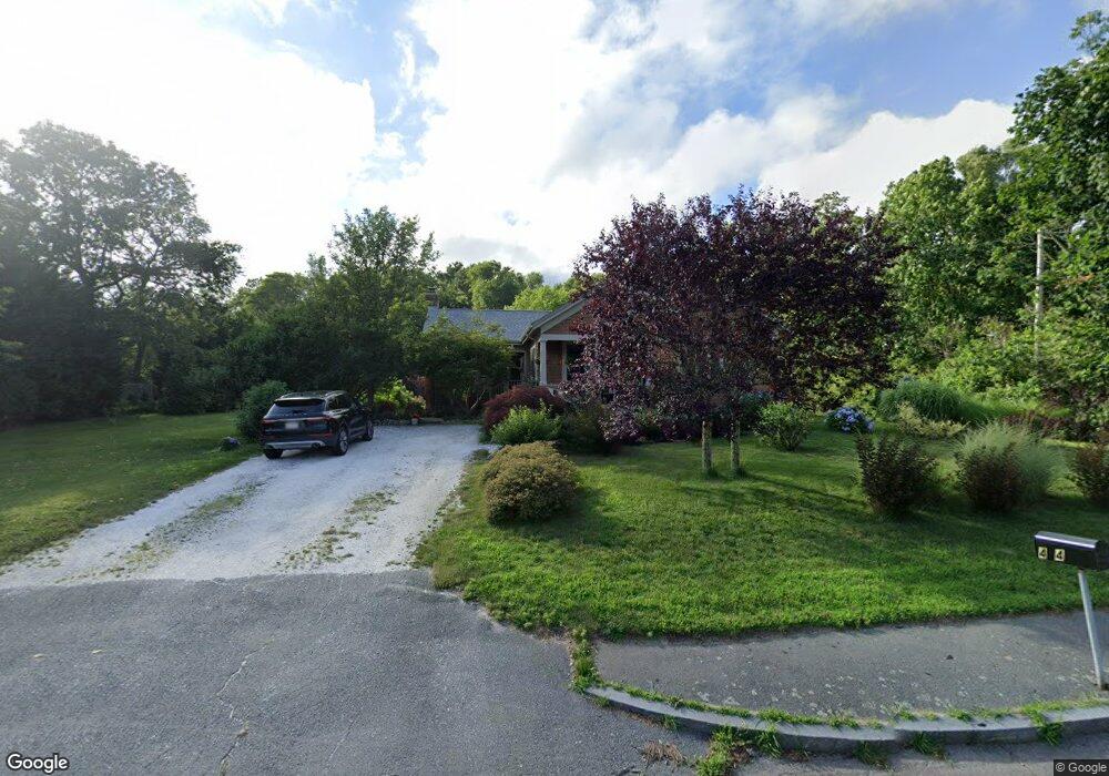
404 Old Westport Rd North Dartmouth, MA 02747
Smith Mills NeighborhoodEstimated Value: $559,000 - $647,000
3
Beds
2
Baths
1,505
Sq Ft
$389/Sq Ft
Est. Value
About This Home
This home is located at 404 Old Westport Rd, North Dartmouth, MA 02747 and is currently estimated at $585,093, approximately $388 per square foot. 404 Old Westport Rd is a home located in Bristol County with nearby schools including Dartmouth High School, Nazarene Christian Academy, and Friends Academy.
Ownership History
Date
Name
Owned For
Owner Type
Purchase Details
Closed on
Apr 10, 1996
Sold by
Marshalek Stephen and Marshalek Rosamond E
Bought by
Mercier Jennifer J
Current Estimated Value
Create a Home Valuation Report for This Property
The Home Valuation Report is an in-depth analysis detailing your home's value as well as a comparison with similar homes in the area
Home Values in the Area
Average Home Value in this Area
Purchase History
| Date | Buyer | Sale Price | Title Company |
|---|---|---|---|
| Mercier Jennifer J | $125,000 | -- |
Source: Public Records
Mortgage History
| Date | Status | Borrower | Loan Amount |
|---|---|---|---|
| Open | Mercier Jennifer J | $278,000 | |
| Closed | Mercier Jennifer J | $55,901 |
Source: Public Records
Tax History Compared to Growth
Tax History
| Year | Tax Paid | Tax Assessment Tax Assessment Total Assessment is a certain percentage of the fair market value that is determined by local assessors to be the total taxable value of land and additions on the property. | Land | Improvement |
|---|---|---|---|---|
| 2025 | $5,304 | $586,100 | $253,700 | $332,400 |
| 2024 | $5,102 | $558,200 | $246,500 | $311,700 |
| 2023 | $4,771 | $492,400 | $204,100 | $288,300 |
| 2022 | $4,773 | $460,700 | $204,100 | $256,600 |
| 2021 | $4,879 | $450,500 | $198,500 | $252,000 |
| 2020 | $4,750 | $436,600 | $196,500 | $240,100 |
| 2019 | $4,675 | $430,900 | $188,700 | $242,200 |
| 2018 | $4,397 | $419,400 | $192,600 | $226,800 |
| 2017 | $3,352 | $315,000 | $178,100 | $136,900 |
| 2016 | $2,943 | $278,200 | $148,500 | $129,700 |
| 2015 | $2,841 | $270,300 | $139,000 | $131,300 |
| 2014 | $2,753 | $263,700 | $135,300 | $128,400 |
Source: Public Records
Map
Nearby Homes
- 320 Old Westport Rd
- 312 Old Westport Rd
- 310 Old Westport Rd
- 53 Morton Ave
- 32 Morton Ave
- Lot 6 Rafael Rd
- 65 Cross Rd
- 28 Greystone Ave
- 135 Old Westport Rd
- 461 Reed Rd
- 219 Chase Rd
- 3 Roller Coaster Way Unit Lot 1
- 46 Old Westport Rd
- 4 Sabrinas Way
- 4 Sabrina Way Unit A
- 4 Sabrina Way Unit C
- 4 Sabrina Way Unit B
- 4 Sabrina Way Unit D
- 0 Undisclosed Unit 73376281
- 1406 Tucker Rd
- 398 Old Westport Rd
- 410 Old Westport Rd
- 405 Old Westport Rd
- 397 Old Westport Rd
- 416 Old Westport Rd
- 411 Old Westport Rd
- 417 Old Westport Rd
- 388 Old Westport Rd
- 393 Old Westport Rd
- 422 Old Westport Rd
- 385 Old Westport Rd
- 421 Old Westport Rd
- 426 Old Westport Rd
- 6 Blossom Ct
- 391 Old Westport Rd
- 2 Blossom Ct
- 386 Old Westport Rd
- 379 Old Westport Rd
- 427 Old Westport Rd
- 10 Blossom Ct