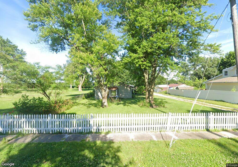
404 S Main St Centerview, MO 64019
Estimated Value: $94,000 - $325,000
Studio
--
Bath
1,708
Sq Ft
$100/Sq Ft
Est. Value
About This Home
This home is located at 404 S Main St, Centerview, MO 64019 and is currently estimated at $171,348, approximately $100 per square foot. 404 S Main St is a home located in Johnson County with nearby schools including Crest Ridge Elementary School, Crest Ridge High School, and Johnson County Christian Academy.
Ownership History
Date
Name
Owned For
Owner Type
Purchase Details
Closed on
Dec 21, 2023
Sold by
Perron Kathryn Louise and Perron Joseph
Bought by
Perron Kathryn Louise and Perron Joseph
Current Estimated Value
Purchase Details
Closed on
Dec 19, 2023
Sold by
Faudi Dorothy Wynn and Faudi Ricky Dean
Bought by
Roberts Dean L
Purchase Details
Closed on
Oct 23, 2008
Sold by
Todd Frank and Todd Doris
Bought by
Perron Kathryn and Todd Doris E
Home Financials for this Owner
Home Financials are based on the most recent Mortgage that was taken out on this home.
Original Mortgage
$32,304
Interest Rate
6%
Mortgage Type
Future Advance Clause Open End Mortgage
Create a Home Valuation Report for This Property
The Home Valuation Report is an in-depth analysis detailing your home's value as well as a comparison with similar homes in the area
Purchase History
| Date | Buyer | Sale Price | Title Company |
|---|---|---|---|
| Perron Kathryn Louise | -- | None Listed On Document | |
| Roberts Dean L | -- | None Listed On Document | |
| Perron Kathryn | -- | -- |
Source: Public Records
Mortgage History
| Date | Status | Borrower | Loan Amount |
|---|---|---|---|
| Previous Owner | Perron Kathryn | $32,304 |
Source: Public Records
Tax History
| Year | Tax Paid | Tax Assessment Tax Assessment Total Assessment is a certain percentage of the fair market value that is determined by local assessors to be the total taxable value of land and additions on the property. | Land | Improvement |
|---|---|---|---|---|
| 2025 | $622 | $8,262 | $0 | $0 |
| 2024 | $580 | $7,543 | $0 | $0 |
| 2023 | $580 | $7,543 | $0 | $0 |
| 2022 | $556 | $7,211 | $0 | $0 |
| 2021 | $552 | $7,211 | $0 | $0 |
| 2020 | $531 | $6,879 | $0 | $0 |
| 2019 | $523 | $6,879 | $0 | $0 |
| 2017 | $483 | $6,698 | $0 | $0 |
| 2016 | $494 | $6,698 | $0 | $0 |
| 2015 | $471 | $6,415 | $0 | $0 |
| 2014 | $470 | $6,415 | $0 | $0 |
Source: Public Records
Map
Nearby Homes
- 65 SW 150th Rd
- 66 SW 150th Rd
- 000 SW 100th Rd
- 52 401st (South 65) Rd
- TBD Lot 7 491st Rd
- 0 Tbd Lot 2 491st Rd
- 26 SW 491st Rd
- 52 401st (North 65) Rd
- 64 SW 401st Rd
- 507 NW 165th Rd
- 245 SW 400th Rd
- 786 NW 100th Rd
- TBD NW 361st Rd
- 412 NW 701st Rd
- 120 NW 191 Rd
- 125 NW 171 Rd
- 734 Iron Horse Dr
- 733 Burlington Rd
- 0 Rd
- 708 Burlington Rd
Your Personal Tour Guide
Ask me questions while you tour the home.