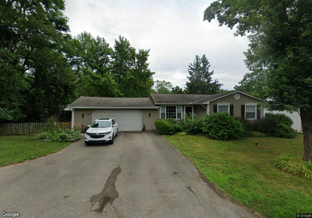
4041 Crystal St West Bloomfield, MI 48323
Estimated Value: $297,000 - $337,000
3
Beds
2
Baths
1,336
Sq Ft
$235/Sq Ft
Est. Value
About This Home
This home is located at 4041 Crystal St, West Bloomfield, MI 48323 and is currently estimated at $313,593, approximately $234 per square foot. 4041 Crystal St is a home located in Oakland County with nearby schools including Walled Lake Central High School, St. Matthew Lutheran School, and St. William School.
Ownership History
Date
Name
Owned For
Owner Type
Purchase Details
Closed on
Aug 30, 2005
Sold by
Christiansen Michael J and Christiansen Christine A
Bought by
Vonwihl Michael and Vonwihl Jodi L
Current Estimated Value
Home Financials for this Owner
Home Financials are based on the most recent Mortgage that was taken out on this home.
Original Mortgage
$172,000
Interest Rate
5.98%
Mortgage Type
New Conventional
Purchase Details
Closed on
Feb 24, 1999
Sold by
Arnoldi Ronald C
Bought by
Christiansen Michael J
Create a Home Valuation Report for This Property
The Home Valuation Report is an in-depth analysis detailing your home's value as well as a comparison with similar homes in the area
Home Values in the Area
Average Home Value in this Area
Purchase History
| Date | Buyer | Sale Price | Title Company |
|---|---|---|---|
| Vonwihl Michael | $215,000 | Devon Title Agency | |
| Christiansen Michael J | $148,000 | -- |
Source: Public Records
Mortgage History
| Date | Status | Borrower | Loan Amount |
|---|---|---|---|
| Previous Owner | Vonwihl Michael | $172,000 |
Source: Public Records
Tax History Compared to Growth
Tax History
| Year | Tax Paid | Tax Assessment Tax Assessment Total Assessment is a certain percentage of the fair market value that is determined by local assessors to be the total taxable value of land and additions on the property. | Land | Improvement |
|---|---|---|---|---|
| 2024 | $1,588 | $128,780 | $0 | $0 |
| 2022 | $1,594 | $118,920 | $40,740 | $78,180 |
| 2021 | $2,463 | $110,460 | $0 | $0 |
| 2020 | $1,480 | $109,380 | $40,730 | $68,650 |
| 2018 | $2,398 | $99,630 | $35,270 | $64,360 |
| 2015 | -- | $79,080 | $0 | $0 |
| 2014 | -- | $71,070 | $0 | $0 |
| 2011 | -- | $62,260 | $0 | $0 |
Source: Public Records
Map
Nearby Homes
- 7969 Richardson Rd
- 7381 Crestmore St
- 7337 Richardson Rd
- 4212 Greendale Ave
- 4245 Bunker Ave
- 7359 Woodlore Dr
- 4335 Crestdale Ave
- 7369 Sweetbriar
- 6978 Colony Dr
- 6903 Dandison Blvd
- 7146 Arrowood Dr
- 0000 Dickert St
- 7555 Windgate Cir
- 3991 Fieldview Ave
- 1047 Addison Cir
- 1778 Addison Cir
- 1777 Addison Cir
- 103 Addison Cir
- 6980 Hambro St
- 3965 Carrick Ave
- 4055 Crystal St
- 4025 Crystal St
- 4020 Crystal St
- 4070 Crooks St
- 4054 Crooks St
- 4040 Crystal St
- 4075 Crystal St
- 4070 Crystal St
- 7733 Richardson Rd
- 4076 Crooks St
- 4055 Circle Blvd
- 4095 Crystal St
- 7759 Richardson Rd
- 7723 Richardson Rd
- 4039 Circle Bvld
- 4080 Crooks St
- 4067 Circle Blvd
- 4075 Circle Blvd
- 4039 Circle Blvd
- 4061 Crooks St