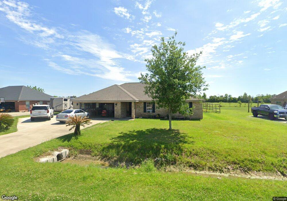
4042 Bertie Ann Rd Lake Charles, LA 70611
Gillis NeighborhoodEstimated Value: $235,000 - $282,000
3
Beds
2
Baths
1,582
Sq Ft
$157/Sq Ft
Est. Value
About This Home
This home is located at 4042 Bertie Ann Rd, Lake Charles, LA 70611 and is currently estimated at $248,829, approximately $157 per square foot. 4042 Bertie Ann Rd is a home located in Calcasieu Parish with nearby schools including Graham & Parks Alternative Public School, Gillis Elementary School, and Putnam Avenue Upper School.
Ownership History
Date
Name
Owned For
Owner Type
Purchase Details
Closed on
Jul 24, 2008
Sold by
Oak Meadows Land & Development Inc
Bought by
Burrow Paul Ryan and Burrow Nancy Carol Gill
Current Estimated Value
Home Financials for this Owner
Home Financials are based on the most recent Mortgage that was taken out on this home.
Original Mortgage
$157,528
Outstanding Balance
$103,110
Interest Rate
6.36%
Mortgage Type
FHA
Estimated Equity
$145,719
Create a Home Valuation Report for This Property
The Home Valuation Report is an in-depth analysis detailing your home's value as well as a comparison with similar homes in the area
Home Values in the Area
Average Home Value in this Area
Purchase History
| Date | Buyer | Sale Price | Title Company |
|---|---|---|---|
| Burrow Paul Ryan | $160,000 | Elite Title Insurance Agency |
Source: Public Records
Mortgage History
| Date | Status | Borrower | Loan Amount |
|---|---|---|---|
| Open | Burrow Paul Ryan | $157,528 |
Source: Public Records
Tax History Compared to Growth
Tax History
| Year | Tax Paid | Tax Assessment Tax Assessment Total Assessment is a certain percentage of the fair market value that is determined by local assessors to be the total taxable value of land and additions on the property. | Land | Improvement |
|---|---|---|---|---|
| 2024 | $1,107 | $17,800 | $2,850 | $14,950 |
| 2023 | $1,107 | $17,800 | $2,850 | $14,950 |
| 2022 | $1,088 | $17,800 | $2,850 | $14,950 |
| 2021 | $1,142 | $17,800 | $2,850 | $14,950 |
| 2020 | $1,764 | $16,200 | $2,740 | $13,460 |
| 2019 | $1,922 | $17,590 | $2,640 | $14,950 |
| 2018 | $1,104 | $17,590 | $2,640 | $14,950 |
| 2017 | $1,952 | $17,590 | $2,640 | $14,950 |
| 2016 | $1,923 | $17,590 | $2,640 | $14,950 |
| 2015 | $1,964 | $17,590 | $2,640 | $14,950 |
Source: Public Records
Map
Nearby Homes
- 0 Camryn Rd
- 4179 Camryn Rd
- 657 Topsy Rd
- 1032 Birdnest Rd
- 4167 Greentree Ln
- 4259 Greentree Ln
- 0 N Hwy 171 Hwy Unit SWL23004627
- 0 Bunker Hill Rd Unit SWL25001343
- 0 Bunker Hill Rd Unit SWL25100640
- 3074 N Hwy 171
- 3076 Hwy 171 Hwy N
- 3039 N Hwy 171 Hwy
- 0 Talon Ln Unit Lot 7 SWL25100714
- 0 Talon Ln Unit Lot 6 SWL24003702
- 0 Talon Ln Unit Lot 13 SWL25100712
- 0 Talon Ln Unit Lot 1 SWL25100706
- TBD Mesa Ln
- 8 Buffalo Run Dr
- 17 Swooping Eagle Dr
- 16 Swooping Eagle Dr
- 4034 Bertie Ann Rd
- 4050 Bertie Ann Rd
- 4045 Bertie Ann Rd
- 4037 Bertie Ann Rd
- 4026 Bertie Ann Rd
- 4058 Bertie Ann Rd
- 4053 Bertie Ann Rd
- 4029 Bertie Ann Rd
- 4061 Bertie Ann Rd
- 4016 Bertie Ann Rd
- 4017 Bertie Ann Rd
- 4066 Bertie Ann Rd
- 4069 Bertie Ann Rd
- 4008 Bertie Ann Rd
- 0 Kim Cross Ln
- 4074 Bertie Ann Rd
- 4077 Bertie Ann Rd
- 919 Kim Cross Ln
- 929 Kim Cross Ln