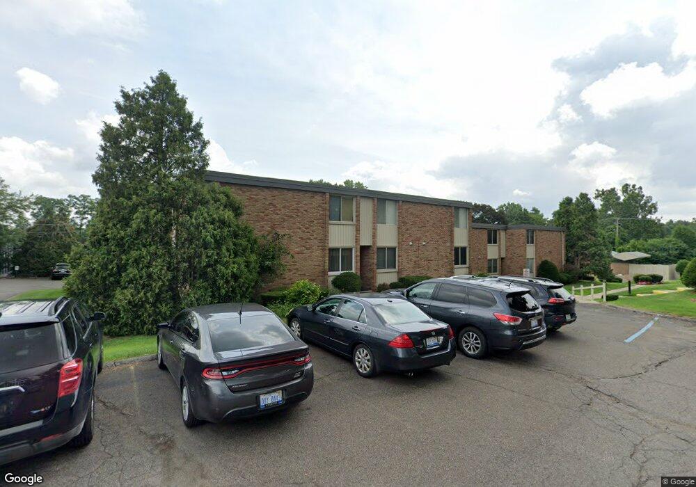
4043 W Maple Rd Bloomfield Hills, MI 48301
Estimated Value: $206,000 - $244,000
1
Bed
2
Baths
1,166
Sq Ft
$191/Sq Ft
Est. Value
About This Home
This home is located at 4043 W Maple Rd, Bloomfield Hills, MI 48301 and is currently estimated at $223,244, approximately $191 per square foot. 4043 W Maple Rd is a home located in Oakland County with nearby schools including Conant Elementary School, South Hills Middle School, and Bloomfield Hills High School.
Ownership History
Date
Name
Owned For
Owner Type
Purchase Details
Closed on
Oct 8, 2020
Sold by
St Clair Capital Llc
Bought by
Sctiroers Wiluam
Current Estimated Value
Purchase Details
Closed on
Feb 10, 2020
Sold by
Larkin Antoinette J
Bought by
St Clair Capital Llc
Purchase Details
Closed on
Mar 17, 2005
Sold by
Partyka Janet S
Bought by
Larkin Antoinette J
Purchase Details
Closed on
Aug 21, 1997
Sold by
Abbo Gary
Bought by
Patricolo John A
Home Financials for this Owner
Home Financials are based on the most recent Mortgage that was taken out on this home.
Original Mortgage
$92,800
Interest Rate
7.54%
Mortgage Type
Purchase Money Mortgage
Create a Home Valuation Report for This Property
The Home Valuation Report is an in-depth analysis detailing your home's value as well as a comparison with similar homes in the area
Home Values in the Area
Average Home Value in this Area
Purchase History
| Date | Buyer | Sale Price | Title Company |
|---|---|---|---|
| Sctiroers Wiluam | $168,500 | Chirco Title Agency Inc | |
| St Clair Capital Llc | $81,000 | Chirco Title Agency Inc | |
| Larkin Antoinette J | $151,000 | Capital Title Ins Agency | |
| Patricolo John A | $116,000 | -- |
Source: Public Records
Mortgage History
| Date | Status | Borrower | Loan Amount |
|---|---|---|---|
| Previous Owner | Patricolo John A | $92,800 |
Source: Public Records
Tax History Compared to Growth
Tax History
| Year | Tax Paid | Tax Assessment Tax Assessment Total Assessment is a certain percentage of the fair market value that is determined by local assessors to be the total taxable value of land and additions on the property. | Land | Improvement |
|---|---|---|---|---|
| 2024 | $1,734 | $92,640 | $0 | $0 |
| 2023 | $1,654 | $81,570 | $0 | $0 |
| 2022 | $3,100 | $81,490 | $0 | $0 |
| 2021 | $3,218 | $60,170 | $0 | $0 |
| 2020 | $601 | $56,100 | $0 | $0 |
| 2019 | $1,153 | $52,140 | $0 | $0 |
| 2018 | $1,159 | $48,680 | $0 | $0 |
| 2017 | $1,151 | $47,750 | $0 | $0 |
| 2016 | $1,153 | $45,000 | $0 | $0 |
| 2015 | -- | $42,450 | $0 | $0 |
| 2014 | -- | $38,020 | $0 | $0 |
| 2011 | -- | $27,030 | $0 | $0 |
Source: Public Records
Map
Nearby Homes
- 6450 Gilbert Lake Rd
- 6360 Hills Dr
- 4017 Hidden Woods Dr
- 6660 Woodbank Dr
- 750 Trailwood Path Unit B
- 450 Billingsgate Ct Unit C
- 1760 Trailwood Path
- 3880 Oakland Dr
- 6952 Sandalwood Dr
- 6572 Spruce Dr
- 7200 Telegraph Rd
- 7005 Cathedral Dr
- 7357 W Greenwich Dr
- 5741 Snowshoe Cir
- 6750 Wing Lake Rd
- 6560 Red Maple Ln
- 5630 S Adams Way
- 6940 Wing Lake Rd
- 6580 Red Maple Ln
- 7100 Wing Lake Rd
- 4043 W Maple Rd Unit . D
- 4043 W Maple Rd Unit 204
- 4043 W Maple Rd
- 4043 W Maple Rd
- 4043 W Maple Rd
- 4043 W Maple Rd
- 4043 W Maple Rd
- 4043 W Maple Rd
- 4043 W Maple Rd
- 4043 W Maple Rd Unit D 202
- 4043 W Maple Rd Unit D, 201
- 4043 W Maple Rd Unit D 101
- 4043 W Maple Rd Unit D, 104
- 4043 W Maple Rd Unit 103
- 4043 W Maple Rd Unit 203
- 4043 W Maple Rd
- 4043 W Maple Rd Unit 102
- 4049 W Maple Rd Unit A, 102
- 4049 W Maple Rd
- 4049 W Maple Rd