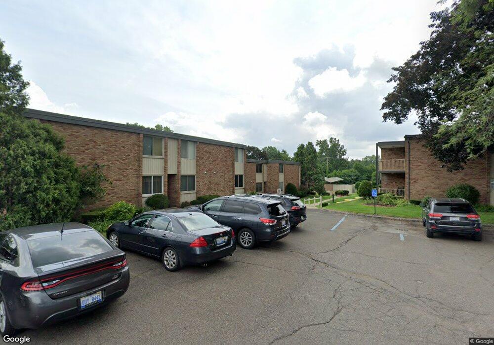
4045 W Maple Rd Bloomfield Hills, MI 48301
Estimated Value: $202,000 - $224,000
2
Beds
2
Baths
1,325
Sq Ft
$162/Sq Ft
Est. Value
About This Home
This home is located at 4045 W Maple Rd, Bloomfield Hills, MI 48301 and is currently estimated at $215,104, approximately $162 per square foot. 4045 W Maple Rd is a home located in Oakland County with nearby schools including Conant Elementary School, South Hills Middle School, and Bloomfield Hills High School.
Ownership History
Date
Name
Owned For
Owner Type
Purchase Details
Closed on
Jul 3, 2024
Sold by
Grosinger Ryan
Bought by
Burman Sebastian
Current Estimated Value
Home Financials for this Owner
Home Financials are based on the most recent Mortgage that was taken out on this home.
Original Mortgage
$204,185
Outstanding Balance
$201,723
Interest Rate
6.94%
Mortgage Type
New Conventional
Estimated Equity
$13,381
Purchase Details
Closed on
Sep 14, 2020
Sold by
Nalu Kevin M
Bought by
Grosinger Ryan
Purchase Details
Closed on
Mar 7, 2003
Sold by
Lundquist Michelle P
Bought by
Nalu Kevin M
Purchase Details
Closed on
Sep 25, 2000
Sold by
Winkler Rachel
Bought by
Lundquist Michelle P
Create a Home Valuation Report for This Property
The Home Valuation Report is an in-depth analysis detailing your home's value as well as a comparison with similar homes in the area
Home Values in the Area
Average Home Value in this Area
Purchase History
| Date | Buyer | Sale Price | Title Company |
|---|---|---|---|
| Burman Sebastian | $210,500 | None Listed On Document | |
| Grosinger Ryan | -- | None Available | |
| Nalu Kevin M | $150,000 | Devon Title Agency | |
| Lundquist Michelle P | $120,000 | -- |
Source: Public Records
Mortgage History
| Date | Status | Borrower | Loan Amount |
|---|---|---|---|
| Open | Burman Sebastian | $204,185 |
Source: Public Records
Tax History Compared to Growth
Tax History
| Year | Tax Paid | Tax Assessment Tax Assessment Total Assessment is a certain percentage of the fair market value that is determined by local assessors to be the total taxable value of land and additions on the property. | Land | Improvement |
|---|---|---|---|---|
| 2024 | $1,454 | $71,970 | $0 | $0 |
| 2023 | $1,386 | $80,670 | $0 | $0 |
| 2022 | $2,598 | $71,470 | $0 | $0 |
| 2021 | $2,530 | $50,440 | $0 | $0 |
| 2020 | $778 | $52,640 | $0 | $0 |
| 2019 | $1,511 | $55,180 | $0 | $0 |
| 2018 | $1,482 | $59,910 | $0 | $0 |
| 2017 | $1,459 | $56,590 | $0 | $0 |
| 2016 | $1,455 | $45,010 | $0 | $0 |
| 2015 | -- | $42,450 | $0 | $0 |
| 2014 | -- | $38,020 | $0 | $0 |
| 2011 | -- | $27,090 | $0 | $0 |
Source: Public Records
Map
Nearby Homes
- 6450 Gilbert Lake Rd
- 750 Trailwood Path Unit B
- 1760 Trailwood Path
- 4017 Hidden Woods Dr
- 6660 Woodbank Dr
- 3880 Oakland Dr
- 6952 Sandalwood Dr
- 6572 Spruce Dr
- 7200 Telegraph Rd
- 5741 Snowshoe Cir
- 7357 W Greenwich Dr
- 6560 Red Maple Ln
- 6940 Wing Lake Rd
- 5671 Shadow Ln
- 6580 Red Maple Ln
- 5592 N Adams Way
- 5904 Wing Lake Rd
- 6727 Lahser Rd
- 23301 W 14 Mile Rd
- 6701 Franklin Rd
- 4045 W Maple Rd Unit 203-BldgC
- 4045 W Maple Rd
- 4045 W Maple Rd
- 4045 W Maple Rd
- 4045 W Maple Rd
- 4045 W Maple Rd
- 4045 W Maple Rd
- 4045 W Maple Rd
- 4045 W Maple Rd Unit C 203
- 4045 W Maple Rd Unit 202
- 4045 W Maple Rd Unit C, 201
- 4045 W Maple Rd Unit 101
- 4045 W Maple Rd Unit 204
- 4045 W Maple Rd Unit 104
- 4047 W Maple Rd Unit B, 203
- 4047 W Maple Rd
- 4047 W Maple Rd
- 4047 W Maple Rd
- 4047 W Maple Rd
- 4047 W Maple Rd