Estimated Value: $484,000 - $497,203
3
Beds
3
Baths
1,634
Sq Ft
$300/Sq Ft
Est. Value
About This Home
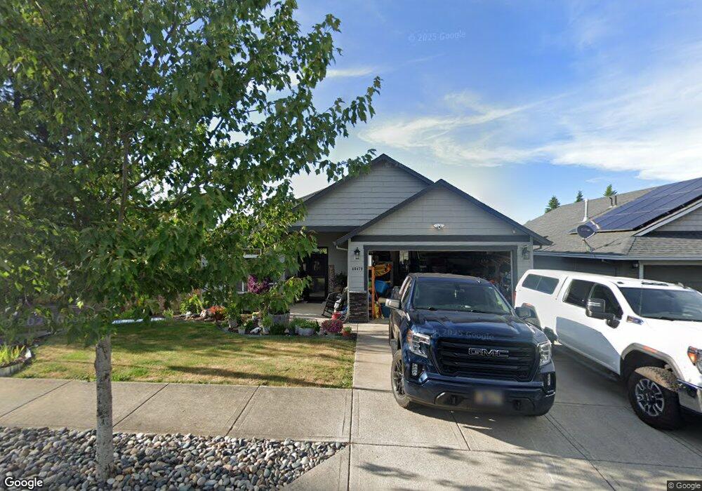
This home is located at 40479 Buck St, Sandy, OR 97055 and is currently estimated at $490,551, approximately $300 per square foot. 40479 Buck St is a home located in Clackamas County with nearby schools including Firwood Elementary School, Cedar Ridge Middle School, and Sandy High School.
Ownership History
Date
Name
Owned For
Owner Type
Purchase Details
Closed on
Jan 31, 2024
Sold by
Campbell Stacy B and Campbell Edward F
Bought by
Campbell Family Trust and Campbell
Current Estimated Value
Purchase Details
Closed on
Oct 24, 2016
Sold by
Campbell Stacy B
Bought by
Campbell Stacy B and Campbell Edward F
Home Financials for this Owner
Home Financials are based on the most recent Mortgage that was taken out on this home.
Original Mortgage
$252,800
Interest Rate
3.5%
Mortgage Type
New Conventional
Purchase Details
Closed on
Apr 1, 2015
Sold by
Stonecreek Development Llc
Bought by
Campbell Stacy B
Home Financials for this Owner
Home Financials are based on the most recent Mortgage that was taken out on this home.
Original Mortgage
$245,271
Interest Rate
3.62%
Mortgage Type
FHA
Purchase Details
Closed on
Nov 6, 2014
Sold by
Sun Ridge Construction Inc
Bought by
Stonecreek Development Llc
Create a Home Valuation Report for This Property
The Home Valuation Report is an in-depth analysis detailing your home's value as well as a comparison with similar homes in the area
Home Values in the Area
Average Home Value in this Area
Purchase History
| Date | Buyer | Sale Price | Title Company |
|---|---|---|---|
| Campbell Family Trust | -- | None Listed On Document | |
| Campbell Stacy B | -- | Fidelity Natl Title Of Or | |
| Campbell Stacy B | $249,796 | Wfg Title | |
| Stonecreek Development Llc | $55,000 | Wfg Title |
Source: Public Records
Mortgage History
| Date | Status | Borrower | Loan Amount |
|---|---|---|---|
| Previous Owner | Campbell Stacy B | $252,800 | |
| Previous Owner | Campbell Stacy B | $245,271 |
Source: Public Records
Tax History
| Year | Tax Paid | Tax Assessment Tax Assessment Total Assessment is a certain percentage of the fair market value that is determined by local assessors to be the total taxable value of land and additions on the property. | Land | Improvement |
|---|---|---|---|---|
| 2025 | $4,747 | $276,679 | -- | -- |
| 2024 | $4,547 | $268,621 | -- | -- |
| 2023 | $4,547 | $260,798 | $0 | $0 |
| 2022 | $4,307 | $253,202 | $0 | $0 |
| 2021 | $4,159 | $245,828 | $0 | $0 |
| 2020 | $4,046 | $238,668 | $0 | $0 |
| 2019 | $4,008 | $231,717 | $0 | $0 |
| 2018 | $3,895 | $224,968 | $0 | $0 |
| 2017 | $3,801 | $218,416 | $0 | $0 |
| 2016 | $3,670 | $212,054 | $0 | $0 |
Source: Public Records
Map
Nearby Homes
- 18050 SE Langensand Rd
- 18462 SE Langensand Rd
- 40192 Laurel St
- 39784 Syblon Ln
- 41057 SE Vista Loop Dr
- 41081 SE Vista Loop Dr
- 41375 SE Vista Loop Dr
- 0 SE Coalman Rd
- 18635 Warm Springs St Unit 4
- 18712 Cloud Cap Ave
- 39576 Trillium St
- 18605 Warm Springs St
- 41540 Metolius Ave Unit 19
- 41570 Metolius Ave Unit 22
- 41580 Metolius Ave Unit 23
- 0 Oregon 211
- 39329 Woodbury Way
- 39307 Woodbury Way
- 18865 Crooked River St Unit 42
- 18845 Crooked River St Unit 40
- 40481 Buck St
- 18198 Antler Ave
- 40483 Buck St
- 40480 Buck St
- 18197 Antler Ave
- 18199 Meadow Ave
- 40482 Buck St
- 18255 Antler Ave
- 40485 Buck St
- 18178 Antler Ave
- 18185 Antler Ave
- 40484 Buck St
- 18187 Meadow Ave
- 18267 Antler Ave
- 40486 Buck St
- 18179 Meadow Ave
- 18273 Antler Ave
- 18075 Meadow Ave
- 18275 Meadow Ave
- 18069 Antler Ave
Your Personal Tour Guide
Ask me questions while you tour the home.