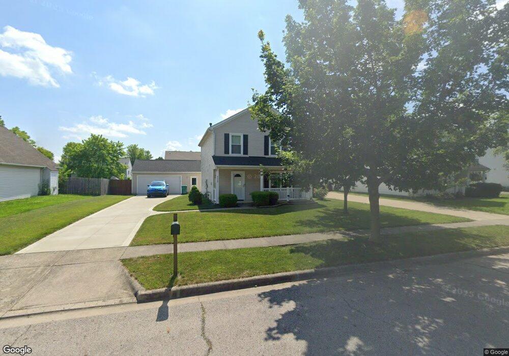
4048 Graves Dr Obetz, OH 43207
Obetz-Lockbourne NeighborhoodEstimated Value: $266,000 - $291,000
3
Beds
3
Baths
1,584
Sq Ft
$175/Sq Ft
Est. Value
About This Home
This home is located at 4048 Graves Dr, Obetz, OH 43207 and is currently estimated at $277,161, approximately $174 per square foot. 4048 Graves Dr is a home located in Franklin County with nearby schools including Hamilton Intermediate School, Hamilton Elementary School, and Hamilton Middle School.
Ownership History
Date
Name
Owned For
Owner Type
Purchase Details
Closed on
Apr 6, 2007
Sold by
National City Mortgage Inc
Bought by
Karrer Susan M
Current Estimated Value
Home Financials for this Owner
Home Financials are based on the most recent Mortgage that was taken out on this home.
Original Mortgage
$96,900
Outstanding Balance
$57,548
Interest Rate
6.19%
Mortgage Type
Purchase Money Mortgage
Estimated Equity
$219,613
Purchase Details
Closed on
Dec 26, 2006
Sold by
Hubbard Pamela S and National City Mortgage Co
Bought by
National City Bank
Purchase Details
Closed on
Sep 24, 2002
Sold by
Dominion Homes Inc
Bought by
Hubbard Pamela S
Home Financials for this Owner
Home Financials are based on the most recent Mortgage that was taken out on this home.
Original Mortgage
$138,531
Interest Rate
6.34%
Mortgage Type
FHA
Create a Home Valuation Report for This Property
The Home Valuation Report is an in-depth analysis detailing your home's value as well as a comparison with similar homes in the area
Home Values in the Area
Average Home Value in this Area
Purchase History
| Date | Buyer | Sale Price | Title Company |
|---|---|---|---|
| Karrer Susan M | $102,000 | None Available | |
| National City Bank | $94,000 | None Available | |
| Hubbard Pamela S | $139,700 | Alliance Title |
Source: Public Records
Mortgage History
| Date | Status | Borrower | Loan Amount |
|---|---|---|---|
| Open | Karrer Susan M | $96,900 | |
| Previous Owner | Hubbard Pamela S | $138,531 |
Source: Public Records
Tax History
| Year | Tax Paid | Tax Assessment Tax Assessment Total Assessment is a certain percentage of the fair market value that is determined by local assessors to be the total taxable value of land and additions on the property. | Land | Improvement |
|---|---|---|---|---|
| 2025 | $3,936 | $83,440 | $23,030 | $60,410 |
| 2024 | $3,936 | $83,440 | $23,030 | $60,410 |
| 2023 | $3,876 | $83,440 | $23,030 | $60,410 |
| 2022 | $2,904 | $52,930 | $5,710 | $47,220 |
| 2021 | $2,943 | $52,930 | $5,710 | $47,220 |
| 2020 | $2,996 | $52,930 | $5,710 | $47,220 |
| 2019 | $2,694 | $42,320 | $4,550 | $37,770 |
| 2018 | $2,443 | $42,320 | $4,550 | $37,770 |
| 2017 | $2,587 | $42,320 | $4,550 | $37,770 |
| 2016 | $2,300 | $34,760 | $6,160 | $28,600 |
| 2015 | $2,184 | $34,760 | $6,160 | $28,600 |
| 2014 | $2,173 | $34,760 | $6,160 | $28,600 |
| 2013 | $1,232 | $40,880 | $7,245 | $33,635 |
Source: Public Records
Map
Nearby Homes
- 4061 Greenup Dr
- 1583 Metcalfe Ave
- 1670 Marshall Ave
- 1551 Metcalfe Ave
- 1722 Obetz Ave
- 1559 Obetz Ave
- 1632 Marlboro Ave
- 3551 Groveport Rd
- 2047 Bridlewood Blvd Unit 2049
- 2057 Bridlewood Blvd Unit 2059
- 3531 Lockbourne Rd
- 1118 Maplewood Rd
- 4451 1/2 Lockbourne Rd Unit R
- 1038 Robmeyer Dr
- 1122 Viewpointe Dr
- 3390 Norwalk Rd
- 1127 Rumsey Rd
- 4310 Charlotte Rd
- 1041 Meadow Ln
- 1067 Rendezvous Ln
- 4056 Graves Dr
- 4040 Graves Dr
- 0 Graves Dr
- 4064 Graves Dr
- 4032 Graves Dr
- 4057 Garrard Dr
- 4057 Garrard Dr Unit 72
- 4041 Garrard Dr
- 4049 Garrard Dr
- 4047 Graves Dr
- 4065 Garrard Dr
- 4033 Garrard Dr
- 4039 Graves Dr
- 4055 Graves Dr
- 4072 Graves Dr
- 4024 Graves Dr
- 4031 Graves Dr
- 4063 Graves Dr
- 4073 Garrard Dr
- 4025 Garrard Dr
Your Personal Tour Guide
Ask me questions while you tour the home.