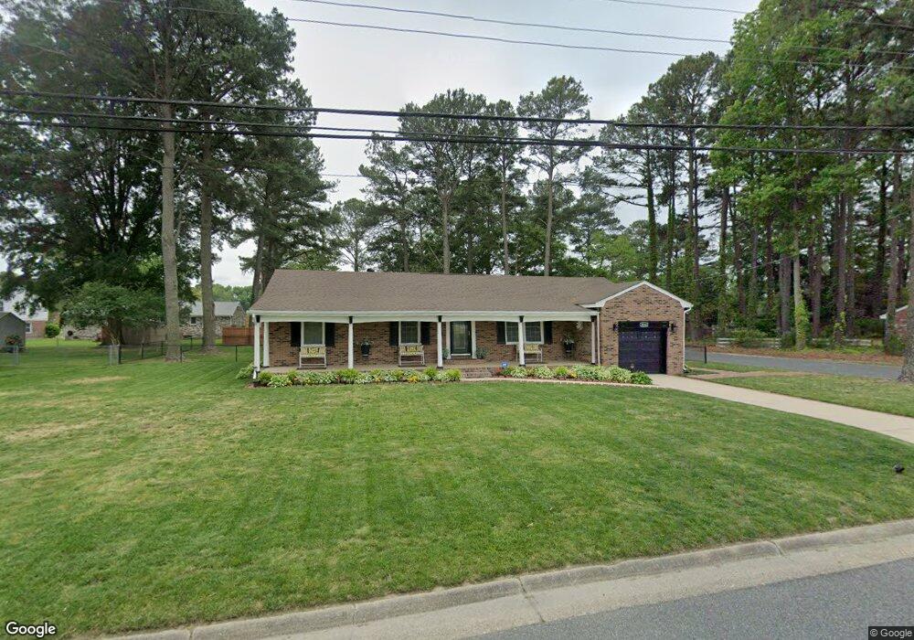
4048 River Shore Rd Portsmouth, VA 23703
Churchland NeighborhoodEstimated Value: $311,178 - $345,000
3
Beds
2
Baths
1,451
Sq Ft
$227/Sq Ft
Est. Value
About This Home
This home is located at 4048 River Shore Rd, Portsmouth, VA 23703 and is currently estimated at $329,045, approximately $226 per square foot. 4048 River Shore Rd is a home located in Portsmouth City with nearby schools including Churchland Primary/Intermediate School, Churchland Middle School, and Churchland High School.
Ownership History
Date
Name
Owned For
Owner Type
Purchase Details
Closed on
Feb 28, 2014
Sold by
Federal Home Loan Mortgage Corporation
Bought by
Futrell Cynthia
Current Estimated Value
Home Financials for this Owner
Home Financials are based on the most recent Mortgage that was taken out on this home.
Original Mortgage
$117,826
Interest Rate
4.37%
Mortgage Type
FHA
Purchase Details
Closed on
Sep 17, 2013
Sold by
White Pc Sub Tr Samuel I and Galloway Anthony B
Bought by
Federal Home Loan Mortgage Corporation
Create a Home Valuation Report for This Property
The Home Valuation Report is an in-depth analysis detailing your home's value as well as a comparison with similar homes in the area
Home Values in the Area
Average Home Value in this Area
Purchase History
| Date | Buyer | Sale Price | Title Company |
|---|---|---|---|
| Futrell Cynthia | $120,000 | -- | |
| Federal Home Loan Mortgage Corporation | $171,583 | -- |
Source: Public Records
Mortgage History
| Date | Status | Borrower | Loan Amount |
|---|---|---|---|
| Previous Owner | Futrell Cynthia | $117,826 |
Source: Public Records
Tax History Compared to Growth
Tax History
| Year | Tax Paid | Tax Assessment Tax Assessment Total Assessment is a certain percentage of the fair market value that is determined by local assessors to be the total taxable value of land and additions on the property. | Land | Improvement |
|---|---|---|---|---|
| 2025 | $3,421 | $270,900 | $82,500 | $188,400 |
| 2024 | $3,421 | $264,260 | $82,500 | $181,760 |
| 2023 | $3,104 | $248,340 | $82,500 | $165,840 |
| 2022 | $2,826 | $217,350 | $68,750 | $148,600 |
| 2021 | $2,566 | $197,400 | $55,440 | $141,960 |
| 2020 | $2,497 | $192,110 | $52,800 | $139,310 |
| 2019 | $2,411 | $185,470 | $52,800 | $132,670 |
| 2018 | $2,411 | $185,470 | $52,800 | $132,670 |
| 2017 | $2,411 | $185,470 | $52,800 | $132,670 |
| 2016 | $2,411 | $185,470 | $52,800 | $132,670 |
| 2015 | $2,411 | $185,470 | $52,800 | $132,670 |
| 2014 | $2,355 | $185,470 | $52,800 | $132,670 |
Source: Public Records
Map
Nearby Homes
- 4008 Oakhurst Rd
- 4028 Swannanoa Dr
- 4232 Summerset Dr
- 4200 Quince Rd
- 4224 Burnham Dr
- 10AC Cedar Ln
- 5606 Gregory Ct
- 5807 Dunkin St
- 3433 Willow Breeze Dr
- 5728 Hawthorne Ln
- 3604 Lilac Dr
- 5833 Hawthorne Ln
- 5693 Rivermill Cir
- 5806 Fawkes St
- 4100 Mayfair Way
- 4959 Briarwood Ln
- 4955 Briarwood Ln
- 5516 Bingham Dr
- 3315 Camellia Dr
- 3616 Bowden St
- 4044 River Shore Rd
- 4037 Wyndybrow Dr
- 4033 Wyndybrow Dr
- 4052 River Shore Rd
- 4040 River Shore Rd
- 4028 Oakhurst Rd
- 4029 Wyndybrow Dr
- 4056 River Shore Rd
- 4036 River Shore Rd
- 4045 Wyndybrow Dr
- 4036 Wyndybrow Dr
- 4020 Wyndybrow Dr
- 4025 Wyndybrow Dr
- 4024 Oakhurst Rd
- 4049 Wyndybrow Dr
- 4044 Wyndybrow Dr
- 4021 Oakhurst Rd
- 4021 Wyndybrow Dr
- 4020 Oakhurst Rd
- 4048 Wyndybrow Dr