Estimated Value: $172,000 - $200,000
--
Bed
1
Bath
888
Sq Ft
$211/Sq Ft
Est. Value
About This Home
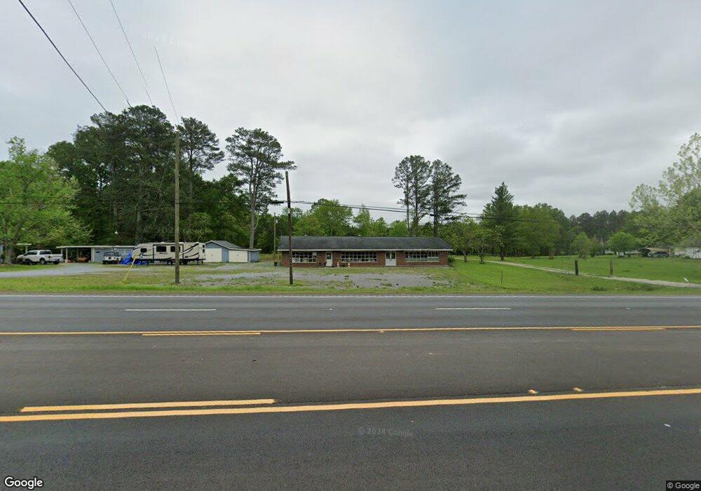
This home is located at 4049 Alabama Hwy SW, Rome, GA 30165 and is currently estimated at $187,480, approximately $211 per square foot. 4049 Alabama Hwy SW is a home with nearby schools including Coosa Middle School and Coosa High School.
Ownership History
Date
Name
Owned For
Owner Type
Purchase Details
Closed on
Jun 7, 2007
Sold by
Not Provided
Bought by
Ray James Earl and Reba Jenkins Ray
Current Estimated Value
Purchase Details
Closed on
May 29, 2007
Sold by
Not Provided
Bought by
Ray James Earl and Reba Jenkins Ray
Purchase Details
Closed on
Jan 2, 2007
Sold by
Not Provided
Bought by
Ray James Earl and Reba Jenkins Ray
Purchase Details
Closed on
Sep 21, 2004
Sold by
Mary Thomas J and Mary Sue Thomas
Bought by
Thomas Mary Sue
Purchase Details
Closed on
Feb 28, 2002
Sold by
Thomas J W
Bought by
Mary Thomas J and Mary Sue Thomas
Purchase Details
Closed on
Jan 1, 1945
Bought by
Thomas J W
Create a Home Valuation Report for This Property
The Home Valuation Report is an in-depth analysis detailing your home's value as well as a comparison with similar homes in the area
Home Values in the Area
Average Home Value in this Area
Purchase History
| Date | Buyer | Sale Price | Title Company |
|---|---|---|---|
| Ray James Earl | -- | -- | |
| Ray James Earl | $112,100 | -- | |
| Ray James Earl | -- | -- | |
| Thomas Mary Sue | -- | -- | |
| Mary Thomas J | -- | -- | |
| Thomas J W | -- | -- |
Source: Public Records
Tax History Compared to Growth
Tax History
| Year | Tax Paid | Tax Assessment Tax Assessment Total Assessment is a certain percentage of the fair market value that is determined by local assessors to be the total taxable value of land and additions on the property. | Land | Improvement |
|---|---|---|---|---|
| 2024 | $2,106 | $70,861 | $18,597 | $52,264 |
| 2023 | $2,027 | $61,571 | $17,267 | $44,304 |
| 2022 | $1,575 | $53,089 | $14,651 | $38,438 |
| 2021 | $1,511 | $50,065 | $13,678 | $36,387 |
| 2020 | $1,472 | $48,376 | $12,362 | $36,014 |
| 2019 | $1,201 | $47,053 | $12,362 | $34,691 |
| 2018 | $1,396 | $46,393 | $11,945 | $34,448 |
| 2017 | $1,388 | $46,028 | $11,326 | $34,702 |
| 2016 | $1,411 | $46,240 | $11,320 | $34,920 |
| 2015 | $1,558 | $52,228 | $11,320 | $40,908 |
| 2014 | $1,558 | $52,228 | $11,320 | $40,908 |
Source: Public Records
Map
Nearby Homes
- 86 N Avery Rd NW
- 53 Northside Dr NW
- 1 Ann Dr NW
- 293 N Avery Rd NW
- 45 Albert Ave NW
- 87 Northside Dr NW
- 4485 Alabama Hwy
- 10 Nest Dr NW
- 48 Atwood Dr NW
- 0 Charleston Dr NW Unit 10543945
- 0 Charleston Dr NW Unit 7598114
- 16 Polaris Terrace NW
- 876 Barker Rd SW
- 4813 Alabama Hwy SW
- 5 Red Fox Dr SW
- 775 Mays Bridge Rd SW
- 26 Red Fox Dr SW
- 3105 Barker Rd SW
- 14 Bryan Springs Rd SW
- 43 Brownlow Dr NW
- 4063 Alabama Hwy SW
- 4070 Alabama Hwy NW
- 4023 Alabama Hwy SW
- 4070 Alabama Hwy
- 4107 Alabama Hwy SW
- 4054 Alabama Hwy NW
- 4100 Alabama Hwy NW
- 4013 Alabama Hwy SW
- 4080 Alabama Hwy NW
- 4119 Alabama Hwy SW
- 4040 Alabama Hwy NW
- 4099 Alabama Hwy SW
- 4099 Alabama Hwy SW
- 4129 Alabama Hwy SW
- 4139 Alabama Hwy SW
- 4138 Alabama Hwy NW
- 0 S Side Alabama Highway Sr 20 Hwy Unit 175 7319440
- 0 S Side Alabama Highway Sr 20 Hwy Unit 5331037
- 3994 Alabama Hwy NW
- 42 S Avery Rd SW