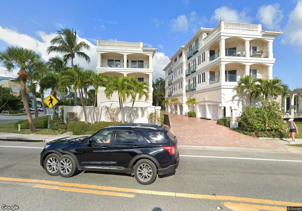
405 Beach Rd Unit BBLK27 Sarasota, FL 34242
Estimated Value: $2,165,000 - $2,428,714
4
Beds
5
Baths
4,646
Sq Ft
$490/Sq Ft
Est. Value
About This Home
This home is located at 405 Beach Rd Unit BBLK27, Sarasota, FL 34242 and is currently estimated at $2,276,679, approximately $490 per square foot. 405 Beach Rd Unit BBLK27 is a home located in Sarasota County with nearby schools including Phillippi Shores Elementary School, Brookside Middle School, and Sarasota High School.
Ownership History
Date
Name
Owned For
Owner Type
Purchase Details
Closed on
Jun 14, 2004
Sold by
Progner Robert O
Bought by
Nehring Marilyn K
Current Estimated Value
Purchase Details
Closed on
Jul 30, 1999
Sold by
Miller James J and Miller Helen K
Bought by
Lavoie Philip A
Home Financials for this Owner
Home Financials are based on the most recent Mortgage that was taken out on this home.
Original Mortgage
$200,000
Interest Rate
7.66%
Create a Home Valuation Report for This Property
The Home Valuation Report is an in-depth analysis detailing your home's value as well as a comparison with similar homes in the area
Home Values in the Area
Average Home Value in this Area
Purchase History
| Date | Buyer | Sale Price | Title Company |
|---|---|---|---|
| Nehring Marilyn K | $1,010,700 | -- | |
| Lavoie Philip A | $276,400 | -- |
Source: Public Records
Mortgage History
| Date | Status | Borrower | Loan Amount |
|---|---|---|---|
| Previous Owner | Lavoie Philip A | $200,000 |
Source: Public Records
Tax History Compared to Growth
Tax History
| Year | Tax Paid | Tax Assessment Tax Assessment Total Assessment is a certain percentage of the fair market value that is determined by local assessors to be the total taxable value of land and additions on the property. | Land | Improvement |
|---|---|---|---|---|
| 2024 | $16,057 | $1,349,358 | -- | -- |
| 2023 | $16,057 | $1,310,056 | $0 | $0 |
| 2022 | $15,585 | $1,271,899 | $0 | $0 |
| 2021 | $15,336 | $1,234,853 | $0 | $0 |
| 2020 | $15,441 | $1,217,804 | $0 | $0 |
| 2019 | $15,012 | $1,190,424 | $0 | $0 |
| 2018 | $14,748 | $1,168,228 | $0 | $0 |
| 2017 | $14,696 | $1,144,200 | $0 | $1,144,200 |
| 2016 | $17,242 | $1,816,600 | $0 | $1,816,600 |
| 2015 | $17,576 | $1,571,600 | $0 | $1,571,600 |
| 2014 | $17,520 | $1,279,996 | $0 | $0 |
Source: Public Records
Map
Nearby Homes
- 5319 Calle de La Siesta
- 420 Beach Rd Unit 203
- 304 Calle Miramar Unit 2
- 276 Island Cir
- 467 Canal Rd Unit 467
- 460 Beach Rd Unit B2
- 344 Canal Rd
- 222 Beach Rd Unit 7
- 5302 La Rosas
- 238 Island Cir
- 430 Island Cir
- 5400 Ocean Blvd Unit 17-04
- 5400 Ocean Blvd Unit 6-4
- 175 Island Cir
- 5300 Ocean Blvd Unit 202
- 538 Canal Rd
- 5219 Calle Menorca
- 462 Island Cir
- 544 Canal Rd
- 5250 Calle de Rio
- 409 Beach Rd Unit B
- 405 Beach Rd Unit 405
- 409 Beach Rd
- 405 Beach Rd Unit B
- 411 Beach Rd Unit 411
- 407 Beach Rd
- 411 Beach Rd Unit A
- 413 Beach Rd
- 5321 Calle de La Siesta Unit 5321
- 5319 Calle de La Siesta Unit 5319/5321
- 329 Beach Rd Unit 1-5
- 329 Beach Rd Unit A
- 329 Beach Rd Unit B
- 329 Beach Rd
- 329 Beach Rd Unit 4
- 329 Beach Rd Unit 3
- 329 Beach Rd Unit 1
- 329 Beach Rd Unit 2
- 430 Canal Rd Unit 11
- 5322 Calle de La Siesta