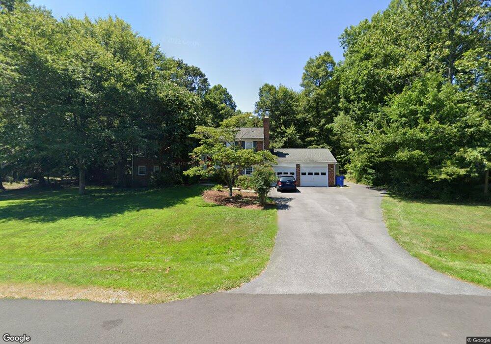
405 Butternut Ct La Plata, MD 20646
Estimated Value: $449,027 - $511,000
4
Beds
4
Baths
1,344
Sq Ft
$350/Sq Ft
Est. Value
About This Home
This home is located at 405 Butternut Ct, La Plata, MD 20646 and is currently estimated at $470,507, approximately $350 per square foot. 405 Butternut Ct is a home located in Charles County with nearby schools including Walter J. Mitchell Elementary School, Milton M. Somers Middle School, and La Plata High School.
Ownership History
Date
Name
Owned For
Owner Type
Purchase Details
Closed on
Dec 28, 2004
Sold by
Perdue Robert S and Perdue Joyce L
Bought by
Keysar Gregory T and Keysar Krista L
Current Estimated Value
Purchase Details
Closed on
Nov 30, 2004
Sold by
Perdue Robert S and Perdue Joyce L
Bought by
Keysar Gregory T and Keysar Krista L
Purchase Details
Closed on
Jun 27, 1983
Sold by
Schlegel Robert H and Schlegel Georgette
Bought by
Perdue Robert S and Perdue Joyce L
Home Financials for this Owner
Home Financials are based on the most recent Mortgage that was taken out on this home.
Original Mortgage
$108,000
Interest Rate
12.96%
Create a Home Valuation Report for This Property
The Home Valuation Report is an in-depth analysis detailing your home's value as well as a comparison with similar homes in the area
Home Values in the Area
Average Home Value in this Area
Purchase History
| Date | Buyer | Sale Price | Title Company |
|---|---|---|---|
| Keysar Gregory T | $364,900 | -- | |
| Keysar Gregory T | $364,900 | -- | |
| Perdue Robert S | $120,000 | -- |
Source: Public Records
Mortgage History
| Date | Status | Borrower | Loan Amount |
|---|---|---|---|
| Previous Owner | Perdue Robert S | $108,000 | |
| Closed | Keysar Gregory T | -- |
Source: Public Records
Tax History
| Year | Tax Paid | Tax Assessment Tax Assessment Total Assessment is a certain percentage of the fair market value that is determined by local assessors to be the total taxable value of land and additions on the property. | Land | Improvement |
|---|---|---|---|---|
| 2025 | -- | $361,767 | -- | -- |
| 2024 | $5,122 | $336,833 | $0 | $0 |
| 2023 | $5,455 | $311,900 | $109,400 | $202,500 |
| 2022 | $4,574 | $304,467 | $0 | $0 |
| 2021 | $4,367 | $297,033 | $0 | $0 |
| 2020 | $4,367 | $289,600 | $98,900 | $190,700 |
| 2019 | $4,383 | $289,600 | $98,900 | $190,700 |
| 2018 | $4,365 | $289,600 | $98,900 | $190,700 |
| 2017 | $4,573 | $301,800 | $0 | $0 |
| 2016 | -- | $290,933 | $0 | $0 |
| 2015 | $4,392 | $280,067 | $0 | $0 |
| 2014 | $4,392 | $269,200 | $0 | $0 |
Source: Public Records
Map
Nearby Homes
- 513 Clarks Run Rd
- 528 Clarks Run Rd
- 12 Willow Woods Dr
- 105 Huckleberry Dr
- 9900 Charles St
- 112 Huckleberry Dr
- 615 Clarks Run Rd
- 915 Hickory Cir
- 907 Hickory Cir
- 613 Wicomico St
- 9 Candleberry Dr
- 113 Burning Bush Place
- 13 Candleberry Dr
- 202 Oak Ave
- 0 Oak Ave
- 3002 Wildflower Dr
- 510 Quince Ct
- 305 Centennial St Unit K
- 3134 Maize Place
- 109 Shallow Brook Way
- 403 Butternut Ct
- 407 Butternut Ct
- 404 Butternut Ct
- 402 Butternut Ct
- 401 Butternut Ct
- 409 Butternut Ct
- 406 Butternut Ct
- 1104 E Patuxent Dr
- 408 Butternut Ct
- 400 Butternut Ct
- 402 Aspen Ct
- 1108 E Patuxent Dr
- 1102 E Patuxent Dr
- 400 Aspen Ct
- 404 Aspen Ct
- 1105 E Patuxent Dr
- 1107 E Patuxent Dr
- 500 Clarks Run Rd
- 406 Aspen Ct
- 1109 E Patuxent Dr
Your Personal Tour Guide
Ask me questions while you tour the home.