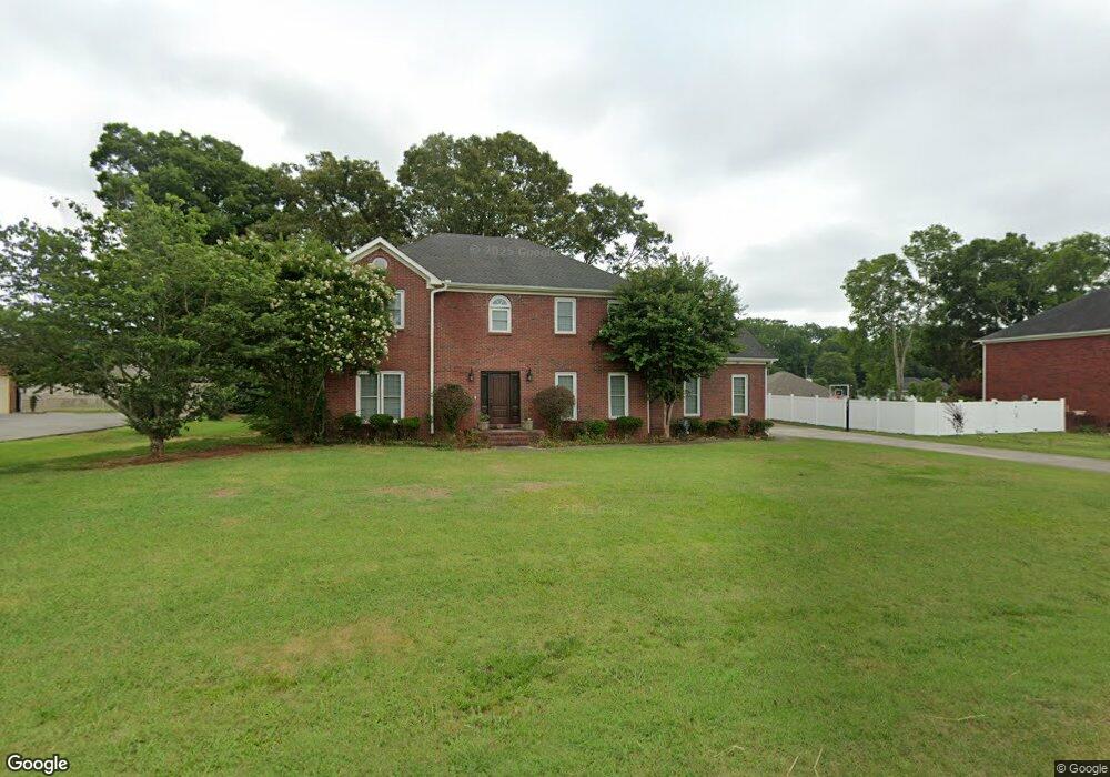
405 Dupree Dr Huntsville, AL 35806
Monrovia NeighborhoodEstimated Value: $392,000 - $438,000
4
Beds
3
Baths
2,724
Sq Ft
$150/Sq Ft
Est. Value
About This Home
This home is located at 405 Dupree Dr, Huntsville, AL 35806 and is currently estimated at $409,787, approximately $150 per square foot. 405 Dupree Dr is a home located in Madison County with nearby schools including Legacy Elementary School, Monrovia Middle School, and Sparkman High School.
Ownership History
Date
Name
Owned For
Owner Type
Purchase Details
Closed on
Dec 31, 2008
Sold by
Simmons Anthony C and Simmons Shirley B
Bought by
Mcclain Donovan R
Current Estimated Value
Home Financials for this Owner
Home Financials are based on the most recent Mortgage that was taken out on this home.
Original Mortgage
$239,795
Outstanding Balance
$157,770
Interest Rate
5.96%
Mortgage Type
New Conventional
Estimated Equity
$252,017
Create a Home Valuation Report for This Property
The Home Valuation Report is an in-depth analysis detailing your home's value as well as a comparison with similar homes in the area
Home Values in the Area
Average Home Value in this Area
Purchase History
| Date | Buyer | Sale Price | Title Company |
|---|---|---|---|
| Mcclain Donovan R | -- | -- |
Source: Public Records
Mortgage History
| Date | Status | Borrower | Loan Amount |
|---|---|---|---|
| Open | Mcclain Donovan R | $239,795 |
Source: Public Records
Tax History Compared to Growth
Tax History
| Year | Tax Paid | Tax Assessment Tax Assessment Total Assessment is a certain percentage of the fair market value that is determined by local assessors to be the total taxable value of land and additions on the property. | Land | Improvement |
|---|---|---|---|---|
| 2024 | $1,159 | $33,220 | $2,000 | $31,220 |
| 2023 | $1,159 | $32,100 | $2,000 | $30,100 |
| 2022 | $990 | $28,600 | $2,000 | $26,600 |
| 2021 | $922 | $26,740 | $2,000 | $24,740 |
| 2020 | $861 | $25,070 | $2,000 | $23,070 |
| 2019 | $823 | $24,030 | $2,000 | $22,030 |
| 2018 | $761 | $22,340 | $0 | $0 |
| 2017 | $761 | $22,340 | $0 | $0 |
| 2016 | $761 | $22,340 | $0 | $0 |
| 2015 | $761 | $22,340 | $0 | $0 |
| 2014 | $767 | $22,500 | $0 | $0 |
Source: Public Records
Map
Nearby Homes
- 195 Sarah Jane Dr
- 200 Sarah Jane Dr
- 223 Wainscott Dr
- 465 Jasmine Dr
- 108 Conifer Ct
- 150 Blue Spruce Dr
- 109 Sarah Jane Dr
- 253 Pumprock Dr
- 104 Raymon Cir
- 114 Pettus Rd
- 124 Kinsale Dr
- 1.4 acres Jeff Rd NW
- 10.4 acres Jeff Rd NW
- 436 Mount Zion Rd
- 110 Danika Dr NW
- 482 Mount Zion Rd
- 124 Huston Ct
- 116 Cove Pointe Way
- 1 ACRE EASEMENT Jeff Rd NW
- 2031 Blake Bottom Rd NW Unit 15
- 415 Dupree Dr
- 133 Erle Phillips Rd NW
- 395 Dupree Dr
- 134 Erle Phillips Rd NW
- 131 Erle Phillips Rd NW
- 402 Dupree Dr
- 427 Dupree Dr
- 412 Dupree Dr
- 132 Erle Phillips Rd
- 2810 Legacy Trace
- 2695 Legacy Trace
- 2035 Legacy Trace
- 1895 Legacy Trace
- 2070 Legacy Trace
- 2460 Legacy Trace
- 2035 Legacy Trace Dr
- 2460 Legacy Trace Dr
- 2810 Legacy Trace Dr
- 2695 Legacy Trace Dr
- 2070 Legacy Trace Dr