Estimated Value: $333,000 - $410,000
Studio
2
Baths
1,728
Sq Ft
$211/Sq Ft
Est. Value
About This Home
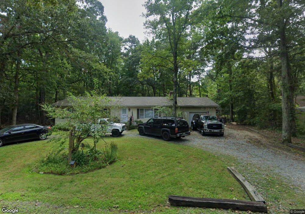
This home is located at 405 E Range Rd, Lusby, MD 20657 and is currently estimated at $364,596, approximately $210 per square foot. 405 E Range Rd is a home located in Calvert County with nearby schools including Dowell Elementary School, Mill Creek Middle School, and Patuxent High School.
Ownership History
Date
Name
Owned For
Owner Type
Purchase Details
Closed on
Oct 28, 2003
Sold by
Rogers Nancy K Taylor Paul E
Bought by
Jacobs Donald and Jacobs Amy
Current Estimated Value
Purchase Details
Closed on
Nov 5, 1986
Sold by
Metheny Harold A
Bought by
Rogers Nancy K Taylor and Rogers Paul E
Purchase Details
Closed on
Jul 5, 1983
Sold by
Ausen Orville G and Ausen Marguerite I
Bought by
Metheny Harold A
Home Financials for this Owner
Home Financials are based on the most recent Mortgage that was taken out on this home.
Original Mortgage
$56,000
Interest Rate
13.08%
Create a Home Valuation Report for This Property
The Home Valuation Report is an in-depth analysis detailing your home's value as well as a comparison with similar homes in the area
Home Values in the Area
Average Home Value in this Area
Purchase History
| Date | Buyer | Sale Price | Title Company |
|---|---|---|---|
| Jacobs Donald | $158,000 | -- | |
| Rogers Nancy K Taylor | $66,500 | -- | |
| Metheny Harold A | $59,000 | -- |
Source: Public Records
Mortgage History
| Date | Status | Borrower | Loan Amount |
|---|---|---|---|
| Previous Owner | Metheny Harold A | $56,000 | |
| Closed | Jacobs Donald | -- |
Source: Public Records
Tax History
| Year | Tax Paid | Tax Assessment Tax Assessment Total Assessment is a certain percentage of the fair market value that is determined by local assessors to be the total taxable value of land and additions on the property. | Land | Improvement |
|---|---|---|---|---|
| 2025 | $3,425 | $276,900 | $0 | $0 |
| 2024 | $3,175 | $254,200 | $0 | $0 |
| 2023 | $2,405 | $231,500 | $55,200 | $176,300 |
| 2022 | $2,306 | $221,967 | $0 | $0 |
| 2021 | $5,464 | $212,433 | $0 | $0 |
| 2020 | $2,538 | $202,900 | $55,200 | $147,700 |
| 2019 | $2,055 | $195,867 | $0 | $0 |
| 2018 | $1,981 | $188,833 | $0 | $0 |
| 2017 | $2,307 | $181,800 | $0 | $0 |
| 2016 | -- | $181,800 | $0 | $0 |
| 2015 | $2,644 | $181,800 | $0 | $0 |
| 2014 | $2,644 | $184,200 | $0 | $0 |
Source: Public Records
Map
Nearby Homes
- 454 Dogwood Dr
- 357 Cayuse Cir
- 334 Longhorn Cir
- 298 Cove Dr
- 12846 Laurel Way
- 484 Lake Dr
- 12817 Abilene Trail
- 422 Lessin Dr
- 12990 Barreda Blvd
- 12921 Pine Ln
- 12751 Powder Horn Trail
- 400 Clubhouse Dr
- 12971 Mills Creek Dr
- 206 Harbor Dr
- 12646 High Sierra Rd
- 13000 Mills Creek Dr
- 12995 Rousby Hall Rd
- 12959 Pine Ln
- 222 Mcmichaels Dr
- 215 Lessin Dr
- 380 E Range Rd
- 401 E Range Rd
- 12876 Rio Grande Trail
- 12800 Barreda Blvd
- 408 S West Ct
- 413 E Range Rd
- 385 E Range Rd
- 410 E Range Rd
- 410 Range Rd E
- 12880 Barreda Blvd
- 412 S West Ct
- 389 E Range Rd
- 417 E Range Rd
- 401 S West Ct
- 416 S West Ct
- 407 S West Ct
- 420 Southwest Ct
- 378 Longhorn Cir
- 403 S West Ct
- 390 Longhorn Cir
Your Personal Tour Guide
Ask me questions while you tour the home.