Estimated Value: $340,024 - $675,000
Studio
--
Bath
1,195
Sq Ft
$464/Sq Ft
Est. Value
About This Home
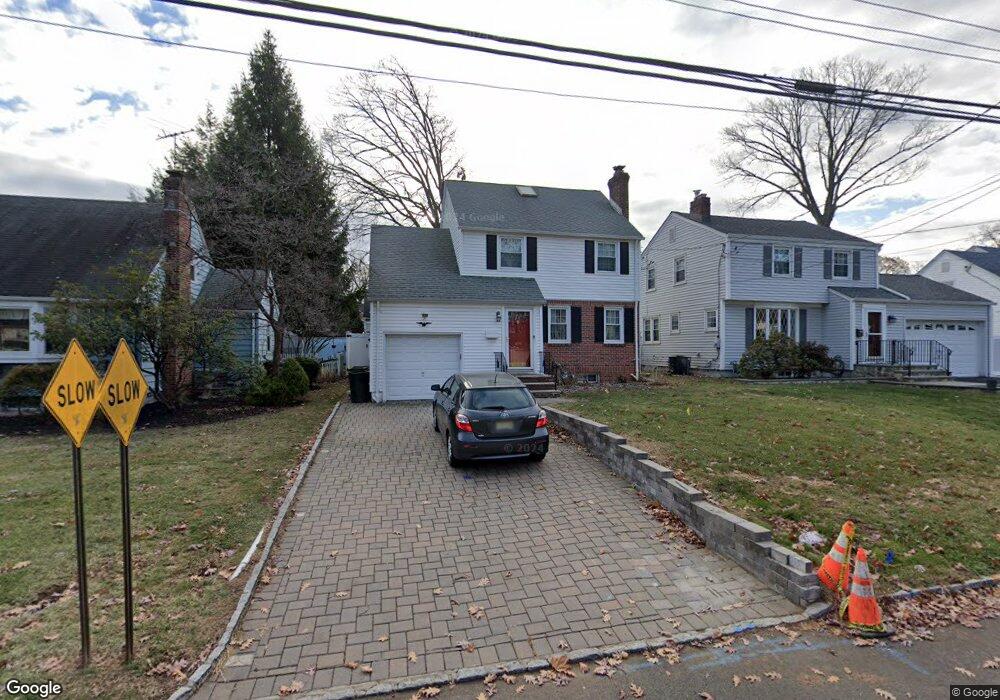
This home is located at 405 Forest Dr, Union, NJ 07083 and is currently estimated at $554,256, approximately $463 per square foot. 405 Forest Dr is a home located in Union County with nearby schools including Washington Elementary School, Union High School, and Kindercare Learning Center.
Ownership History
Date
Name
Owned For
Owner Type
Purchase Details
Closed on
Nov 20, 2009
Sold by
Spagnoletti Patrick and Spagnoletti Laipeng
Bought by
Cummings Dollette
Current Estimated Value
Home Financials for this Owner
Home Financials are based on the most recent Mortgage that was taken out on this home.
Original Mortgage
$316,800
Outstanding Balance
$205,372
Interest Rate
4.86%
Mortgage Type
New Conventional
Estimated Equity
$348,884
Purchase Details
Closed on
Aug 15, 2003
Sold by
Pudlak Raymond
Bought by
Spagnoletti Patrick and Spagnoletti Laipeng
Home Financials for this Owner
Home Financials are based on the most recent Mortgage that was taken out on this home.
Original Mortgage
$279,200
Interest Rate
5.69%
Create a Home Valuation Report for This Property
The Home Valuation Report is an in-depth analysis detailing your home's value as well as a comparison with similar homes in the area
Home Values in the Area
Average Home Value in this Area
Purchase History
| Date | Buyer | Sale Price | Title Company |
|---|---|---|---|
| Cummings Dollette | $352,000 | Chicago Title Insurance Co | |
| Spagnoletti Patrick | $349,000 | -- |
Source: Public Records
Mortgage History
| Date | Status | Borrower | Loan Amount |
|---|---|---|---|
| Open | Cummings Dollette | $316,800 | |
| Previous Owner | Spagnoletti Patrick | $279,200 |
Source: Public Records
Tax History
| Year | Tax Paid | Tax Assessment Tax Assessment Total Assessment is a certain percentage of the fair market value that is determined by local assessors to be the total taxable value of land and additions on the property. | Land | Improvement |
|---|---|---|---|---|
| 2025 | $9,454 | $42,300 | $18,300 | $24,000 |
| 2024 | $9,166 | $42,300 | $18,300 | $24,000 |
| 2023 | $9,166 | $42,300 | $18,300 | $24,000 |
| 2022 | $8,847 | $42,300 | $18,300 | $24,000 |
| 2021 | $8,633 | $42,300 | $18,300 | $24,000 |
| 2020 | $8,461 | $42,300 | $18,300 | $24,000 |
| 2019 | $8,347 | $42,300 | $18,300 | $24,000 |
| 2018 | $8,205 | $42,300 | $18,300 | $24,000 |
| 2017 | $8,084 | $42,300 | $18,300 | $24,000 |
| 2016 | $7,886 | $42,300 | $18,300 | $24,000 |
| 2015 | $7,756 | $42,300 | $18,300 | $24,000 |
| 2014 | $7,582 | $42,300 | $18,300 | $24,000 |
Source: Public Records
Map
Nearby Homes
- 393 Huntington Rd
- 399 Martin Rd
- 318 Delaware Ave
- 341 Forest Dr
- 277 Newark Ave
- 578 Winchester Ave
- 381 Dogwood Dr
- 569 Scotland Rd
- 369 Bergen St
- 341 Trotting Rd
- 461 Thoreau Terrace
- 52 E Sumner Ave
- 731 Woodland Ave
- 128 E Roselle Ave
- 214 Washington Ave
- 346 Tucker Ave
- 545 Homer Terrace
- 270 Clermont Terrace
- 437 Bailey Ave
- 201 E Lincoln Ave
- 401 Forest Dr
- 409 Forest Dr
- 399 Forest Dr
- 413 Forest Dr
- 408 Huntington Rd
- 404 Huntington Rd
- 412 Huntington Rd
- 400 Huntington Rd
- 404 Forest Dr
- 408 Forest Dr
- 417 Forest Dr
- 416 Huntington Rd
- 400 Forest Dr
- 412 Forest Dr
- 396 Forest Dr
- 396 Huntington Rd
- 420 Huntington Rd
- 419 Forest Dr
- 416 Forest Dr
- 392 Forest Dr
Your Personal Tour Guide
Ask me questions while you tour the home.