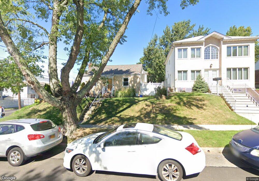
405 Giffords Ln Staten Island, NY 10308
Great Kills NeighborhoodEstimated Value: $727,045 - $875,000
4
Beds
4
Baths
1,950
Sq Ft
$421/Sq Ft
Est. Value
About This Home
This home is located at 405 Giffords Ln, Staten Island, NY 10308 and is currently estimated at $821,511, approximately $421 per square foot. 405 Giffords Ln is a home located in Richmond County with nearby schools including P.S. 32 The Gifford School, I.S. 075 Frank D. Paulo, and Susan E Wagner High School.
Ownership History
Date
Name
Owned For
Owner Type
Purchase Details
Closed on
Dec 26, 2002
Sold by
Krebusheski Stanley Michael
Bought by
Aloshi Esat and Aloshi Mihana
Current Estimated Value
Home Financials for this Owner
Home Financials are based on the most recent Mortgage that was taken out on this home.
Original Mortgage
$361,250
Interest Rate
5.9%
Mortgage Type
Purchase Money Mortgage
Create a Home Valuation Report for This Property
The Home Valuation Report is an in-depth analysis detailing your home's value as well as a comparison with similar homes in the area
Home Values in the Area
Average Home Value in this Area
Purchase History
| Date | Buyer | Sale Price | Title Company |
|---|---|---|---|
| Aloshi Esat | $430,950 | -- |
Source: Public Records
Mortgage History
| Date | Status | Borrower | Loan Amount |
|---|---|---|---|
| Previous Owner | Aloshi Esat | $361,250 |
Source: Public Records
Tax History Compared to Growth
Tax History
| Year | Tax Paid | Tax Assessment Tax Assessment Total Assessment is a certain percentage of the fair market value that is determined by local assessors to be the total taxable value of land and additions on the property. | Land | Improvement |
|---|---|---|---|---|
| 2025 | $7,722 | $40,140 | $9,869 | $30,271 |
| 2024 | $6,549 | $42,840 | $8,723 | $34,117 |
| 2023 | $7,808 | $38,448 | $8,121 | $30,327 |
| 2022 | $7,618 | $41,460 | $9,720 | $31,740 |
| 2021 | $7,576 | $38,040 | $9,720 | $28,320 |
| 2020 | $7,189 | $35,580 | $9,720 | $25,860 |
| 2019 | $6,702 | $36,060 | $9,720 | $26,340 |
| 2018 | $6,531 | $32,040 | $8,072 | $23,968 |
| 2017 | $6,482 | $31,800 | $8,615 | $23,185 |
| 2016 | $5,997 | $30,000 | $9,292 | $20,708 |
| 2015 | $5,124 | $28,302 | $7,155 | $21,147 |
| 2014 | $5,124 | $26,700 | $8,100 | $18,600 |
Source: Public Records
Map
Nearby Homes
- 87 Pemberton Ave
- 132 Elkhart St
- 72 Eric Ln
- 12 Lexington Ln
- 414 Elverton Ave
- 466 Doane Ave
- 420 Arthur Kill Rd
- 62 Daleham St
- 379 Brookfield Ave
- 350 Brookfield Ave
- 12 Troy St
- 38 Troy St
- 40 Troy St
- 52 Barlow Ave
- 259 Brookfield Ave
- 339 Abingdon Ave
- 47 Jumel St
- 98 Kennington St
- 168 Leverett Ave
- 305 Corbin Ave
- 161 Gurley Ave
- 155 Gurley Ave Unit 2
- 155 Gurley Ave
- 154 Fairfield St
- 150 Fairfield St
- 151 Gurley Ave
- 146 Fairfield St
- 148 Fairfield St
- 173 Gurley Ave
- 406 Giffords Ln
- 142 Fairfield St
- 408 Giffords Ln
- 147 Gurley Ave
- 175 Gurley Ave
- 416 Giffords Ln
- 138 Fairfield St
- 179 Gurley Ave
- 395 Giffords Ln
- 143 Gurley Ave
- 420 Giffords Ln