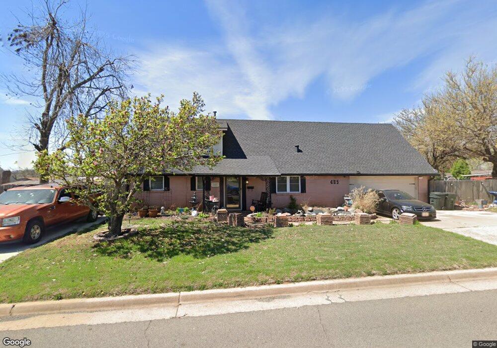
405 Howard Dr Oklahoma City, OK 73115
Estimated Value: $186,000 - $201,000
3
Beds
2
Baths
1,161
Sq Ft
$168/Sq Ft
Est. Value
About This Home
This home is located at 405 Howard Dr, Oklahoma City, OK 73115 and is currently estimated at $195,094, approximately $168 per square foot. 405 Howard Dr is a home located in Oklahoma County with nearby schools including Bonham Elementary School, Midwest City Elementary School, and Rice Challenge Academy.
Ownership History
Date
Name
Owned For
Owner Type
Purchase Details
Closed on
Nov 30, 2001
Sold by
Tucker Phillip L and Tucker Terri Ralene
Bought by
Pogue Manuel and Pogue Tanisha
Current Estimated Value
Purchase Details
Closed on
Feb 4, 1999
Sold by
Va
Bought by
Tucker Phillip L
Home Financials for this Owner
Home Financials are based on the most recent Mortgage that was taken out on this home.
Original Mortgage
$75,000
Interest Rate
6.79%
Mortgage Type
VA
Purchase Details
Closed on
Aug 31, 1998
Sold by
Whetsel John and Emery Berton Coridon
Bought by
Va
Create a Home Valuation Report for This Property
The Home Valuation Report is an in-depth analysis detailing your home's value as well as a comparison with similar homes in the area
Home Values in the Area
Average Home Value in this Area
Purchase History
| Date | Buyer | Sale Price | Title Company |
|---|---|---|---|
| Pogue Manuel | $92,500 | Capitol Abstract & Title Co | |
| Tucker Phillip L | -- | Stewart Escrow & Title | |
| Va | $61,942 | -- |
Source: Public Records
Mortgage History
| Date | Status | Borrower | Loan Amount |
|---|---|---|---|
| Previous Owner | Tucker Phillip L | $75,000 |
Source: Public Records
Tax History Compared to Growth
Tax History
| Year | Tax Paid | Tax Assessment Tax Assessment Total Assessment is a certain percentage of the fair market value that is determined by local assessors to be the total taxable value of land and additions on the property. | Land | Improvement |
|---|---|---|---|---|
| 2024 | $1,381 | $13,679 | $2,472 | $11,207 |
| 2023 | $1,381 | $13,281 | $1,772 | $11,509 |
| 2022 | $1,317 | $12,894 | $1,891 | $11,003 |
| 2021 | $1,321 | $12,519 | $2,147 | $10,372 |
| 2020 | $1,314 | $12,155 | $2,282 | $9,873 |
| 2019 | $1,309 | $12,463 | $2,047 | $10,416 |
| 2018 | $1,285 | $12,100 | $0 | $0 |
| 2017 | $1,281 | $11,989 | $2,096 | $9,893 |
| 2016 | $1,275 | $11,640 | $2,063 | $9,577 |
| 2015 | $1,242 | $11,302 | $2,027 | $9,275 |
| 2014 | $1,199 | $10,972 | $2,127 | $8,845 |
Source: Public Records
Map
Nearby Homes
- 4720 Trapp Dr
- 410 Vickie Dr
- 4916 Jeffery Dr
- 4937 Jeffery Dr
- 605 S Sooner Rd
- 310 S Sooner Rd
- 4800 Gina Place
- 4761 Koelsch Dr
- 1017 Howard Dr
- 4812 Del Crest Dr
- 816 S Sooner Rd
- 5804 SE 7th St
- 4412 E Reno St
- 4408 E Reno Ave
- 720 Del Haven Dr
- 1311 Sean Ct
- 1306 Sean Ct
- 613 Mark Dr
- 1318 Alviola Ave
- 1321 Alviola Ave