Estimated Value: $257,000 - $306,070
3
Beds
1
Bath
1,707
Sq Ft
$166/Sq Ft
Est. Value
About This Home
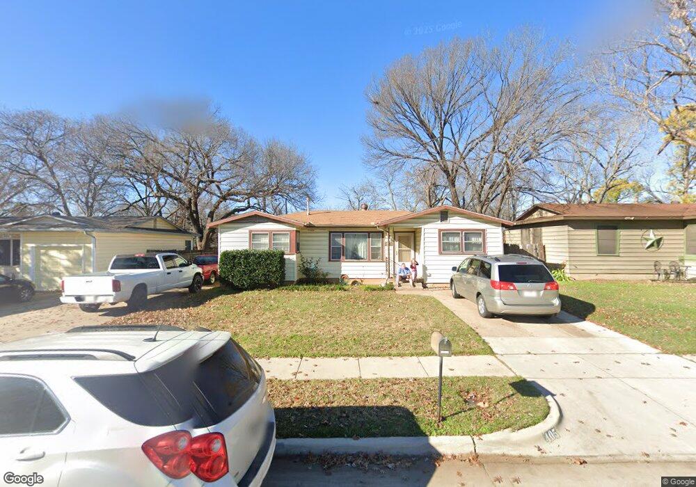
This home is located at 405 Michael Blvd, Hurst, TX 76053 and is currently estimated at $283,518, approximately $166 per square foot. 405 Michael Blvd is a home located in Tarrant County with nearby schools including Bellaire Elementary School, Hurst J High School, and L.D. Bell High School.
Ownership History
Date
Name
Owned For
Owner Type
Purchase Details
Closed on
Jul 15, 2022
Sold by
Joseph Weaver Jr Marion and Joseph Ann Patricia
Bought by
Weaver Marion and Weaver Patricia
Current Estimated Value
Home Financials for this Owner
Home Financials are based on the most recent Mortgage that was taken out on this home.
Original Mortgage
$472,500
Outstanding Balance
$451,813
Interest Rate
5.7%
Mortgage Type
New Conventional
Estimated Equity
-$168,295
Purchase Details
Closed on
Apr 1, 1997
Sold by
Ortolani Shelley
Bought by
Camelot Homes Inc
Create a Home Valuation Report for This Property
The Home Valuation Report is an in-depth analysis detailing your home's value as well as a comparison with similar homes in the area
Home Values in the Area
Average Home Value in this Area
Purchase History
| Date | Buyer | Sale Price | Title Company |
|---|---|---|---|
| Weaver Marion | -- | Bc Law Firm Pa | |
| Camelot Homes Inc | $21,616 | -- |
Source: Public Records
Mortgage History
| Date | Status | Borrower | Loan Amount |
|---|---|---|---|
| Open | Weaver Marion | $472,500 |
Source: Public Records
Tax History
| Year | Tax Paid | Tax Assessment Tax Assessment Total Assessment is a certain percentage of the fair market value that is determined by local assessors to be the total taxable value of land and additions on the property. | Land | Improvement |
|---|---|---|---|---|
| 2025 | $596 | $293,012 | $50,000 | $243,012 |
| 2024 | $596 | $293,012 | $50,000 | $243,012 |
| 2023 | $3,019 | $269,373 | $35,000 | $234,373 |
| 2022 | $3,154 | $261,267 | $35,000 | $226,267 |
| 2021 | $3,004 | $251,581 | $35,000 | $216,581 |
| 2020 | $2,724 | $201,241 | $35,000 | $166,241 |
| 2019 | $2,519 | $192,680 | $35,000 | $157,680 |
| 2018 | $727 | $93,569 | $15,000 | $78,569 |
| 2017 | $2,153 | $141,459 | $15,000 | $126,459 |
| 2016 | $1,957 | $120,252 | $15,000 | $105,252 |
| 2015 | $631 | $70,300 | $15,000 | $55,300 |
| 2014 | $631 | $70,300 | $15,000 | $55,300 |
Source: Public Records
Map
Nearby Homes
- 42 Page St
- 413 Wanda Way
- 308 Wanda Way
- 212 E Ellen Ave
- 312 E Ellen Ave
- 705 Timbercreek Dr
- 260 Corinna Ct
- 108 Donald Dr
- 205 Corinna Ct
- 740 Shady Ln
- 47 Donald Ct
- 408 Harrison Ln
- 552 Norwood Dr
- 4106 Hollow Oak Dr
- 1302 Woodridge Cir
- 609 Norwood Dr
- 840 Forest Hollow Dr
- 1309 Driftwood Dr
- 701 Harrison Ln
- 231 Elm St
- 401 Michael Blvd
- 409 Michael Blvd
- 413 Michael Blvd
- 317 Michael Blvd
- 38 Page St
- 46 Page St
- 417 Michael Blvd
- 313 Michael Blvd
- 404 Michael Blvd
- 408 Michael Blvd
- 400 Michael Blvd
- 34 Page St
- 50 Page St
- 412 Michael Blvd
- 316 Michael Blvd
- 416 Michael Blvd
- 312 Michael Blvd
- 425 Wanda Way
- 421 Wanda Way
- 425 Michael Blvd
Your Personal Tour Guide
Ask me questions while you tour the home.