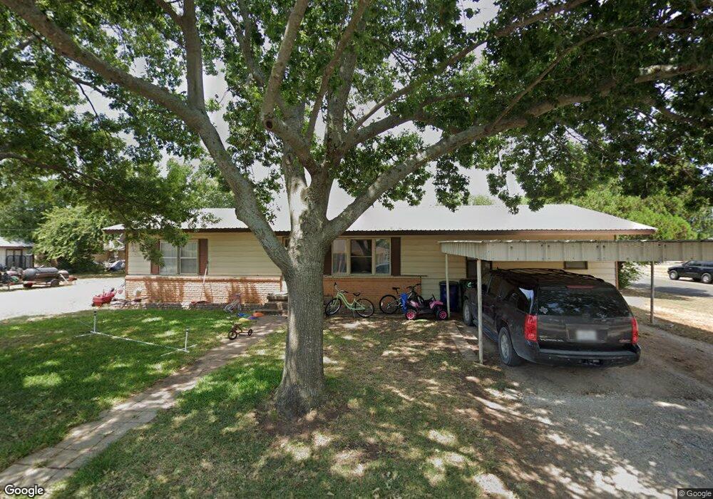
405 N Trenchard St Decatur, TX 76234
Estimated Value: $250,767 - $323,000
--
Bed
--
Bath
1,680
Sq Ft
$167/Sq Ft
Est. Value
About This Home
This home is located at 405 N Trenchard St, Decatur, TX 76234 and is currently estimated at $281,192, approximately $167 per square foot. 405 N Trenchard St is a home located in Wise County with nearby schools including Decatur High School and Victory Christian Academy.
Ownership History
Date
Name
Owned For
Owner Type
Purchase Details
Closed on
Aug 4, 2014
Sold by
Howard Paul E and Howard Brett C
Bought by
Horner Michael E and Horner Charlotte
Current Estimated Value
Home Financials for this Owner
Home Financials are based on the most recent Mortgage that was taken out on this home.
Original Mortgage
$260,000
Outstanding Balance
$142,866
Interest Rate
4.2%
Mortgage Type
Future Advance Clause Open End Mortgage
Estimated Equity
$138,326
Purchase Details
Closed on
May 20, 2008
Sold by
Goodwin Charles E and Goodwin Glenda R
Bought by
Horner Michael E and Horner Charlotte
Home Financials for this Owner
Home Financials are based on the most recent Mortgage that was taken out on this home.
Original Mortgage
$92,200
Interest Rate
5.86%
Mortgage Type
Purchase Money Mortgage
Purchase Details
Closed on
Jan 1, 1901
Bought by
Horner Michael E and Horner Charlotte
Create a Home Valuation Report for This Property
The Home Valuation Report is an in-depth analysis detailing your home's value as well as a comparison with similar homes in the area
Home Values in the Area
Average Home Value in this Area
Purchase History
| Date | Buyer | Sale Price | Title Company |
|---|---|---|---|
| Horner Michael E | -- | None Available | |
| Horner Michael E | -- | -- | |
| Horner Michael E | -- | -- |
Source: Public Records
Mortgage History
| Date | Status | Borrower | Loan Amount |
|---|---|---|---|
| Open | Horner Michael E | $260,000 | |
| Previous Owner | Horner Michael E | $92,200 |
Source: Public Records
Tax History Compared to Growth
Tax History
| Year | Tax Paid | Tax Assessment Tax Assessment Total Assessment is a certain percentage of the fair market value that is determined by local assessors to be the total taxable value of land and additions on the property. | Land | Improvement |
|---|---|---|---|---|
| 2025 | $4,355 | $265,863 | $86,631 | $179,232 |
| 2024 | $4,355 | $239,286 | $62,776 | $176,510 |
| 2023 | $4,289 | $236,445 | $62,776 | $173,669 |
| 2022 | $4,305 | $196,585 | $56,678 | $139,907 |
| 2021 | $3,766 | $165,020 | $56,680 | $108,340 |
| 2020 | $3,409 | $145,330 | $52,190 | $93,140 |
| 2019 | $3,402 | $137,260 | $52,190 | $85,070 |
| 2018 | $2,951 | $114,130 | $28,320 | $85,810 |
| 2017 | $2,464 | $94,920 | $23,600 | $71,320 |
| 2016 | $2,312 | $89,060 | $23,600 | $65,460 |
| 2015 | -- | $90,040 | $23,600 | $66,440 |
| 2014 | -- | $85,850 | $18,880 | $66,970 |
Source: Public Records
Map
Nearby Homes
- 407 N Lane St
- 606 W Mulberry St
- 0 N Hwy 287 Unit 25379920
- 304 Cyndilu Ln
- 1 S Martin Extension
- 601 W Brady St
- 101 E Mulberry St
- 401 S Holman St
- 700 N Church St
- 802 N Church St
- 903 N Miller St
- 4112 U S 380
- 50+/- acres U S 380
- 305 E Shoemaker St
- 114 Sondra Lin Blvd
- TBD Farm To Market 51
- 602 N Cates St
- W W Rose Ave
- 204 W Collins St
- 307 E Vernon St
- 406 N Cowan St
- 406 N Trenchard St
- 403 N Trenchard St
- 404 N Trenchard St
- 404 N Cowan St
- 402 N Trenchard St
- 505 W Ash St
- 501 N Cowan St
- 409 N Cowan St
- 407 N Cowan St
- 600 W Oak St
- 503 W Ash St
- 400 N Trenchard St
- 414 W Oak St
- 602 W Oak St
- 405 N Cowan St
- 503 N Cowan St
- 501 W Ash St
- 505 N Cowan St
- 410 W Oak St