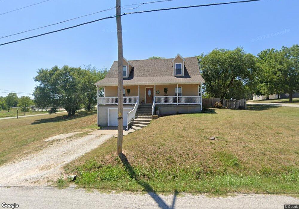
405 N Ward St Stockton, MO 65785
Estimated Value: $143,000 - $324,000
--
Bed
--
Bath
3,120
Sq Ft
$78/Sq Ft
Est. Value
About This Home
This home is located at 405 N Ward St, Stockton, MO 65785 and is currently estimated at $244,277, approximately $78 per square foot. 405 N Ward St is a home located in Cedar County with nearby schools including Stockton Elementary School, Stockton Middle School, and Stockton High School.
Ownership History
Date
Name
Owned For
Owner Type
Purchase Details
Closed on
Mar 3, 2016
Sold by
Anderson Franklin D and Anderson Brandy L
Bought by
Haught Jacob and Haught Aimee
Current Estimated Value
Home Financials for this Owner
Home Financials are based on the most recent Mortgage that was taken out on this home.
Original Mortgage
$101,624
Outstanding Balance
$81,669
Interest Rate
4.12%
Mortgage Type
FHA
Estimated Equity
$162,608
Purchase Details
Closed on
Jul 14, 2010
Sold by
Shepherd Richard J
Bought by
Anderson Franklin D and Anderson Brandy L
Purchase Details
Closed on
Jul 6, 2010
Sold by
Brown Wesley and Brown Sallie
Bought by
Anderson Franklin D and Anderson Brandy L
Create a Home Valuation Report for This Property
The Home Valuation Report is an in-depth analysis detailing your home's value as well as a comparison with similar homes in the area
Home Values in the Area
Average Home Value in this Area
Purchase History
| Date | Buyer | Sale Price | Title Company |
|---|---|---|---|
| Haught Jacob | -- | None Available | |
| Anderson Franklin D | -- | None Available | |
| Anderson Franklin D | -- | None Available |
Source: Public Records
Mortgage History
| Date | Status | Borrower | Loan Amount |
|---|---|---|---|
| Open | Haught Jacob | $101,624 |
Source: Public Records
Tax History Compared to Growth
Tax History
| Year | Tax Paid | Tax Assessment Tax Assessment Total Assessment is a certain percentage of the fair market value that is determined by local assessors to be the total taxable value of land and additions on the property. | Land | Improvement |
|---|---|---|---|---|
| 2025 | $1,195 | $28,530 | $660 | $27,870 |
| 2024 | $1,195 | $24,810 | $570 | $24,240 |
| 2023 | $1,206 | $24,810 | $0 | $0 |
| 2022 | $1,204 | $24,810 | $0 | $0 |
| 2021 | $1,153 | $24,810 | $0 | $0 |
| 2020 | $1,153 | $23,760 | $0 | $0 |
| 2019 | $1,123 | $23,760 | $0 | $0 |
| 2018 | $1,118 | $23,760 | $0 | $0 |
| 2017 | -- | $23,760 | $0 | $0 |
| 2016 | -- | $23,760 | $0 | $0 |
| 2015 | -- | $23,760 | $0 | $0 |
| 2014 | -- | $23,760 | $0 | $0 |
| 2013 | -- | $23,760 | $0 | $0 |
Source: Public Records
Map
Nearby Homes
- 315 Skyline Dr
- 602 W 32 Hwy
- 204 N Blake
- 602 W Highway 32
- 21772 State Highway 32
- 000 State Highway 32
- 008 State Highway 32
- 007 State Highway 32
- 006 State Highway 32
- 212 East St
- 708 West St
- 712 West St
- 111 E Locust St
- 502 E Highway 32
- 312 East St
- 407 S High St
- 309 S Chestnut St
- 700 Owens Mill Rd
- 704 S Highway J
- 1014 Lancaster Dr
- 000 N Ward St
- 0 N Ward St
- 303 W Craig St
- 309 W Craig St
- 205 W Craig St
- 201 W Craig St
- 211 W Craig St
- 210 W Craig St
- 607 N Ward St
- 611 N Ward St
- 310 W Glenn St
- 309 W Glenn St
- 511 N Ward St
- 507 N Ward St
- 515 N Ward St
- 201 W Crestview St
- 207 W Crestview St
- 204 W Crestview St
- 200 W Crestview St
- 208 W Crestview St