Estimated Value: $88,000 - $128,000
--
Bed
1
Bath
1,397
Sq Ft
$78/Sq Ft
Est. Value
About This Home
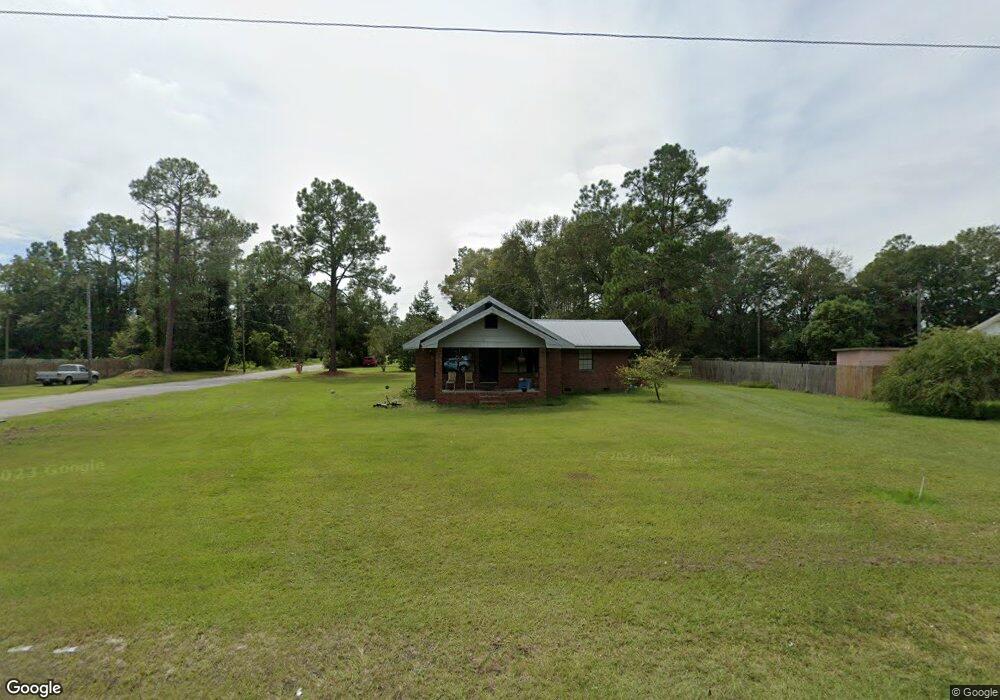
This home is located at 405 Radio Station Rd, Alma, GA 31510 and is currently estimated at $108,965, approximately $77 per square foot. 405 Radio Station Rd is a home located in Bacon County with nearby schools including Bacon County Primary School, Bacon County Elementary School, and Bacon County Middle School.
Ownership History
Date
Name
Owned For
Owner Type
Purchase Details
Closed on
Jun 30, 2022
Sold by
Carter Kim
Bought by
Bruner Lauren C
Current Estimated Value
Home Financials for this Owner
Home Financials are based on the most recent Mortgage that was taken out on this home.
Original Mortgage
$60,110
Outstanding Balance
$50,440
Interest Rate
4.32%
Mortgage Type
New Conventional
Estimated Equity
$58,525
Purchase Details
Closed on
May 21, 1992
Bought by
Carter Kim
Create a Home Valuation Report for This Property
The Home Valuation Report is an in-depth analysis detailing your home's value as well as a comparison with similar homes in the area
Home Values in the Area
Average Home Value in this Area
Purchase History
| Date | Buyer | Sale Price | Title Company |
|---|---|---|---|
| Bruner Lauren C | $65,000 | -- | |
| Carter Kim | $33,000 | -- |
Source: Public Records
Mortgage History
| Date | Status | Borrower | Loan Amount |
|---|---|---|---|
| Open | Bruner Lauren C | $60,110 |
Source: Public Records
Tax History Compared to Growth
Tax History
| Year | Tax Paid | Tax Assessment Tax Assessment Total Assessment is a certain percentage of the fair market value that is determined by local assessors to be the total taxable value of land and additions on the property. | Land | Improvement |
|---|---|---|---|---|
| 2024 | $1,086 | $29,880 | $2,120 | $27,760 |
| 2023 | $1,038 | $26,920 | $2,120 | $24,800 |
| 2022 | $728 | $18,880 | $2,120 | $16,760 |
| 2021 | $711 | $18,440 | $2,120 | $16,320 |
| 2020 | $654 | $16,230 | $1,952 | $14,278 |
| 2019 | $654 | $16,230 | $1,952 | $14,278 |
| 2018 | $660 | $16,409 | $1,952 | $14,457 |
| 2017 | $661 | $16,409 | $1,952 | $14,457 |
| 2016 | $746 | $16,409 | $1,952 | $14,457 |
| 2015 | $730 | $18,099 | $2,180 | $15,919 |
| 2014 | $655 | $18,099 | $2,180 | $15,919 |
| 2013 | $655 | $16,061 | $2,179 | $13,881 |
Source: Public Records
Map
Nearby Homes
- 301 Taylor Rd
- 403 S Ware St
- 122 Grace Loop Unit 1
- 118 Grace Loop Unit 1
- 117 Grace Loop Unit 1
- 314 W 16th St
- 9TH E 417
- 0 E 6th St Unit 114222
- 113 Brite Blue Dr
- 166 Grace Loop Unit 1
- 1348 U S 1
- 907 N Pierce St
- 401 Lee St
- 0 Oriole Rd Unit 160930
- 0 Oriole Rd Unit 23852171
- 0 Oriole Rd Unit 1654653
- 0 Oriole Rd Unit 10543585
- 118 Morris Dr
- 245 Starling Rd
- 1109 W 4th Street Extension
- 107 Mccrea Ave
- 403 Radio Station Rd
- 501 Radio Station Rd
- 109 Mccrea Ave
- 108 Mccrea Ave
- 401 Radio Station Rd
- 401 Williams St
- 202 Mccrea Ave
- 507 Radio Station Rd
- 203 Crosby Rd
- 304 Crosby Rd
- 321 Radio Station Rd
- 207 Crosby Rd
- 201 Crosby Rd
- 128 Crosby Rd
- 303 Crosby Rd
- 305 Crosby Rd
- 127 Crosby Rd
- 308 Crosby Rd
- 208 Taylor Rd