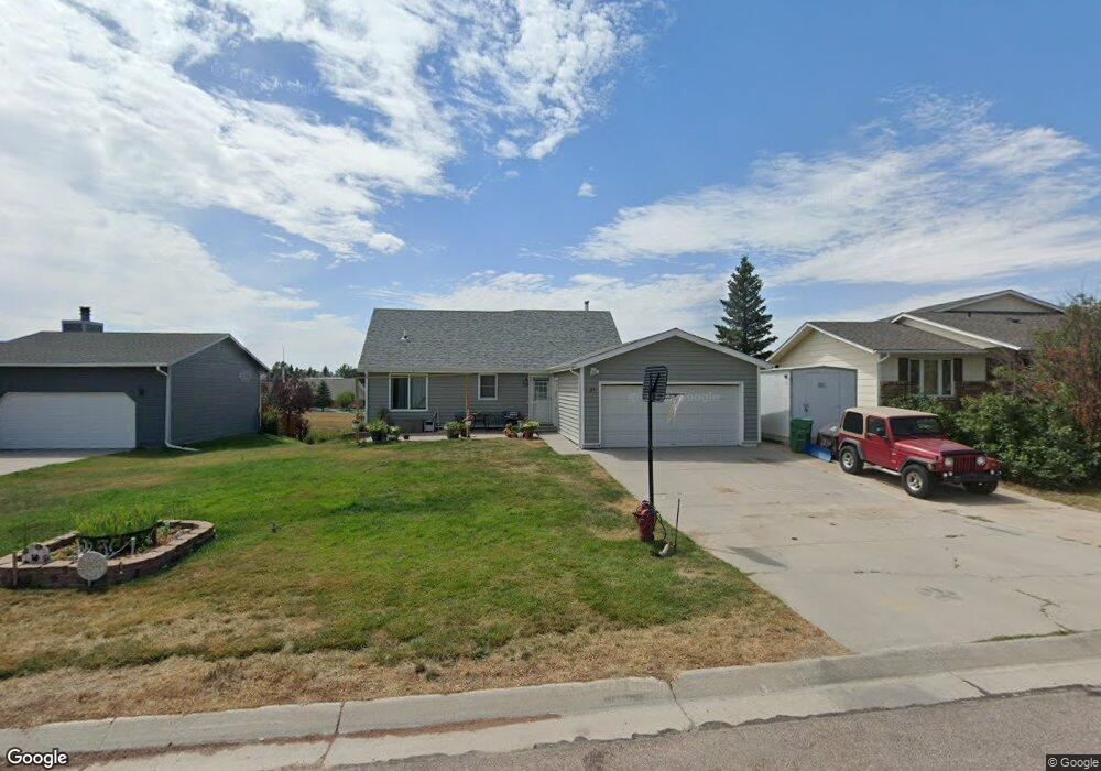
405 Range Cir Wright, WY 82732
Estimated Value: $230,613 - $243,000
4
Beds
2
Baths
1,265
Sq Ft
$189/Sq Ft
Est. Value
About This Home
This home is located at 405 Range Cir, Wright, WY 82732 and is currently estimated at $239,153, approximately $189 per square foot. 405 Range Cir is a home with nearby schools including Westwood High School, Pronghorn Elementary School, and Sage Valley Junior High School.
Ownership History
Date
Name
Owned For
Owner Type
Purchase Details
Closed on
Jun 22, 2010
Sold by
Humiston Robert R and Humiston Darl J
Bought by
Humiston Leroy W
Current Estimated Value
Home Financials for this Owner
Home Financials are based on the most recent Mortgage that was taken out on this home.
Original Mortgage
$180,074
Interest Rate
4.87%
Mortgage Type
FHA
Create a Home Valuation Report for This Property
The Home Valuation Report is an in-depth analysis detailing your home's value as well as a comparison with similar homes in the area
Purchase History
| Date | Buyer | Sale Price | Title Company |
|---|---|---|---|
| Humiston Leroy W | -- | None Available |
Source: Public Records
Mortgage History
| Date | Status | Borrower | Loan Amount |
|---|---|---|---|
| Closed | Humiston Leroy W | $180,074 |
Source: Public Records
Tax History
| Year | Tax Paid | Tax Assessment Tax Assessment Total Assessment is a certain percentage of the fair market value that is determined by local assessors to be the total taxable value of land and additions on the property. | Land | Improvement |
|---|---|---|---|---|
| 2025 | $1,414 | $14,086 | $2,895 | $11,191 |
| 2024 | $14 | $18,059 | $3,712 | $14,347 |
| 2023 | $1,360 | $17,357 | $3,284 | $14,073 |
| 2022 | $1,143 | $14,553 | $2,952 | $11,601 |
| 2021 | $1,021 | $13,399 | $2,952 | $10,447 |
| 2020 | $1,029 | $13,533 | $2,952 | $10,581 |
| 2019 | $1,021 | $13,447 | $2,952 | $10,495 |
| 2018 | $1,066 | $14,099 | $2,952 | $11,147 |
| 2017 | $1,111 | $14,718 | $2,998 | $11,720 |
| 2016 | $1,253 | $16,580 | $2,998 | $13,582 |
| 2015 | -- | $15,092 | $2,998 | $12,094 |
| 2014 | -- | $14,797 | $2,998 | $11,799 |
Source: Public Records
Map
Nearby Homes
- 412 Range Cir
- 431 Sundance Cir
- 402
- 427 Sand Creek Cir -
- 307 Bozeman Way
- 306 Willow Creek Dr
- 310 & 312 Charcoal Ct
- 559 Hay Creek Rd
- 1 Levi Rd
- 10 Levi Rd
- 28 Cowboy Way
- 120 Noonan Rd
- Lot 6 Moonshiner Ln
- 0 Highway 59 S Unit 25-2821
- Tbd Sky Dog Rd
- 5108 Wyoming 450
- 8969 State Highway 59 S
- TBD Shiplap Spur