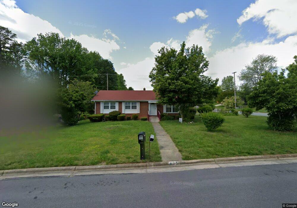
405 Runyon Dr High Point, NC 27260
Greater High Point NeighborhoodEstimated Value: $177,000 - $227,000
3
Beds
2
Baths
1,364
Sq Ft
$150/Sq Ft
Est. Value
About This Home
This home is located at 405 Runyon Dr, High Point, NC 27260 and is currently estimated at $204,326, approximately $149 per square foot. 405 Runyon Dr is a home located in Guilford County with nearby schools including Jamestown Elementary School, Southwest Guilford Middle School, and Southwest Guilford High School.
Ownership History
Date
Name
Owned For
Owner Type
Purchase Details
Closed on
Nov 24, 2023
Sold by
Luxlane Inc
Bought by
Parsons Evelyn G
Current Estimated Value
Purchase Details
Closed on
Nov 16, 2023
Sold by
Mcneil Jeffery Michael
Bought by
Luxlane Inc
Purchase Details
Closed on
Dec 5, 2022
Sold by
Mcneil Jeffery Michael
Bought by
Luxlane Inc
Purchase Details
Closed on
Oct 20, 2021
Sold by
Ingram Bobby Damon and Ingram Mikeshia Cherese
Bought by
Mcneil Jeffrey Michael
Purchase Details
Closed on
Oct 12, 2017
Sold by
Ingram Gloria Y
Bought by
Ingram Bobby Damon
Create a Home Valuation Report for This Property
The Home Valuation Report is an in-depth analysis detailing your home's value as well as a comparison with similar homes in the area
Home Values in the Area
Average Home Value in this Area
Purchase History
| Date | Buyer | Sale Price | Title Company |
|---|---|---|---|
| Parsons Evelyn G | $157,000 | None Listed On Document | |
| Luxlane Inc | -- | None Listed On Document | |
| Luxlane Inc | -- | -- | |
| Mcneil Jeffrey Michael | $5,000 | None Available | |
| Ingram Bobby Damon | -- | Chicago Title Insurance Comp | |
| Ingram Gloria Y | -- | Chicago Title Insurance Comp |
Source: Public Records
Tax History
| Year | Tax Paid | Tax Assessment Tax Assessment Total Assessment is a certain percentage of the fair market value that is determined by local assessors to be the total taxable value of land and additions on the property. | Land | Improvement |
|---|---|---|---|---|
| 2025 | $1,881 | $136,500 | $25,000 | $111,500 |
| 2024 | $1,881 | $136,500 | $25,000 | $111,500 |
| 2023 | $1,881 | $136,500 | $25,000 | $111,500 |
| 2022 | $1,840 | $136,500 | $25,000 | $111,500 |
| 2021 | $1,087 | $78,900 | $13,000 | $65,900 |
| 2020 | $1,087 | $78,900 | $13,000 | $65,900 |
| 2019 | $1,087 | $78,900 | $0 | $0 |
| 2018 | $0 | $78,900 | $0 | $0 |
| 2017 | $1,082 | $78,900 | $0 | $0 |
| 2016 | $1,217 | $86,800 | $0 | $0 |
| 2015 | $1,224 | $86,800 | $0 | $0 |
| 2014 | $1,245 | $86,800 | $0 | $0 |
Source: Public Records
Map
Nearby Homes
- 601 Runyon Dr
- 1514 Kingsway Dr
- 1456 London Dr
- 1451 Finsbury Ln
- 600 Hendrix St
- 615 Hendrix St
- 735 Hendrix St
- 737 Hendrix St
- 206 Paramount St
- 2305 Delaware Place
- 404 Hickory Chapel Rd
- 211 Spencer St
- 1005 Gordon St
- 1007 Gordon St
- 509 Valleybrook Dr
- 2209 Gable Way
- 627 Spring Garden Cir
- 507 Valleybrook Dr
- 1227 Greensboro Rd
- 1707 Brockett Ave
Your Personal Tour Guide
Ask me questions while you tour the home.