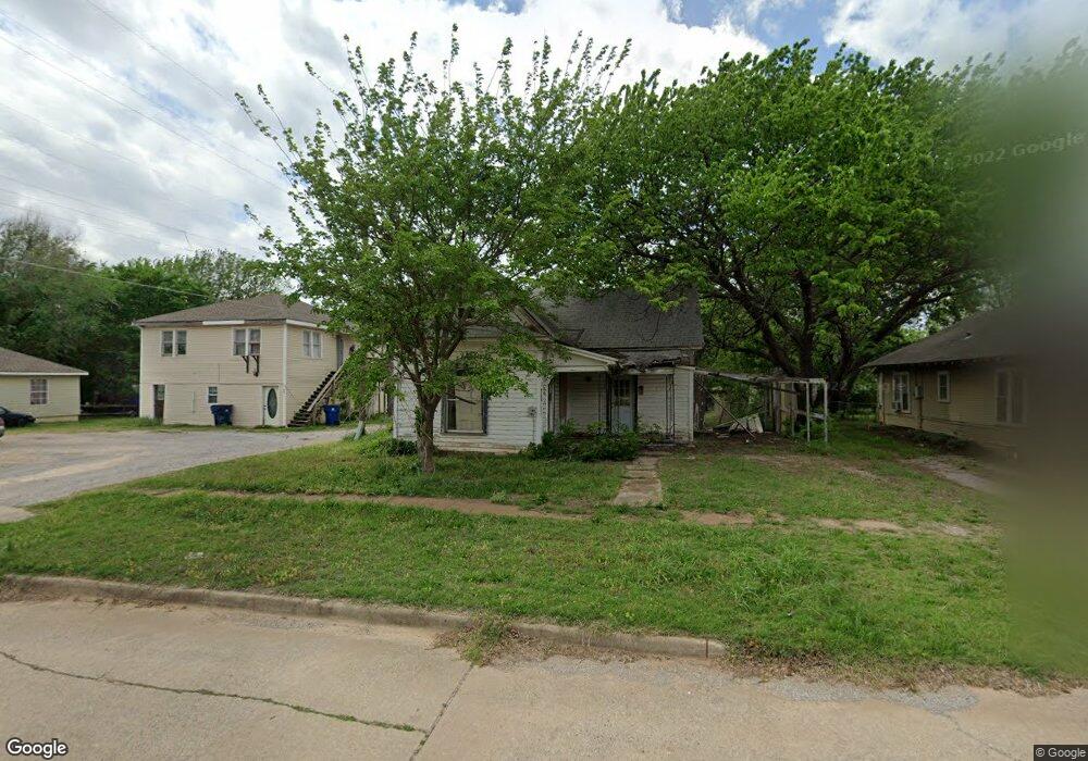
405 S 11th St Duncan, OK 73533
Estimated Value: $59,000 - $71,000
3
Beds
1
Bath
1,546
Sq Ft
$42/Sq Ft
Est. Value
About This Home
This home is located at 405 S 11th St, Duncan, OK 73533 and is currently estimated at $65,468, approximately $42 per square foot. 405 S 11th St is a home located in Stephens County with nearby schools including Emerson Elementary School, Duncan Middle School, and Duncan High School.
Ownership History
Date
Name
Owned For
Owner Type
Purchase Details
Closed on
Oct 5, 2018
Sold by
Phillips Catrina Denise
Bought by
Layne Roy
Current Estimated Value
Purchase Details
Closed on
Jun 24, 2015
Sold by
Phillips Mitchell Alan
Bought by
Phillips Catrina Denise
Purchase Details
Closed on
Mar 28, 2014
Sold by
Rice Scott L and Rice Scott
Bought by
Phillips Mitchell and Campiche Catrina
Purchase Details
Closed on
Jul 11, 2011
Sold by
Davoy Sheri
Bought by
Rice Scott L and Rice Lisa L
Purchase Details
Closed on
Aug 10, 2007
Sold by
Davouit Mdine and Davouit Sheri
Bought by
Davouit Sheri
Create a Home Valuation Report for This Property
The Home Valuation Report is an in-depth analysis detailing your home's value as well as a comparison with similar homes in the area
Purchase History
| Date | Buyer | Sale Price | Title Company |
|---|---|---|---|
| Layne Roy | $1,000 | None Available | |
| Phillips Catrina Denise | -- | None Available | |
| Phillips Mitchell | $5,000 | None Available | |
| Rice Scott L | $60,000 | None Available | |
| Davouit Sheri | -- | None Available |
Source: Public Records
Tax History
| Year | Tax Paid | Tax Assessment Tax Assessment Total Assessment is a certain percentage of the fair market value that is determined by local assessors to be the total taxable value of land and additions on the property. | Land | Improvement |
|---|---|---|---|---|
| 2025 | $43 | $510 | $363 | $147 |
| 2024 | $39 | $463 | $363 | $100 |
| 2023 | $39 | $463 | $363 | $100 |
| 2022 | $36 | $441 | $363 | $78 |
| 2021 | $35 | $420 | $363 | $57 |
| 2020 | $33 | $381 | $363 | $18 |
| 2019 | $31 | $363 | $363 | $0 |
| 2018 | $54 | $602 | $363 | $239 |
| 2017 | $52 | $602 | $363 | $239 |
| 2016 | $60 | $705 | $363 | $342 |
| 2015 | $273 | $705 | $363 | $342 |
| 2014 | $273 | $3,114 | $440 | $2,674 |
Source: Public Records
Map
Nearby Homes
- 305 S 12th St
- 507 S 13th St
- 711 S 12th St
- 1240 S 9th St
- 708 W Pecan Ave
- 713 W Elm Ave
- 0 W Mulberry Ave
- 1109 W Stephens Ave
- 1009 W Duncan Ave
- 1203 W Walnut Ave
- 451 S 11th St
- 27 N 14th St
- 0 Alaska Unit 2602709
- 1106 W Ash Ave
- 1114 S 10th St
- 1314 W Beech Ave
- 1105 W Beech Ave
- 512 W Oak Ave
- 1309 W Beech Ave
- 809 W Beech Ave
- 403 S 11th St
- 407 S 11th St
- 1106 W Pecan Ave
- 401 S 11th St
- 1014 W Pecan Ave
- 415 S 11th St
- 1108 W Pecan Ave
- 1109 W Mulberry Ave
- 1012 W Pecan Ave
- 417 S 11th St
- 451 451 S 11th
- 1111 W Mulberry Ave
- 1015 W Mulberry Ave
- 408 S 12th St
- 1114 W Pecan Ave
- 1008 W Pecan Ave
- 1115 W Mulberry Ave
- 1008 W Pecan Ave
- 1008 W Pecan Ave
- 313 S 11th St
Your Personal Tour Guide
Ask me questions while you tour the home.