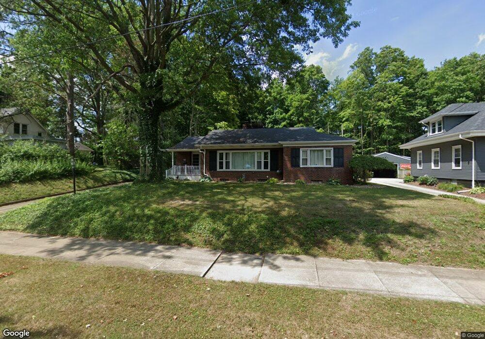
405 Vincent St Alliance, OH 44601
Estimated Value: $256,000 - $322,000
3
Beds
2
Baths
2,369
Sq Ft
$118/Sq Ft
Est. Value
About This Home
This home is located at 405 Vincent St, Alliance, OH 44601 and is currently estimated at $279,433, approximately $117 per square foot. 405 Vincent St is a home located in Stark County with nearby schools including Alliance Early Learning School, Alliance Intermediate School at Northside, and Alliance Middle School.
Ownership History
Date
Name
Owned For
Owner Type
Purchase Details
Closed on
Apr 12, 2007
Sold by
Robb Patricia
Bought by
Rohrer Roberta L
Current Estimated Value
Purchase Details
Closed on
Apr 19, 2005
Sold by
Bunn William H
Bought by
Rohrer Roberta and Robb Patricia
Home Financials for this Owner
Home Financials are based on the most recent Mortgage that was taken out on this home.
Original Mortgage
$128,000
Interest Rate
5.89%
Mortgage Type
Purchase Money Mortgage
Create a Home Valuation Report for This Property
The Home Valuation Report is an in-depth analysis detailing your home's value as well as a comparison with similar homes in the area
Home Values in the Area
Average Home Value in this Area
Purchase History
| Date | Buyer | Sale Price | Title Company |
|---|---|---|---|
| Rohrer Roberta L | $66,000 | None Available | |
| Rohrer Roberta | $160,000 | -- |
Source: Public Records
Mortgage History
| Date | Status | Borrower | Loan Amount |
|---|---|---|---|
| Previous Owner | Rohrer Roberta | $128,000 |
Source: Public Records
Tax History Compared to Growth
Tax History
| Year | Tax Paid | Tax Assessment Tax Assessment Total Assessment is a certain percentage of the fair market value that is determined by local assessors to be the total taxable value of land and additions on the property. | Land | Improvement |
|---|---|---|---|---|
| 2025 | -- | $73,050 | $21,910 | $51,140 |
| 2024 | -- | $73,050 | $21,910 | $51,140 |
| 2023 | $2,657 | $66,120 | $16,520 | $49,600 |
| 2022 | $1,337 | $66,120 | $16,520 | $49,600 |
| 2021 | $2,677 | $66,120 | $16,520 | $49,600 |
| 2020 | $2,435 | $56,180 | $14,350 | $41,830 |
| 2019 | $2,401 | $56,180 | $14,350 | $41,830 |
| 2018 | $2,412 | $56,180 | $14,350 | $41,830 |
| 2017 | $2,311 | $52,960 | $12,530 | $40,430 |
| 2016 | $2,221 | $50,480 | $10,050 | $40,430 |
| 2015 | $2,240 | $50,480 | $10,050 | $40,430 |
| 2014 | $45 | $43,870 | $8,720 | $35,150 |
| 2013 | $1,020 | $43,870 | $8,720 | $35,150 |
Source: Public Records
Map
Nearby Homes
- 1515 S Rockhill Ave
- 1475 Chatauqua Ct
- 112 E College St
- 884 W College Rd
- 203 Glamorgan St
- 1321 Parkway Blvd
- 738 Kingsway St
- 896 Parkway Blvd
- 807 S Union Ave
- 1437 S Linden Ave
- 970 Kingsway St
- 390 E College St
- 140 W Summit St
- 317 E State St
- 645 W Summit St
- 1038 Fairview Place
- 734 Parkway Blvd
- 1175 S Freedom Ave
- 725 W Summit St
- 551 South St
- 343 Vincent St
- 415 Vincent St
- 443 Vincent St
- 443 Vincent St
- 356 Vincent St
- 356 Vincent St
- 325 Vincent St
- 1460 Inwood Rd
- 318 Vincent St
- 1440 Inwood Rd
- 355 W Simpson St
- 347 W Simpson St
- 404 Overlook Dr
- 419 W Simpson St
- 253 Vincent St
- 254 Vincent St
- 1410 Inwood Rd
- 307 W Simpson St
- 1485 Inwood Rd
- 240 Vincent St