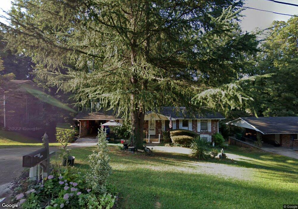
4052 Brookcrest Cir Unit 5 Decatur, GA 30032
Estimated Value: $225,000 - $255,000
3
Beds
2
Baths
1,275
Sq Ft
$186/Sq Ft
Est. Value
About This Home
This home is located at 4052 Brookcrest Cir Unit 5, Decatur, GA 30032 and is currently estimated at $236,916, approximately $185 per square foot. 4052 Brookcrest Cir Unit 5 is a home located in DeKalb County with nearby schools including Snapfinger Elementary School, Columbia Middle School, and Columbia High School.
Ownership History
Date
Name
Owned For
Owner Type
Purchase Details
Closed on
Sep 8, 2006
Sold by
St Cyr Keith and St Cyr Gwendolyn
Bought by
Logan Willie C and Turner Pamela
Current Estimated Value
Home Financials for this Owner
Home Financials are based on the most recent Mortgage that was taken out on this home.
Original Mortgage
$138,600
Outstanding Balance
$96,171
Interest Rate
9.85%
Mortgage Type
New Conventional
Estimated Equity
$140,745
Purchase Details
Closed on
Mar 28, 2003
Sold by
Fowler Patricia E
Bought by
St Cyr Gwendolyn & Keith
Home Financials for this Owner
Home Financials are based on the most recent Mortgage that was taken out on this home.
Original Mortgage
$121,125
Interest Rate
5.74%
Mortgage Type
New Conventional
Create a Home Valuation Report for This Property
The Home Valuation Report is an in-depth analysis detailing your home's value as well as a comparison with similar homes in the area
Home Values in the Area
Average Home Value in this Area
Purchase History
| Date | Buyer | Sale Price | Title Company |
|---|---|---|---|
| Logan Willie C | $134,900 | -- | |
| St Cyr Gwendolyn & Keith | $127,500 | -- |
Source: Public Records
Mortgage History
| Date | Status | Borrower | Loan Amount |
|---|---|---|---|
| Open | Logan Willie C | $138,600 | |
| Previous Owner | St Cyr Gwendolyn & Keith | $121,125 |
Source: Public Records
Tax History Compared to Growth
Tax History
| Year | Tax Paid | Tax Assessment Tax Assessment Total Assessment is a certain percentage of the fair market value that is determined by local assessors to be the total taxable value of land and additions on the property. | Land | Improvement |
|---|---|---|---|---|
| 2025 | $2,715 | $96,840 | $52,000 | $44,840 |
| 2024 | $2,484 | $84,280 | $52,000 | $32,280 |
| 2023 | $2,484 | $80,720 | $31,720 | $49,000 |
| 2022 | $1,979 | $65,720 | $16,000 | $49,720 |
| 2021 | $1,798 | $57,840 | $16,000 | $41,840 |
| 2020 | $1,684 | $52,720 | $16,000 | $36,720 |
| 2019 | $1,523 | $46,400 | $16,000 | $30,400 |
| 2018 | $1,035 | $40,360 | $4,080 | $36,280 |
| 2017 | $950 | $28,480 | $4,080 | $24,400 |
| 2016 | $727 | $22,640 | $4,080 | $18,560 |
| 2014 | $482 | $15,280 | $4,080 | $11,200 |
Source: Public Records
Map
Nearby Homes
- 3401 Tulip Dr
- 3465 Tulip Dr
- 3513 Larkspur Terrace
- 3519 Larkspur Terrace
- 3508 Sweetgum Ln
- 3651 Tulip Dr
- 3505 Sweetgum Ln
- 1485 Janmar Dr
- 3531 Tulip Dr
- 1733 Hollyhock Terrace
- 1496 Meadowlark Dr
- 1729 W Austin Rd
- 1645 Cobbs Creek Ln
- 1669 Freedom Valley
- 3842 Brookcrest Cir
- 3682 Daisy Dr
- 1674 Freedom Valley
- 3645 Aldea Dr
- 1616 Cobbs Creek Ln
- 3511 Misty Valley Rd
- 4046 Brookcrest Cir
- 4058 Brookcrest Cir
- 3597 Hillsborough Ln
- 4040 Brookcrest Cir
- 3591 Hillsborough Ln
- 3603 Hillsborough Ln
- 4068 Brookcrest Cir
- 4053 Brookcrest Cir
- 4059 Brookcrest Cir
- 4059 Brookcrest Cir
- 4059 Brookcrest Cir Unit 5
- 3583 Hillsborough Ln
- 4049 Brookcrest Cir
- 4034 Brookcrest Cir
- 4041 Brookcrest Cir
- 3398 Tulip Dr Unit 5
- 3621 Hillsborough Ln
- 4028 Brookcrest Cir
- 4035 Brookcrest Cir
- 3608 Sherrydale Ln