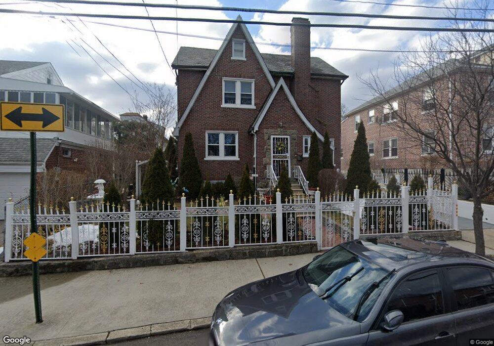
4053 Duryea Ave Bronx, NY 10466
Edenwald NeighborhoodEstimated Value: $685,709 - $756,000
Studio
--
Bath
2,294
Sq Ft
$314/Sq Ft
Est. Value
About This Home
This home is located at 4053 Duryea Ave, Bronx, NY 10466 and is currently estimated at $720,677, approximately $314 per square foot. 4053 Duryea Ave is a home located in Bronx County with nearby schools including P.S. 68 - Bronx, One World Middle School At Edenwald, and Baychester Middle School.
Ownership History
Date
Name
Owned For
Owner Type
Purchase Details
Closed on
Aug 6, 2024
Sold by
Simpson Gary A
Bought by
Lawrence Monica L and Simpson Gary A
Current Estimated Value
Purchase Details
Closed on
Aug 30, 2018
Sold by
Box Deceased Arnold and Estate Of Julia Blake
Bought by
Simpson Gary A
Home Financials for this Owner
Home Financials are based on the most recent Mortgage that was taken out on this home.
Original Mortgage
$505,672
Outstanding Balance
$440,068
Interest Rate
4.5%
Mortgage Type
New Conventional
Estimated Equity
$280,609
Create a Home Valuation Report for This Property
The Home Valuation Report is an in-depth analysis detailing your home's value as well as a comparison with similar homes in the area
Home Values in the Area
Average Home Value in this Area
Purchase History
| Date | Buyer | Sale Price | Title Company |
|---|---|---|---|
| Lawrence Monica L | -- | -- | |
| Simpson Gary A | $515,000 | -- | |
| Simpson Gary A | $515,000 | -- |
Source: Public Records
Mortgage History
| Date | Status | Borrower | Loan Amount |
|---|---|---|---|
| Open | Simpson Gary A | $505,672 | |
| Closed | Simpson Gary A | $505,672 |
Source: Public Records
Tax History
| Year | Tax Paid | Tax Assessment Tax Assessment Total Assessment is a certain percentage of the fair market value that is determined by local assessors to be the total taxable value of land and additions on the property. | Land | Improvement |
|---|---|---|---|---|
| 2025 | $7,815 | $41,246 | $9,310 | $31,936 |
| 2024 | $7,815 | $38,911 | $8,829 | $30,082 |
| 2023 | $7,455 | $36,709 | $9,124 | $27,585 |
| 2022 | $6,914 | $40,200 | $10,320 | $29,880 |
| 2021 | $6,577 | $42,180 | $10,320 | $31,860 |
| 2020 | $6,617 | $37,080 | $10,320 | $26,760 |
| 2019 | $6,124 | $32,940 | $10,320 | $22,620 |
| 2018 | $5,577 | $30,591 | $8,888 | $21,703 |
| 2017 | $5,237 | $28,860 | $10,320 | $18,540 |
| 2016 | $2,288 | $29,100 | $10,320 | $18,780 |
| 2015 | $3,524 | $30,210 | $9,858 | $20,352 |
| 2014 | $3,524 | $28,500 | $11,160 | $17,340 |
Source: Public Records
Map
Nearby Homes
- 29 Bell Ave
- 10 Pratt Ave
- 3968 Duryea Ave
- 3964 Duryea Ave
- 3963 Duryea Ave
- 75 W Kingsbridge Rd
- 4040 Pratt Ave
- 138 W Kingsbridge Rd
- 4083 Seton Ave
- 4048 Harper Ave
- 4073 Monticello Ave
- 149 W Kingsbridge Rd
- 3924 Duryea Ave
- 3919 Pratt Ave
- 1461 E 233rd St
- 4058 Murdock Ave
- 4118 Hill Ave
- 3946 Secor Ave
- 548 S 8th Ave
- 547 S 11th Ave
- 4055 Duryea Ave
- 4055 Duryea Ave Unit 2
- 4049 Duryea Ave
- 4065 Duryea Ave
- 4045 Duryea Ave
- 4058 Amundson Ave
- 4060 Amundson Ave
- 4056 Amundson Ave
- 4068 Amundson Ave
- 4054 Duryea Ave
- 4052 Amundson Ave
- 4067 Duryea Ave
- 4070 Amundson Ave
- 4041 Duryea Ave
- 47 Duryea Ave
- 4046 Amundson Ave
- 4048 Duryea Ave
- 4074-4076 Amundson Ave
- 46 Nuvern Ave
- 4040 Amundson Ave
Your Personal Tour Guide
Ask me questions while you tour the home.