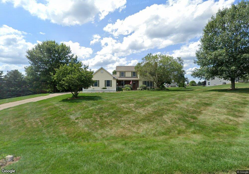
4053 Pheasant Run Wooster, OH 44691
Estimated Value: $381,983 - $458,000
3
Beds
3
Baths
2,036
Sq Ft
$202/Sq Ft
Est. Value
About This Home
This home is located at 4053 Pheasant Run, Wooster, OH 44691 and is currently estimated at $410,496, approximately $201 per square foot. 4053 Pheasant Run is a home located in Wayne County with nearby schools including Triway High School and Country Corner.
Ownership History
Date
Name
Owned For
Owner Type
Purchase Details
Closed on
Jan 20, 1999
Sold by
Evans John R
Bought by
Jennings Steven E and Jennings Wendy J
Current Estimated Value
Home Financials for this Owner
Home Financials are based on the most recent Mortgage that was taken out on this home.
Original Mortgage
$162,000
Outstanding Balance
$34,186
Interest Rate
6.76%
Mortgage Type
New Conventional
Estimated Equity
$376,310
Purchase Details
Closed on
Aug 22, 1995
Sold by
Hilltop Realty Inc
Bought by
Evans John R and Evans Jacqueline L
Create a Home Valuation Report for This Property
The Home Valuation Report is an in-depth analysis detailing your home's value as well as a comparison with similar homes in the area
Home Values in the Area
Average Home Value in this Area
Purchase History
| Date | Buyer | Sale Price | Title Company |
|---|---|---|---|
| Jennings Steven E | $180,000 | -- | |
| Evans John R | $22,500 | -- |
Source: Public Records
Mortgage History
| Date | Status | Borrower | Loan Amount |
|---|---|---|---|
| Open | Jennings Steven E | $162,000 |
Source: Public Records
Tax History
| Year | Tax Paid | Tax Assessment Tax Assessment Total Assessment is a certain percentage of the fair market value that is determined by local assessors to be the total taxable value of land and additions on the property. | Land | Improvement |
|---|---|---|---|---|
| 2024 | $4,112 | $113,200 | $20,310 | $92,890 |
| 2023 | $4,141 | $113,670 | $20,310 | $93,360 |
| 2022 | $3,151 | $77,870 | $14,510 | $63,360 |
| 2021 | $2,823 | $74,690 | $14,510 | $60,180 |
| 2020 | $2,857 | $74,690 | $14,510 | $60,180 |
| 2019 | $2,542 | $64,090 | $12,920 | $51,170 |
| 2018 | $2,588 | $64,090 | $12,920 | $51,170 |
| 2017 | $2,513 | $64,090 | $12,920 | $51,170 |
| 2016 | $2,506 | $61,620 | $12,420 | $49,200 |
| 2015 | $2,449 | $61,620 | $12,420 | $49,200 |
| 2014 | $2,451 | $61,620 | $12,420 | $49,200 |
| 2013 | $2,693 | $65,070 | $13,050 | $52,020 |
Source: Public Records
Map
Nearby Homes
- 2717 Timothy Place
- 2820 Indian Run
- 5001 S Jefferson Rd
- 140 Ohio St
- 5 E Melrose Unit 5
- 3065 Dover Rd
- 227 N Walnut St
- 606 E Henry St
- 3419 Fredericksburg Rd
- 758 Western Dr
- 223 E Larwill St
- 230 Clark Ave
- 423 N Market St
- 419 Nold Ave
- 534 N Buckeye St
- 331 Derr Ave
- 801 & 803 Colony Ct
- 134 E Bowman St Unit 1/2
- 851 Park Blvd
- 1047 Ashwood Dr
- 4085 Pheasant Run
- 4019 Pheasant Run
- 4054 Mallard Way
- 3949 Pheasant Run
- 4090 Mallard Way
- 4036 Pheasant Run
- 4072 Pheasant Run
- 4000 Pheasant Run
- 4020 Mallard Way
- 4135 Pheasant Run
- 4400 Pheasant Run
- 4300 Pheasant Run
- 0 Pheasant Run
- 3950 Mallard Way
- 4130 Mallard Way
- 3919 Pheasant Run
- 3989 Batdorf Rd
- 4059 Batdorf Rd
- 3970 Pheasant Run
- 4140 Pheasant Run
Your Personal Tour Guide
Ask me questions while you tour the home.