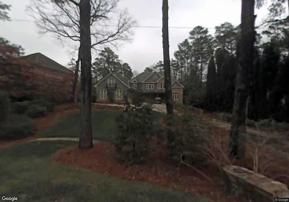
4053 Randall Farm Rd SE Atlanta, GA 30339
Estimated Value: $2,210,964 - $2,438,000
4
Beds
7
Baths
7,690
Sq Ft
$303/Sq Ft
Est. Value
About This Home
This home is located at 4053 Randall Farm Rd SE, Atlanta, GA 30339 and is currently estimated at $2,327,321, approximately $302 per square foot. 4053 Randall Farm Rd SE is a home located in Cobb County with nearby schools including Teasley Elementary School, Campbell Middle School, and Campbell High School.
Ownership History
Date
Name
Owned For
Owner Type
Purchase Details
Closed on
Jul 9, 2004
Sold by
O'Sullivan Matthew C
Bought by
Osullivan Matthew C
Current Estimated Value
Home Financials for this Owner
Home Financials are based on the most recent Mortgage that was taken out on this home.
Original Mortgage
$1,100,000
Outstanding Balance
$230,188
Interest Rate
3.63%
Mortgage Type
New Conventional
Estimated Equity
$2,097,133
Purchase Details
Closed on
Jun 5, 2001
Sold by
Vinguard Properties Inc
Bought by
Merrill W Harrison
Home Financials for this Owner
Home Financials are based on the most recent Mortgage that was taken out on this home.
Original Mortgage
$479,500
Interest Rate
7.11%
Mortgage Type
New Conventional
Create a Home Valuation Report for This Property
The Home Valuation Report is an in-depth analysis detailing your home's value as well as a comparison with similar homes in the area
Home Values in the Area
Average Home Value in this Area
Purchase History
| Date | Buyer | Sale Price | Title Company |
|---|---|---|---|
| Osullivan Matthew C | -- | -- | |
| Merrill W Harrison | -- | -- |
Source: Public Records
Mortgage History
| Date | Status | Borrower | Loan Amount |
|---|---|---|---|
| Open | Osullivan Matthew C | $1,100,000 | |
| Previous Owner | Merrill W Harrison | $479,500 |
Source: Public Records
Tax History Compared to Growth
Tax History
| Year | Tax Paid | Tax Assessment Tax Assessment Total Assessment is a certain percentage of the fair market value that is determined by local assessors to be the total taxable value of land and additions on the property. | Land | Improvement |
|---|---|---|---|---|
| 2025 | $6,566 | $759,372 | $144,500 | $614,872 |
| 2024 | $6,581 | $759,372 | $144,500 | $614,872 |
| 2023 | $6,215 | $705,840 | $144,500 | $561,340 |
| 2022 | $6,406 | $700,740 | $139,400 | $561,340 |
| 2021 | $6,272 | $655,964 | $136,000 | $519,964 |
| 2020 | $5,971 | $555,073 | $122,400 | $432,673 |
| 2019 | $6,155 | $616,748 | $136,000 | $480,748 |
| 2018 | $6,155 | $616,748 | $136,000 | $480,748 |
| 2017 | $5,318 | $606,376 | $136,000 | $470,376 |
| 2016 | $5,328 | $606,376 | $136,000 | $470,376 |
| 2015 | $15,306 | $519,556 | $125,800 | $393,756 |
| 2014 | $14,935 | $502,696 | $0 | $0 |
Source: Public Records
Map
Nearby Homes
- 2872 Bainbridge Way SE
- 3773 Randall Rd SE
- 2966 Waverly Ct SE
- 3099 Farmington Dr SE
- 3191 Lemons Ridge
- 4101 Brookview Dr SE
- 3680 Tanglewood Dr SE
- 3201 Teton Dr SE
- 4220 Paces Ferry Rd SE
- 3200 Farmington
- 3772 Paces Ferry West SE
- 4395 Woodland Brook Dr SE
- 2400 Cumberland Pkwy SE Unit 614
- 2400 Cumberland Pkwy SE Unit 213
- 2400 Cumberland Pkwy SE Unit 611
- 2400 Cumberland Pkwy SE Unit 411
- 2400 Cumberland Pkwy SE Unit 613
- 2792 Lansdowne Ln SE
- 3600 Tanglewood Dr SE
- 4031 Randall Farm Rd SE
- 4055 Randall Farm Rd SE
- 4029 Randall Farm Rd SE
- 4056 Keswick Dr SE
- 4058 Keswick Dr SE
- 4057 Randall Farm Rd SE
- 4027 Randall Farm Rd SE
- 4054 Keswick Dr SE
- 2982 Paces Lake Dr SE
- 4050 Randall Farm Rd SE
- 2968 Paces Lake Dr SE Unit 1
- 4063 Randall Farm Rd SE
- 3019 Paces Lake Dr SE
- 4060 Keswick Dr SE
- 4060 Randall Farm Rd SE
- 4052 Keswick Dr SE
- 4011 Randall Farm Rd SE
- 2956 Paces Lake Dr SE
- 4062 Keswick Dr SE
- 4080 Randall Farm Rd SE