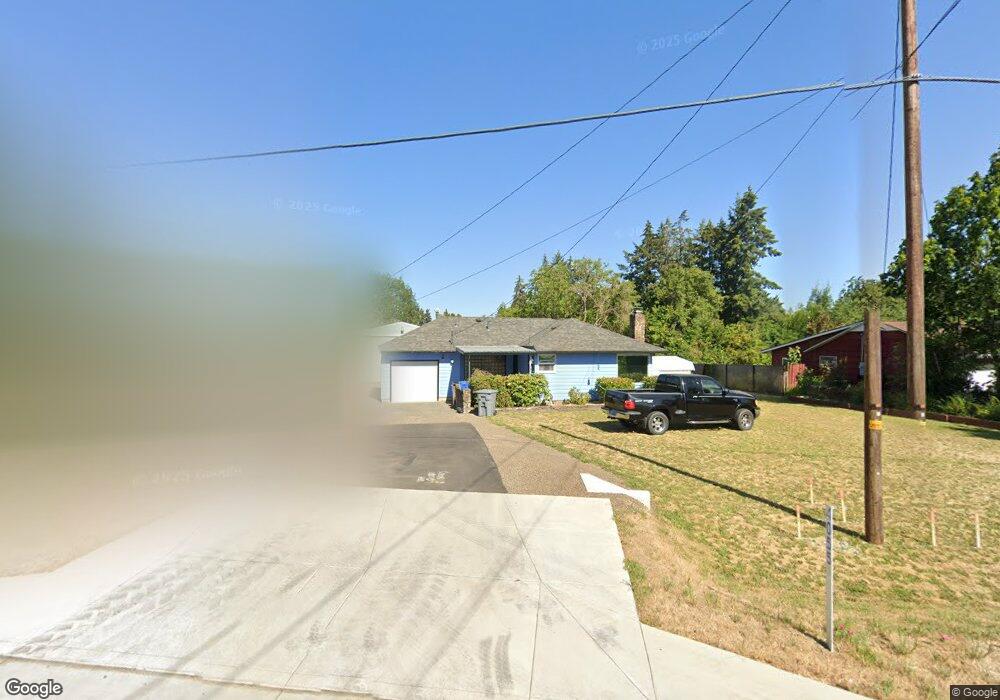
4055 NE Highway 20 Corvallis, OR 97330
Estimated Value: $369,000 - $578,000
1
Bed
1
Bath
870
Sq Ft
$498/Sq Ft
Est. Value
About This Home
This home is located at 4055 NE Highway 20, Corvallis, OR 97330 and is currently estimated at $432,867, approximately $497 per square foot. 4055 NE Highway 20 is a home located in Benton County with nearby schools including Mt. View Elementary School, Cheldelin Middle School, and Crescent Valley High School.
Ownership History
Date
Name
Owned For
Owner Type
Purchase Details
Closed on
Mar 1, 2022
Sold by
Keith Jegglie
Bought by
Department Of Transportation
Current Estimated Value
Purchase Details
Closed on
Aug 27, 2018
Sold by
Franklin Darrel E and Franklin Judith A
Bought by
Jegglie Keith and Morrison Teri
Home Financials for this Owner
Home Financials are based on the most recent Mortgage that was taken out on this home.
Original Mortgage
$174,400
Interest Rate
4.5%
Mortgage Type
New Conventional
Purchase Details
Closed on
Nov 13, 2014
Sold by
Carl D Franklin Living Trust
Bought by
Franklin Darrel E and Franklin Judith A
Purchase Details
Closed on
May 15, 2008
Sold by
Franklin Carl D
Bought by
Carl D Franklin Living Trust
Purchase Details
Closed on
Mar 19, 2008
Sold by
Franklin Rita Ruth
Bought by
Franklin Carl Dean
Create a Home Valuation Report for This Property
The Home Valuation Report is an in-depth analysis detailing your home's value as well as a comparison with similar homes in the area
Home Values in the Area
Average Home Value in this Area
Purchase History
| Date | Buyer | Sale Price | Title Company |
|---|---|---|---|
| Department Of Transportation | $15,600 | None Listed On Document | |
| Jegglie Keith | $218,000 | First American Title | |
| Franklin Darrel E | -- | First American Title | |
| Franklin Darrel E | -- | None Available | |
| Carl D Franklin Living Trust | -- | None Available | |
| Franklin Carl Dean | -- | None Available |
Source: Public Records
Mortgage History
| Date | Status | Borrower | Loan Amount |
|---|---|---|---|
| Previous Owner | Jegglie Keith | $174,400 |
Source: Public Records
Tax History Compared to Growth
Tax History
| Year | Tax Paid | Tax Assessment Tax Assessment Total Assessment is a certain percentage of the fair market value that is determined by local assessors to be the total taxable value of land and additions on the property. | Land | Improvement |
|---|---|---|---|---|
| 2024 | $2,810 | $185,500 | -- | -- |
| 2023 | $2,646 | $180,097 | $0 | $0 |
| 2022 | $2,568 | $174,851 | $0 | $0 |
| 2021 | $2,550 | $174,497 | $0 | $0 |
| 2020 | $2,531 | $169,415 | $0 | $0 |
| 2019 | $2,319 | $164,481 | $0 | $0 |
| 2018 | $2,337 | $159,690 | $0 | $0 |
| 2017 | $2,103 | $155,039 | $0 | $0 |
| 2016 | $2,069 | $150,523 | $0 | $0 |
| 2015 | $2,072 | $146,139 | $0 | $0 |
| 2014 | $2,034 | $141,883 | $0 | $0 |
| 2012 | -- | $133,738 | $0 | $0 |
Source: Public Records
Map
Nearby Homes
- 2635 NE Seavy Place
- 651 NE Sherwood Way
- 475 NE Conifer Blvd
- 4880 NE Highway 20
- 277 NE Conifer Blvd Unit 24 Bl
- 2601 NE Jack London St Unit 71 St
- 311 NE Plymouth Cir
- Lot 601 NE Circle Blvd
- 325 NW Autumn Place
- 390 NW Conifer Blvd
- 5055 NE Elliott Cir
- 5055 NE Elliott Cir Unit 35 Cir
- 755 NE Circle Blvd
- 755 NE Circle Blvd Unit 43
- 800 (next to) NE Circle Bl
- 2622 NW Satinwood St
- * NW Wild Rose Dr
- Lot 6 NW Wild Rose Dr
- 2655 NW Highland (#99) Dr Unit 99
- 2655 NW Highland (#13) Dr Unit 13
- 4075 NE Highway 20
- 4035 NE Highway 20
- 4038 NE Fair Acres Dr
- 4025 NE Highway 20
- 4040 NE Fair Acres Dr
- 4050 NE Fair Acres Dr
- 4070 NE Highway 20
- 4140 NE Highway 20
- 4100 NE Fair Acres Dr
- 4110 NE Fair Acres Dr
- 4150 NE Highway 20
- 2645 NE Pilkington Ave
- 4160 NE Highway 20
- 4148 NE Asbahr Place
- 2675 NE Pilkington Ave
- 4130 NE Fair Acres Dr
- 4041-4043 NE Fair Acres
- 4130 NE Highway 20
- 4061 NE Fair Acres (- 4063) Dr
- 4061 NE Fair Acres (-4063) Dr