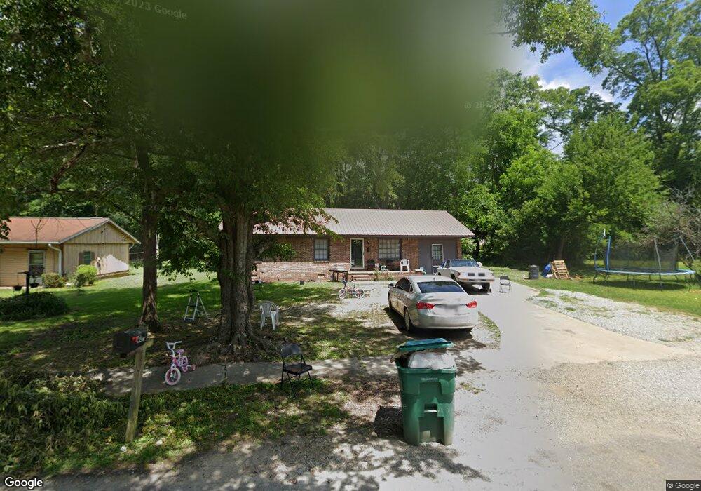
406 Barnes St Union Point, GA 30669
Estimated Value: $140,000 - $185,000
3
Beds
2
Baths
1,050
Sq Ft
$156/Sq Ft
Est. Value
About This Home
This home is located at 406 Barnes St, Union Point, GA 30669 and is currently estimated at $163,393, approximately $155 per square foot. 406 Barnes St is a home located in Greene County with nearby schools including Greene County High School.
Ownership History
Date
Name
Owned For
Owner Type
Purchase Details
Closed on
Apr 16, 2021
Sold by
Hill Jarius
Bought by
Positive Outlook Investments Llc
Current Estimated Value
Purchase Details
Closed on
Dec 23, 2020
Sold by
Johnson Real Estate Properties Llc
Bought by
Hill Jarius
Purchase Details
Closed on
Jun 6, 2017
Bought by
Johnson Real Estate Properties
Purchase Details
Closed on
May 14, 1991
Sold by
Callaway Altonia T
Bought by
Callaway Allyson
Purchase Details
Closed on
Jan 1, 1971
Bought by
Callaway Altonia T
Create a Home Valuation Report for This Property
The Home Valuation Report is an in-depth analysis detailing your home's value as well as a comparison with similar homes in the area
Home Values in the Area
Average Home Value in this Area
Purchase History
| Date | Buyer | Sale Price | Title Company |
|---|---|---|---|
| Positive Outlook Investments Llc | -- | -- | |
| Hill Jarius | $110,000 | -- | |
| Johnson Real Estate Properties | -- | -- | |
| Callaway Allyson | -- | -- | |
| Callaway Altonia T | -- | -- |
Source: Public Records
Tax History Compared to Growth
Tax History
| Year | Tax Paid | Tax Assessment Tax Assessment Total Assessment is a certain percentage of the fair market value that is determined by local assessors to be the total taxable value of land and additions on the property. | Land | Improvement |
|---|---|---|---|---|
| 2024 | $1,096 | $39,120 | $2,520 | $36,600 |
| 2023 | $796 | $37,080 | $2,520 | $34,560 |
| 2022 | $604 | $25,120 | $2,520 | $22,600 |
| 2021 | $403 | $22,480 | $2,520 | $19,960 |
| 2020 | $455 | $14,400 | $2,680 | $11,720 |
| 2019 | $468 | $14,400 | $2,680 | $11,720 |
| 2018 | $329 | $14,400 | $2,680 | $11,720 |
| 2017 | $420 | $14,431 | $2,700 | $11,731 |
| 2016 | $430 | $14,670 | $2,700 | $11,970 |
| 2015 | $399 | $14,670 | $2,700 | $11,970 |
| 2014 | $412 | $14,967 | $2,700 | $12,267 |
Source: Public Records
Map
Nearby Homes
- 324 N Rhodes St
- 215 Hunter St
- 0 Woodland Ct Unit 10543600
- 202 Veazey St
- 0 S Rhodes St Unit 10618488
- 0 Washington Hwy Unit 7276060
- 112 Hendry St
- 1041 Hillcrest Dr
- 1860 Washington Hwy
- 1241 Old Siloam Rd
- 1581 Highway 77 S Hwy
- 1581 Highway 77 S
- 5401 Union Point Hwy
- 1201 Buffalo Lick Rd
- 0 Buffalo Lick Rd Unit 10551234
- 0 Buffalo Lick Rd Unit 10551325
- 1251 Adams Rd
- 0 Old Union Point Rd Unit 1 10557753
- 1251 Brick House Rd
- 1251 Brickhouse Rd
- 404 Barnes St
- 408 Barnes St
- 910 Crawfordville Rd
- 912 Crawfordville Rd
- 902 Crawfordville Rd
- 821 Park Ave
- 315 Hunter St
- 312 Barnes St
- 312 Barnes St
- 914 Crawfordville Rd
- 311 Hunter St
- 909 Crawfordville Rd
- 901 Crawfordville Rd
- 911 Crawfordville Rd
- 820 Park Ave
- 310 Barnes St
- 312 Hunter St
- 1010 Hurt St
- 814 Park Ave
- 310 Hunter St