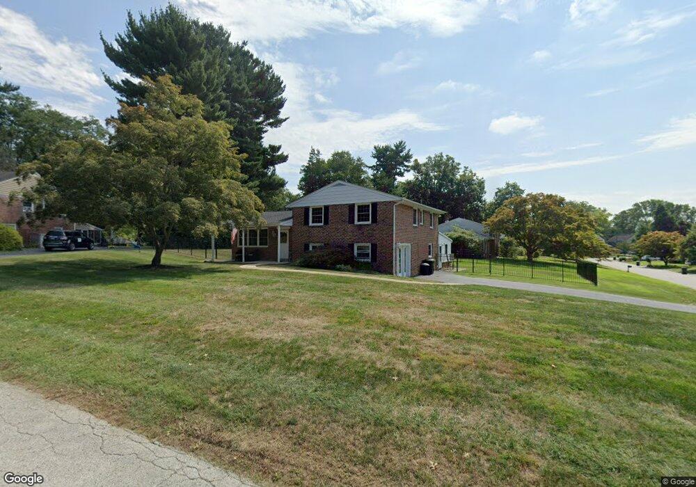
406 Burning Tree Rd Wallingford, PA 19086
Estimated Value: $573,000 - $683,000
3
Beds
3
Baths
2,161
Sq Ft
$290/Sq Ft
Est. Value
About This Home
This home is located at 406 Burning Tree Rd, Wallingford, PA 19086 and is currently estimated at $627,173, approximately $290 per square foot. 406 Burning Tree Rd is a home located in Delaware County with nearby schools including Nether Providence El School, Strath Haven Middle School, and Strath Haven High School.
Ownership History
Date
Name
Owned For
Owner Type
Purchase Details
Closed on
Dec 12, 1996
Sold by
Petrosemolo Arthur E and Petrosemolo Christine S
Bought by
Pierangeli Paul J and Pierangeli Daneen M
Current Estimated Value
Home Financials for this Owner
Home Financials are based on the most recent Mortgage that was taken out on this home.
Original Mortgage
$141,600
Outstanding Balance
$9,875
Interest Rate
4%
Estimated Equity
$617,298
Create a Home Valuation Report for This Property
The Home Valuation Report is an in-depth analysis detailing your home's value as well as a comparison with similar homes in the area
Home Values in the Area
Average Home Value in this Area
Purchase History
| Date | Buyer | Sale Price | Title Company |
|---|---|---|---|
| Pierangeli Paul J | $177,000 | -- |
Source: Public Records
Mortgage History
| Date | Status | Borrower | Loan Amount |
|---|---|---|---|
| Open | Pierangeli Paul J | $141,600 |
Source: Public Records
Tax History
| Year | Tax Paid | Tax Assessment Tax Assessment Total Assessment is a certain percentage of the fair market value that is determined by local assessors to be the total taxable value of land and additions on the property. | Land | Improvement |
|---|---|---|---|---|
| 2025 | $11,867 | $332,840 | $111,250 | $221,590 |
| 2024 | $11,867 | $332,840 | $111,250 | $221,590 |
| 2023 | $11,402 | $332,840 | $111,250 | $221,590 |
| 2022 | $11,160 | $332,840 | $111,250 | $221,590 |
| 2021 | $18,130 | $332,840 | $111,250 | $221,590 |
| 2020 | $9,816 | $169,380 | $60,550 | $108,830 |
| 2019 | $9,545 | $169,380 | $60,550 | $108,830 |
| 2018 | $9,360 | $169,380 | $0 | $0 |
| 2017 | $9,102 | $169,380 | $0 | $0 |
| 2016 | $930 | $169,380 | $0 | $0 |
| 2015 | $949 | $169,380 | $0 | $0 |
| 2014 | $930 | $169,380 | $0 | $0 |
Source: Public Records
Map
Nearby Homes
- 209 Willow Rd
- 512 Media Pkwy
- 403 Trenton Ct
- 709 Pennsylvania Ave
- 404 Nashville Ct
- 703 Dover Ct
- 787 Pennsylvania Ave
- 820B Putnam Blvd Unit 49B
- 832B Putnam Blvd Unit 55B
- 844A Putnam Blvd Unit 61A
- 214-216 Beech Rd
- 856A Putnam Blvd Unit 67A
- 856 Putnam Blvd Unit B
- 6 Cedar Rd
- 357 Saybrook Ln Unit 158
- 102 Harvey Rd Unit 1BMP
- 102 Harvey Rd Unit 1AP
- 102 Harvey Rd Unit 1PS
- 102 Harvey Rd Unit 1BP
- 203 Chestnut Pkwy
- 520 Georgetown Rd
- 404 Burning Tree Rd
- 407 Burning Tree Rd
- 521 Georgetown Rd
- 522 Georgetown Rd
- 519 Georgetown Rd
- 402 Burning Tree Dr
- 523 Georgetown Rd
- 402 Burning Tree Rd
- 517 Georgetown Rd
- 514 Georgetown Rd
- 621 Morris Ln
- 525 Georgetown Rd
- 617 Morris Ln
- 615 Morris Ln
- 619 Morris Ln
- 623 Morris Ln
- 613 Morris Ln
- 405 Burning Tree Rd
- 602 Creekside Rd
Your Personal Tour Guide
Ask me questions while you tour the home.