Estimated Value: $279,649 - $366,000
--
Bed
--
Bath
1,510
Sq Ft
$220/Sq Ft
Est. Value
About This Home
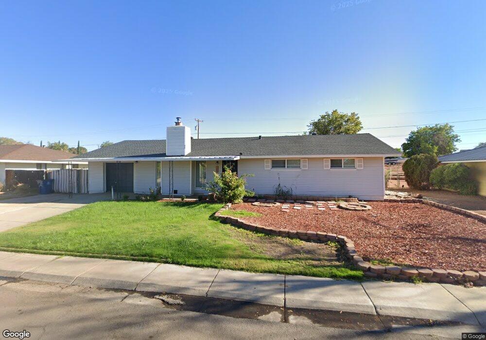
This home is located at 406 Date St, Page, AZ 86040 and is currently estimated at $331,912, approximately $219 per square foot. 406 Date St is a home with nearby schools including Desert View Elementary Intermediate School, Lake View Elementary Primary School, and Page Middle School.
Ownership History
Date
Name
Owned For
Owner Type
Purchase Details
Closed on
Sep 13, 2023
Sold by
Washburn Lydia K
Bought by
Washburn Marc Manson and Washburn Holly Marie
Current Estimated Value
Purchase Details
Closed on
Nov 29, 2001
Sold by
Washburn Marcian Manson and Washburn Holly Marie Tessendorf
Bought by
Washburn Lydia K
Purchase Details
Closed on
Nov 27, 2001
Sold by
Bank One Trust Company
Bought by
Washburn Lydia K
Purchase Details
Closed on
Aug 18, 2000
Sold by
Bank One Trust Company Na
Bought by
Washburn Marcian Manson and Washburn Holly Marie Tessendorf
Create a Home Valuation Report for This Property
The Home Valuation Report is an in-depth analysis detailing your home's value as well as a comparison with similar homes in the area
Home Values in the Area
Average Home Value in this Area
Purchase History
| Date | Buyer | Sale Price | Title Company |
|---|---|---|---|
| Washburn Marc Manson | -- | None Listed On Document | |
| Washburn Lydia K | -- | -- | |
| Washburn Lydia K | -- | -- | |
| Washburn Lydia K | -- | -- | |
| Washburn Marcian Manson | -- | -- |
Source: Public Records
Tax History
| Year | Tax Paid | Tax Assessment Tax Assessment Total Assessment is a certain percentage of the fair market value that is determined by local assessors to be the total taxable value of land and additions on the property. | Land | Improvement |
|---|---|---|---|---|
| 2025 | $1,445 | $23,507 | -- | -- |
| 2024 | $1,445 | $25,235 | -- | -- |
| 2023 | $1,845 | $21,977 | $0 | $0 |
| 2022 | $1,011 | $19,933 | $0 | $0 |
| 2021 | $1,181 | $17,333 | $0 | $0 |
| 2020 | $902 | $16,138 | $0 | $0 |
| 2019 | $868 | $15,911 | $0 | $0 |
| 2018 | $863 | $14,576 | $0 | $0 |
| 2017 | $815 | $13,968 | $0 | $0 |
| 2016 | $805 | $14,435 | $0 | $0 |
| 2015 | $821 | $14,340 | $0 | $0 |
Source: Public Records
Map
Nearby Homes
- 425 Cedar St
- 22 Sunset St Unit 22
- 134 Calle Hermosa
- 801 Oak St Unit 133
- 801 Oak St Unit 70
- 801 Oak St Unit 62
- 57 Aero Ave
- 314 Clubhouse Dr Unit 16
- 1531 Rim View Dr
- 8.35 Acres S Parcel Rainbow Dr
- 112 Schoppman Ln Unit 60
- 265 Myrtle Dr
- 451 Ticaboo Canyon Dr Unit 33
- 461 Ticaboo Canyon Dr Unit 34
- 112 Bryce Canyon Dr
- 122 Bryce Canyon Dr
- 132 Bryce Canyon Dr
- 142 Bryce Canyon Dr
- 12 Sumner Cove
- 30 Tek Ct
Your Personal Tour Guide
Ask me questions while you tour the home.