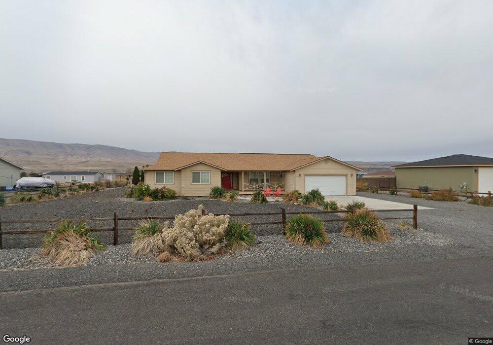
406 Davidson Blvd N Mattawa, WA 99349
Estimated Value: $540,000 - $705,000
3
Beds
2
Baths
2,021
Sq Ft
$301/Sq Ft
Est. Value
About This Home
This home is located at 406 Davidson Blvd N, Mattawa, WA 99349 and is currently estimated at $608,185, approximately $300 per square foot. 406 Davidson Blvd N is a home located in Grant County with nearby schools including Wahluke High School.
Ownership History
Date
Name
Owned For
Owner Type
Purchase Details
Closed on
May 16, 2007
Sold by
Estate Of Robert L Gant and Gant Faith P
Bought by
Marital Trust Under Article Viii Of The and Gant Faith P
Current Estimated Value
Purchase Details
Closed on
Jun 12, 2005
Sold by
Sellers Edward S and Sellers Nancy J
Bought by
Gant Robert L and Gant Faith P
Home Financials for this Owner
Home Financials are based on the most recent Mortgage that was taken out on this home.
Original Mortgage
$105,000
Interest Rate
5.72%
Mortgage Type
Purchase Money Mortgage
Purchase Details
Closed on
Jun 8, 2005
Sold by
Desert Aire Associates
Bought by
Sellers Edward and Sellers Nancy
Home Financials for this Owner
Home Financials are based on the most recent Mortgage that was taken out on this home.
Original Mortgage
$105,000
Interest Rate
5.72%
Mortgage Type
Purchase Money Mortgage
Create a Home Valuation Report for This Property
The Home Valuation Report is an in-depth analysis detailing your home's value as well as a comparison with similar homes in the area
Home Values in the Area
Average Home Value in this Area
Purchase History
| Date | Buyer | Sale Price | Title Company |
|---|---|---|---|
| Marital Trust Under Article Viii Of The | -- | None Available | |
| Gant Robert L | $185,000 | Chicago Title Ins Co | |
| Sellers Edward | $21,800 | Chicago Title Ins Co |
Source: Public Records
Mortgage History
| Date | Status | Borrower | Loan Amount |
|---|---|---|---|
| Closed | Gant Robert L | $105,000 |
Source: Public Records
Tax History Compared to Growth
Tax History
| Year | Tax Paid | Tax Assessment Tax Assessment Total Assessment is a certain percentage of the fair market value that is determined by local assessors to be the total taxable value of land and additions on the property. | Land | Improvement |
|---|---|---|---|---|
| 2025 | $4,294 | $439,594 | -- | -- |
| 2024 | $4,213 | $439,594 | $133,000 | $306,594 |
| 2023 | $3,432 | $308,185 | $55,750 | $252,435 |
| 2022 | $3,309 | $308,185 | $55,750 | $252,435 |
| 2021 | $3,205 | $308,185 | $55,750 | $252,435 |
| 2020 | $3,061 | $288,750 | $55,750 | $233,000 |
| 2019 | $2,601 | $223,105 | $30,000 | $193,105 |
| 2018 | $3,182 | $248,545 | $30,000 | $218,545 |
| 2017 | $2,352 | $195,635 | $30,000 | $165,635 |
| 2016 | $2,105 | $175,495 | $30,000 | $145,495 |
| 2013 | -- | $193,560 | $45,000 | $148,560 |
Source: Public Records
Map
Nearby Homes
- 894 Desert Aire Dr SW
- 851 Desert Aire Dr SW
- 207 Clayton Place SW
- 208 Moon River View SW
- 206 Moon River View
- 615 Sunset Blvd SW
- 910 Columbia Blvd SW
- 509B Clubhouse Way Unit A
- 101 Wren Loop
- 113 Airport Way N Unit 3
- 447 Airport Way SW
- 304 Airport Way SW
- 449 Airport Way SW
- 313 Airport Way SW
- 453 Airport Way SW
- 206 Cherry Ln W
- 204 Cherry Ln W
- 29083 Road U SW
- 412 Apple Place SW
- 227 Sunshine Cir S
- 404 Davidson Blvd N
- 408 Davidson Blvd N
- 896 Desert Aire Dr SW
- 402 Davidson Blvd SW
- 402 Davidson Blvd SW
- 894 Desert Aire Dr N
- 420 Davidson Blvd N
- 405 Davidson Blvd N
- 892 Desert Aire Dr SW
- 403 Davidson Blvd N
- 892 Desert Aire Dr N
- 900 Desert Aire Dr SW
- 407 Davidson Blvd N
- 900 Desert Aire Dr N
- 316 Davidson Blvd SW
- 313 Davidson Blvd N
- 890 Desert Aire Dr N
- 412 Davidson Blvd N
- 897 Desert Aire Dr SW
- 902 Desert Aire Dr N