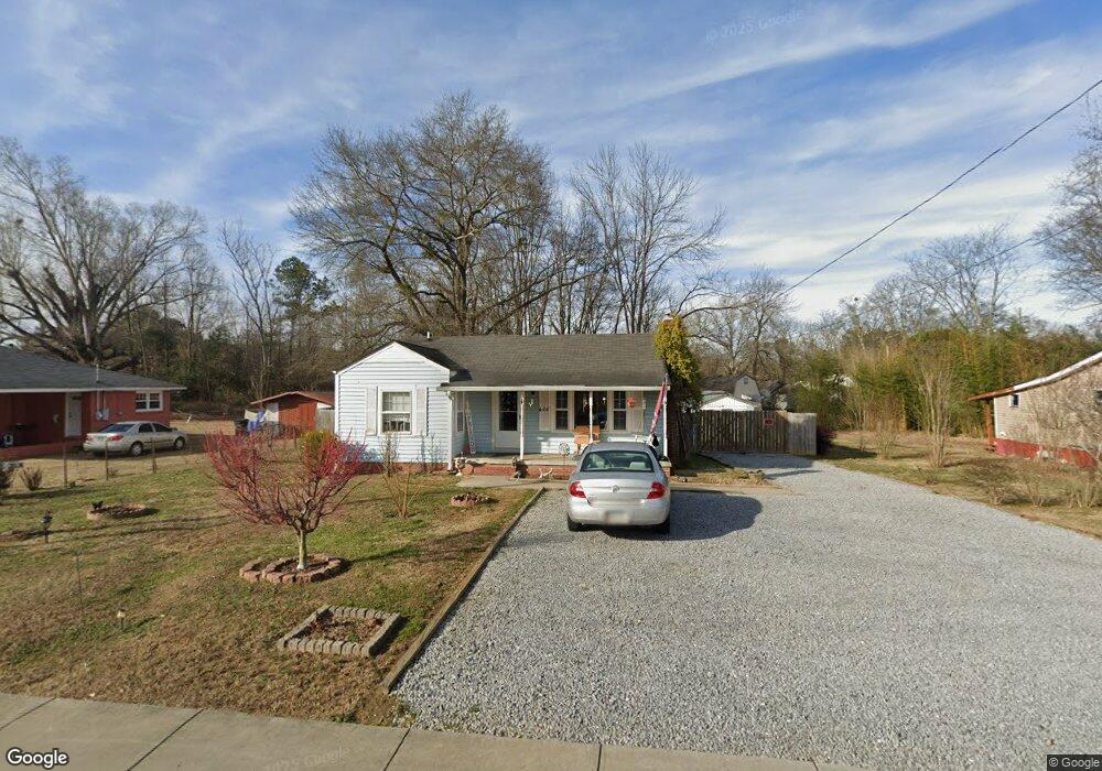
406 E May St Calhoun, GA 30701
Estimated Value: $111,000 - $185,000
2
Beds
1
Bath
926
Sq Ft
$159/Sq Ft
Est. Value
About This Home
This home is located at 406 E May St, Calhoun, GA 30701 and is currently estimated at $146,960, approximately $158 per square foot. 406 E May St is a home located in Gordon County with nearby schools including Calhoun Elementary School, Calhoun Middle School, and Calhoun High School.
Ownership History
Date
Name
Owned For
Owner Type
Purchase Details
Closed on
Jan 2, 2016
Sold by
Newport Properties
Bought by
S C Investment Properties Inc
Current Estimated Value
Purchase Details
Closed on
Jan 22, 1997
Bought by
Halcomb Lester
Purchase Details
Closed on
May 7, 1996
Bought by
Secretary Of Housing
Purchase Details
Closed on
Jan 4, 1900
Bought by
Newport Properties Inc
Create a Home Valuation Report for This Property
The Home Valuation Report is an in-depth analysis detailing your home's value as well as a comparison with similar homes in the area
Purchase History
| Date | Buyer | Sale Price | Title Company |
|---|---|---|---|
| S C Investment Properties Inc | $43,000 | -- | |
| Halcomb Lester | $39,000 | -- | |
| Secretary Of Housing | $37,900 | -- | |
| Chase Manhattan Mortgage | $37,900 | -- | |
| Newport Properties Inc | $35,600 | -- |
Source: Public Records
Tax History
| Year | Tax Paid | Tax Assessment Tax Assessment Total Assessment is a certain percentage of the fair market value that is determined by local assessors to be the total taxable value of land and additions on the property. | Land | Improvement |
|---|---|---|---|---|
| 2025 | $1,174 | $44,676 | $8,000 | $36,676 |
| 2023 | $1,090 | $38,756 | $8,000 | $30,756 |
| 2022 | $325 | $34,156 | $8,000 | $26,156 |
| 2021 | $772 | $25,916 | $5,600 | $20,316 |
| 2020 | $787 | $26,236 | $5,600 | $20,636 |
| 2019 | $786 | $26,236 | $5,600 | $20,636 |
| 2018 | $192 | $19,948 | $4,200 | $15,748 |
| 2017 | $169 | $17,172 | $3,360 | $13,812 |
| 2016 | $173 | $17,572 | $3,920 | $13,652 |
| 2015 | $172 | $17,252 | $3,920 | $13,332 |
| 2014 | $162 | $16,494 | $3,920 | $12,574 |
Source: Public Records
Map
Nearby Homes
- 511 Circle Dr
- 119 Telfair St
- The Kensington II Plan at Laurel Creek
- The Pearson Plan at Laurel Creek
- The Coleman Plan at Laurel Creek
- The Benson II Plan at Laurel Creek
- The Piedmont Plan at Laurel Creek
- The McGinnis Plan at Laurel Creek
- The Caldwell Plan at Laurel Creek
- 507 Linda Ln
- 402 Linda Ln
- 119 Peters St
- 199 Cherry St SE
- 0 S Wall St Unit 10665175
- 108 Rips Rd
- 180 Honeysuckle Dr SE
- 123 Deer Park Ln
- 212 Sherwood Dr
- 0 Deer Park Ln Unit 10659841
- 0 Deer Park Ln Unit 7692335
Your Personal Tour Guide
Ask me questions while you tour the home.